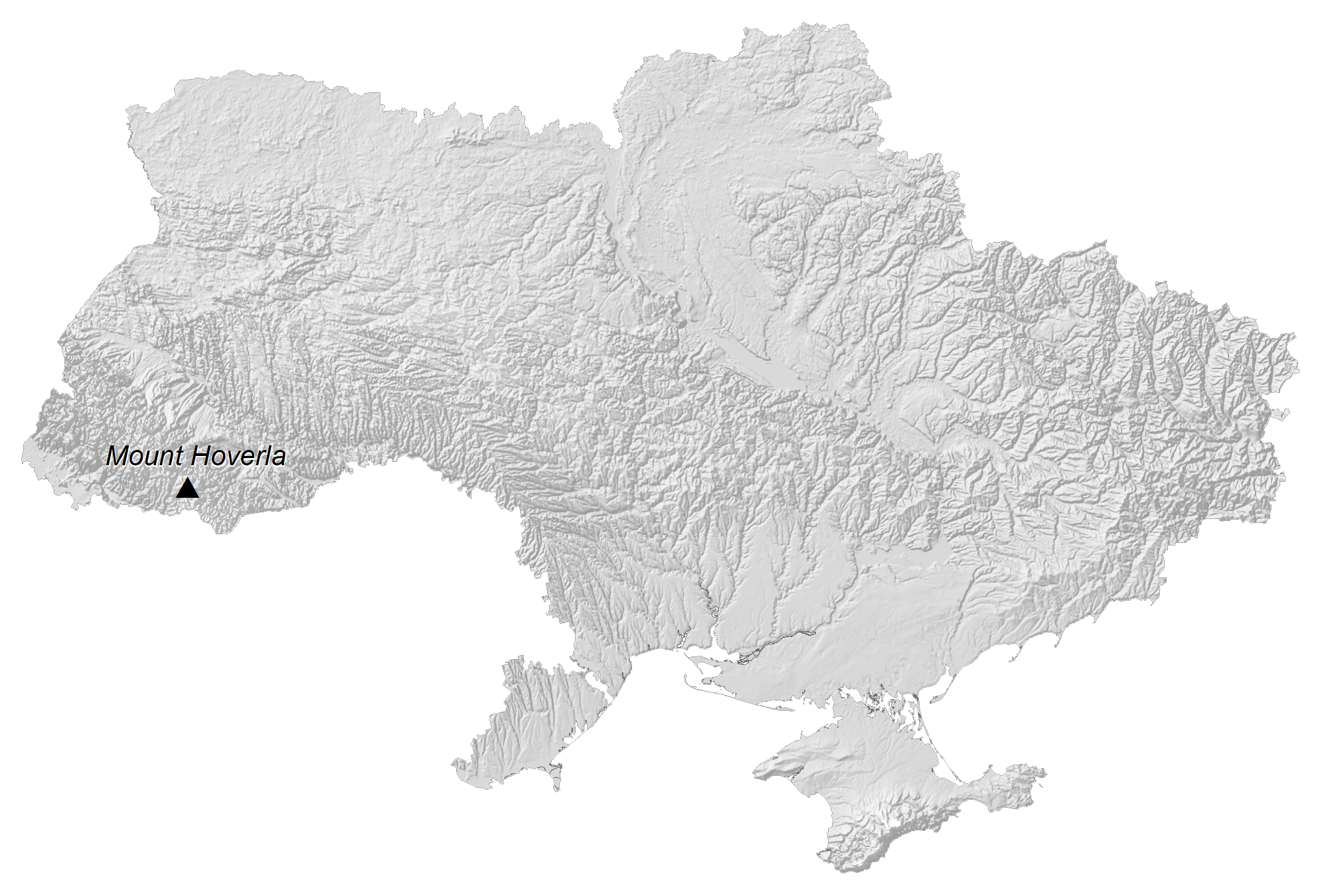
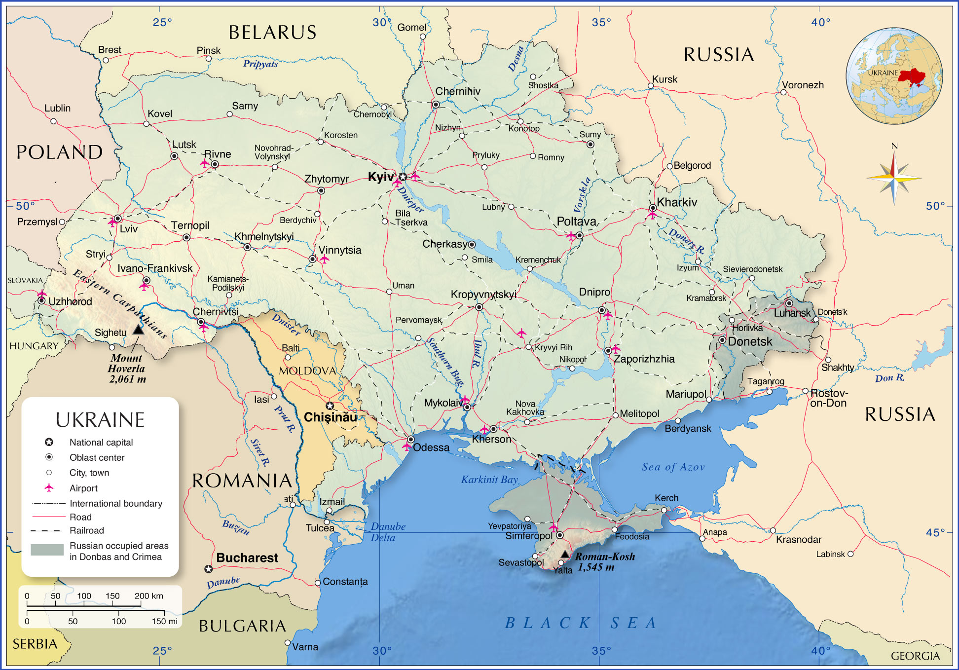
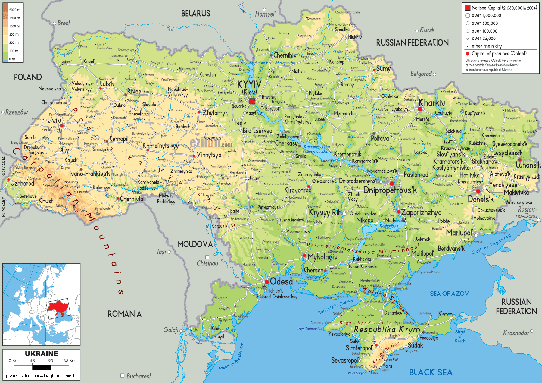
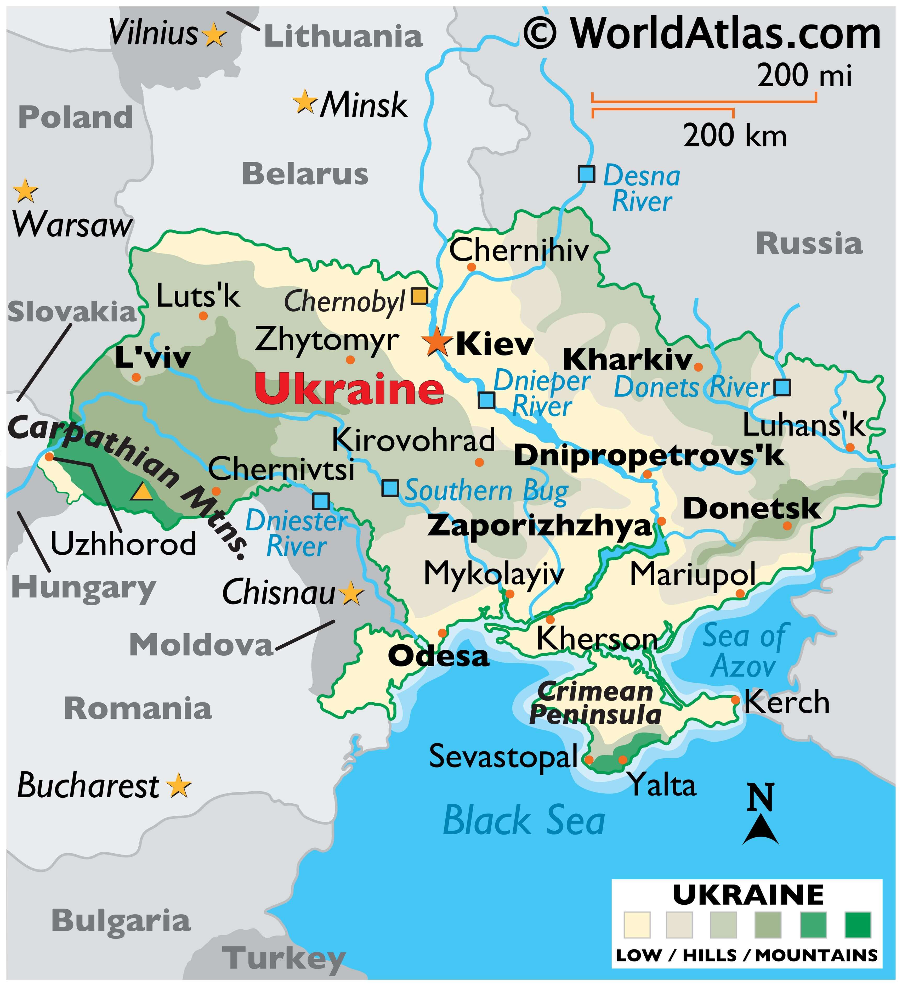
Ukraine is the largest country that is entirely within Europe. The country sits on the southwestern part of the Russian Plain and is bordered by the Black Sea and the Sea of Azov to the south, Russia to the east and north, Belarus to the north, Poland, Slovakia, and Hungary to the west, and Romania and Moldova to the south.About 95% of the country is flat with an average elevation of the land is only 574 ft (175 m). As observed on the physical map of Ukraine above the northern reaches of the Carpathian Mountains stretch across western Ukraine. The country’s highest point is located there, Hoverla Mountain, at 2061 m (6762 ft) tall. It has been marked on the map above by a yellow upright triangle.
The southern lowland of Ukraine continues into the Crimean Peninsula, a peninsula jutting into the sea from southern Ukraine via the Perekop Isthmus. It is a disputed territory. The Crimean Mountains front the southern edges of the Crimean Peninsula, and some lower, heavily-eroded mountains extend into Russia just north of the Sea of Azov.
Much of central Ukraine is covered by plateaus and fertile plains (steppes), somewhat hilly areas of grasslands and shrublands.
The Black Sea Coastal Lowlands cover the southern edges of the country.
Include the Desna, Dnieper, Dniester, Donets and the Southern Bug. Numerous waterfalls are found in both the Carpathian and Crimean Mountains.
The Dnieper River, one of the major rivers of Europe (fourth by length) flows from Russia, through Belarus and Ukraine, to the Black Sea. The river’s total length is 2,285 km (1,420 mi).
| Flag: |  |
|---|---|
| Legal Name: | Ukraine |
| Capital Value: | Kyiv (Kiev) |
| Demonym(s): | Ukrainian |
| Government: | Unitary semi-presidential republic |
| Legislature: | Verkhovna Rada |
| Total Area: | 603,550 km² |
| Land Area: | 579,330 km² |
| Water Area: | 24,220 km² |
| Population: | 44,385,155 |
| Density: | 73.8/km (191.1/sq mi) (115th) |
| GDP: | $153.78 Billion |
| GDP Per Capita: | $3,659.03 |
| Currency Value: | Hryvnia (UAH) |
| Driving side: | right |
| Calling code: | +380 |
| Internet TLD: |
|
Explore the Geography of Ukraine
Ukraine is a country rich with history, culture, and geography. This map of Ukraine highlights some of the most important features of the country, including its major cities, rivers, highways, and disputed areas. With a satellite and elevation map, you can explore features like the Dnieper River, vast plains, and hilly terrain. Get to know Ukraine and all it has to offer by exploring its geography.
Online Interactive Political Map
Click on ![]() to view map in "full screen" mode.
to view map in "full screen" mode.
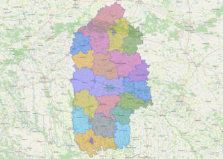
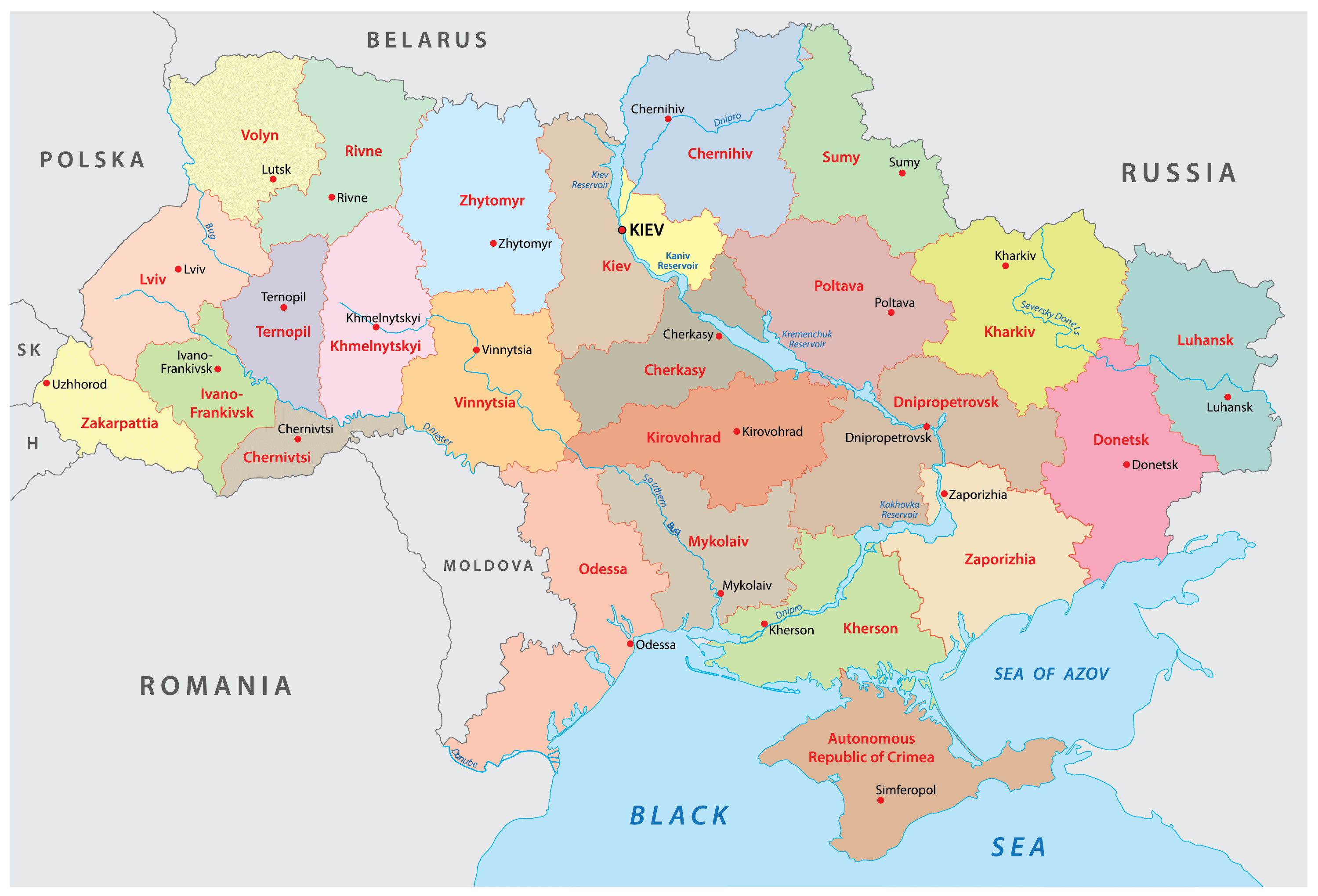
Ukraine is divided into 24 provinces (oblast), 1 autonomous republic (avtonomna respublika) and 2 municipalities (mista). In alphabetical order, these provinces are: Cherkasy, Chernihiv, Chernivtsi, Dnipropetrovs’k (Dnipro), Donets’k, Ivano-Frankivs’k, Kharkiv, Kherson, Khmel’nyts’kyy, Kirovohrad (Kropyvnyts’kyy), Kyiv, Luhans’k, L’viv, Mykolayiv, Odesa, Poltava, Rivne, Sumy, Ternopil’, Vinnytsya, Volyn’ (Luts’K), Zakarpattya (Uzhhorod), Zaporizhzhya and Zhytomyr. Crimea or Avtonomna Respublika Krym (Simferopol’) is an autonomous republic. Kyiv (Kiev) and Sevastopol’ are two municipalities of special status. The 24 oblasts and Crimea are further subdivided into 136 raions (district) and city municipalities.
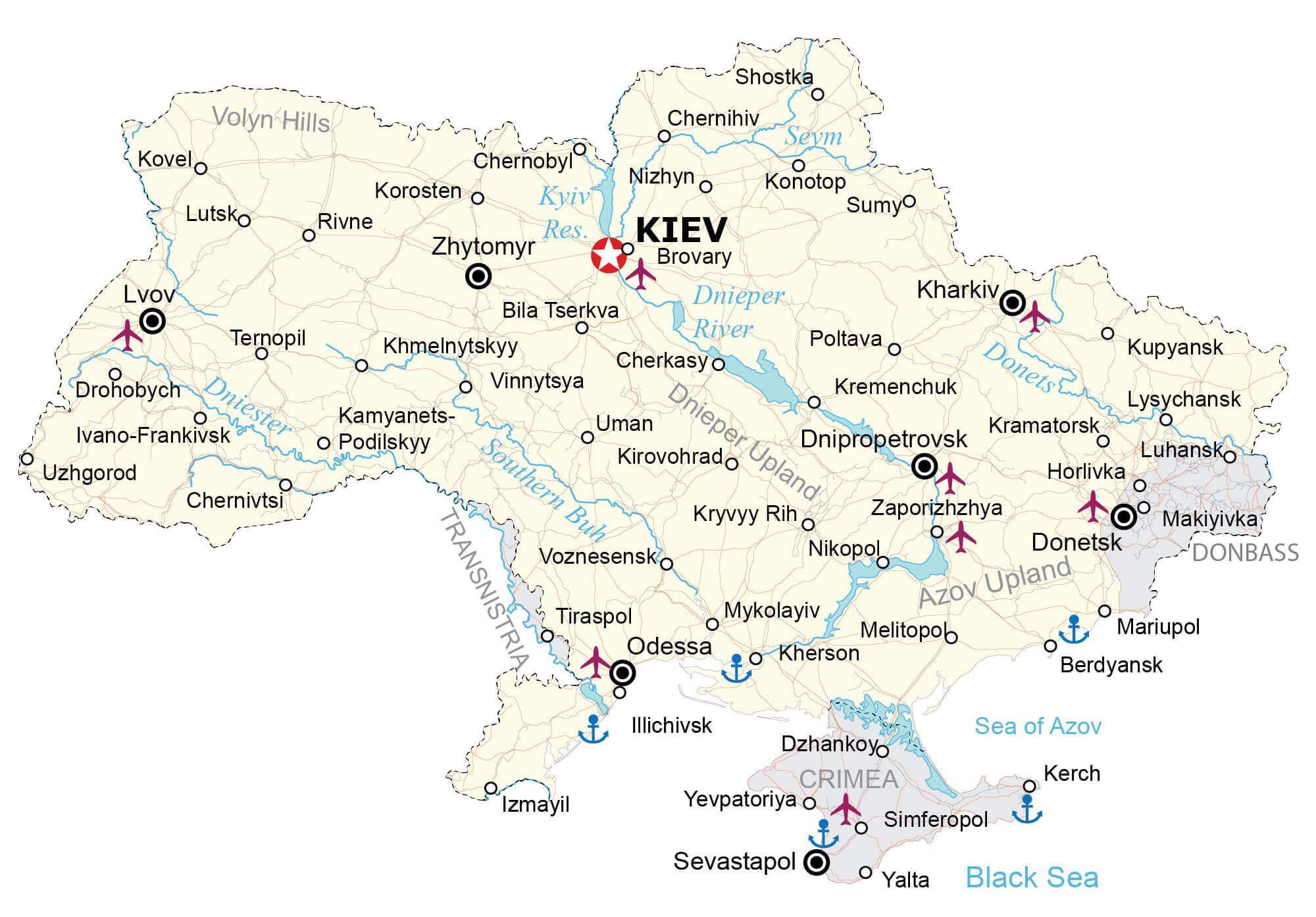
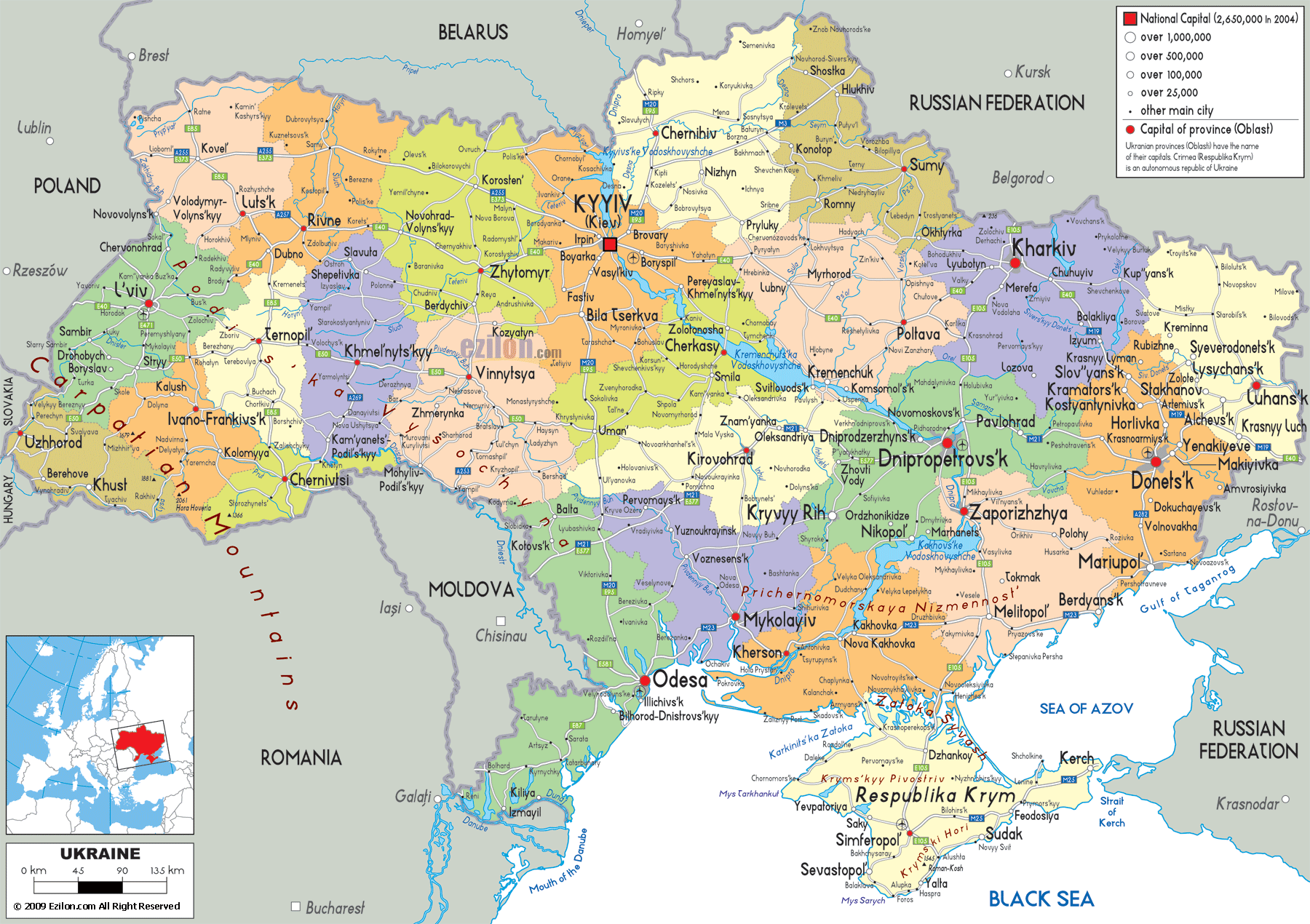
With an area of 603,628 sq. km (which also includes the area covered by the Crimean Peninsula), Ukraine is the 2nd largest country by area in Europe and the 46th largest country in the world. With a population over 42 million people, Ukraine is the 7th/8th most populous county in Europe and the 32nd most populous country in the world. Located in the north-central part of the country, along the Dnieper River is Kiev (Kyiv) – the capital and the most populous city of Ukraine. Kiev is the chief cultural and industrial center of Eastern Europe.
Location Maps
Where is Ukraine?
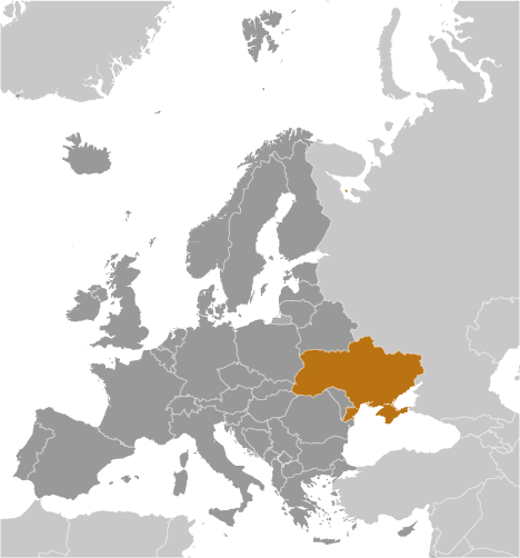
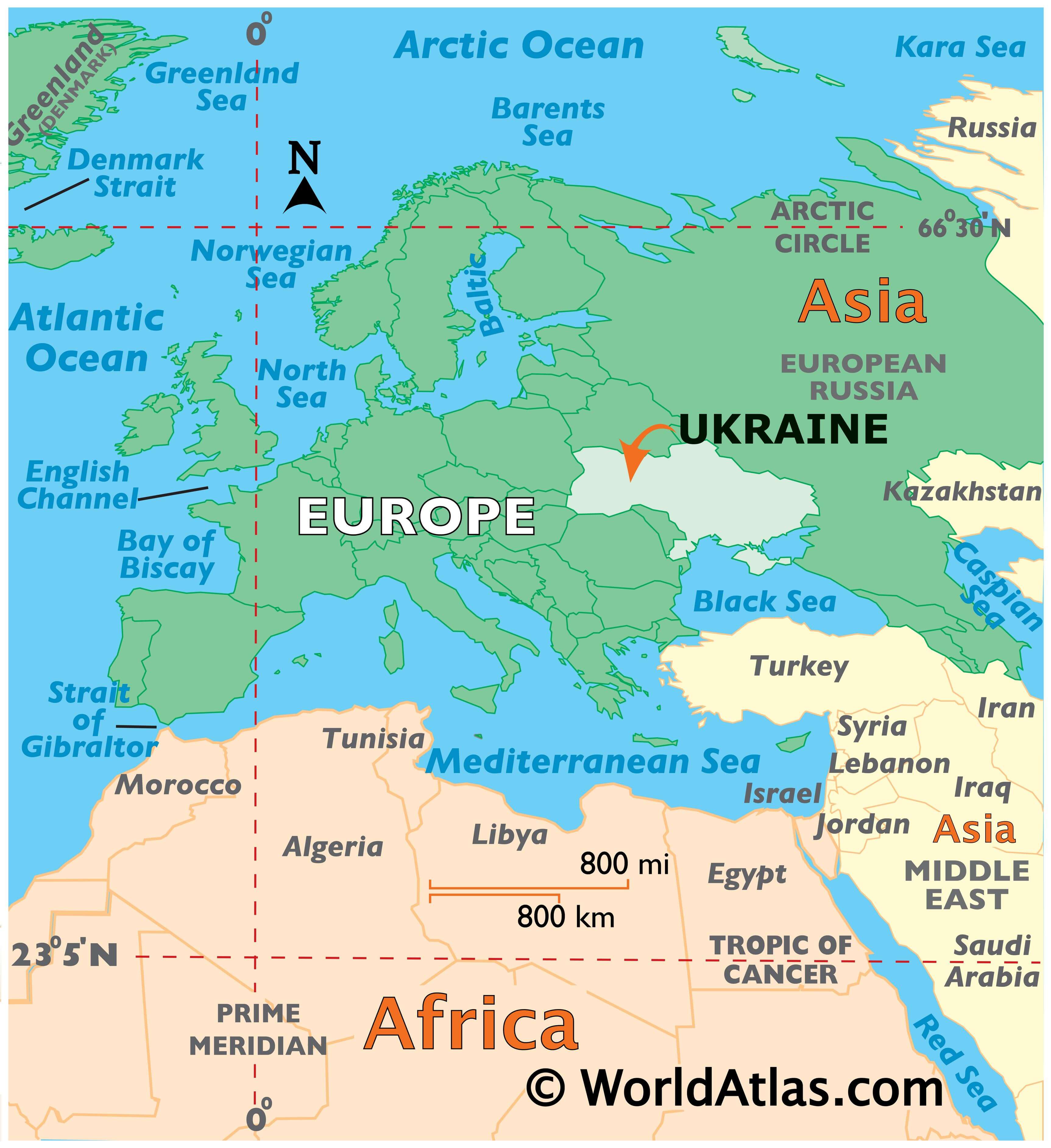
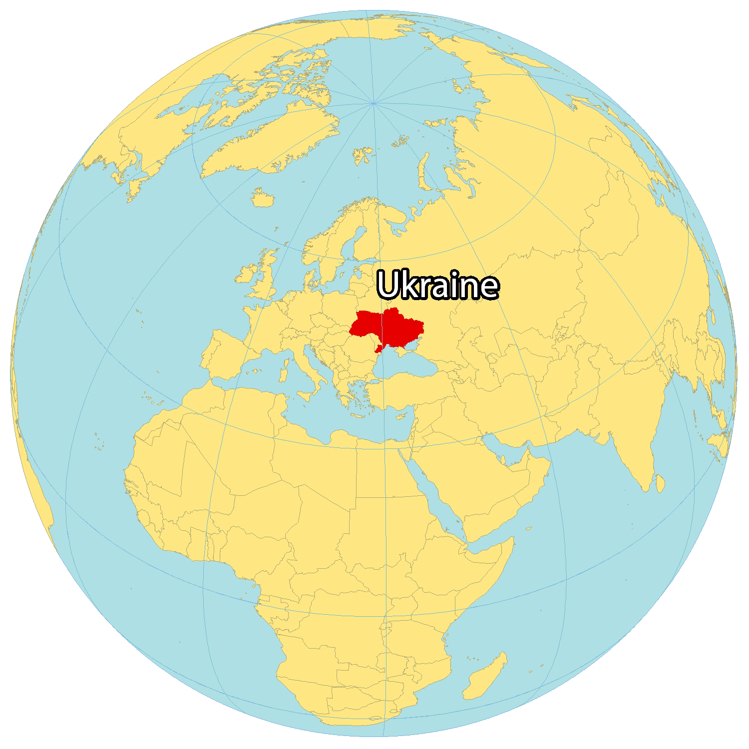
Ukraine is an eastern European nation, situated along the coast of the Black Sea. It has many neighbouring countries in Europe, like Russia to the northeast, Moldova and Romania to the south, Hungary and Slovakia to the southwest, Poland to the west, and Belarus to the north. There are also some disputed borders in the Crimea, Donbas, and Transnistria regions with Russia and Moldova. Ukraine is the second-largest country in Europe, behind Russia, with an area of 603,628 square kilometers (233,062 sq mi).
High Definition Political Map of Ukraine
Physical Map of Ukraine
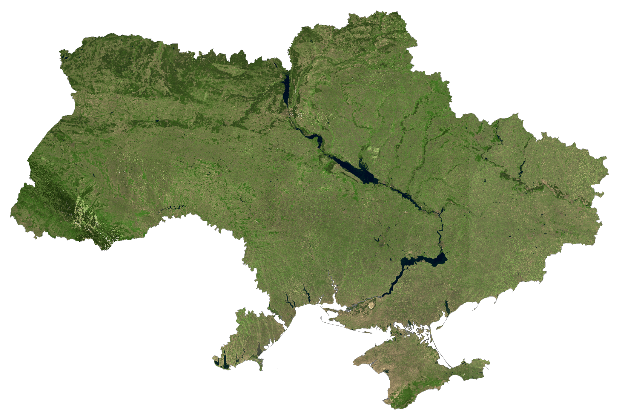
Ukraine Satellite Map
Elevation Map