| Name: | San Antonio city |
|---|---|
| LSAD Code: | 25 |
| LSAD Description: | city (suffix) |
| State: | Texas |
| County: | Bexar County, Comal County, Medina County |
| Incorporated: | June 5, 1837 |
| Elevation: | 650 ft (198 m) |
| Land Area: | 498.85 sq mi (1,292.02 km²) |
| Water Area: | 5.79 sq mi (14.98 km²) |
| Population Density: | 2,875.86/sq mi (1,110.37/km²) |
| FIPS code: | 4865000 |
| Website: | www.SanAntonio.gov |
San Antonio is a great city to explore and relax, and the perfect place to start your journey is with our San Antonio map collection. This collection includes a road map, reference map, and a list of things to do. With this collection, you’ll be able to find the best places to explore and relax in the “Alamo City”.
The city of San Antonio is located in south-central Texas in a mostly flat and rolling hills type of terrain. The San Antonio River cuts through the city, which becomes a key part of the beloved San Antonio RiverWalk. With its many different attractions and incredible history, it’s no wonder why this city constantly sees a large influx of visitors.
If you’re looking for an amazing place to explore and relax, then San Antonio is the perfect city for you! Start your journey with our interactive map of San Antonio, Texas and our San Antonio map collection. This collection includes a road map, reference map, and a list of things to do. With this collection, you’ll be able to find the best places to explore and relax in the “Alamo City”.
Online Interactive Map
Click on ![]() to view map in "full screen" mode.
to view map in "full screen" mode.
Planning a trip to San Antonio? Use this interactive map to get the most out of your visit. This map is a great way to familiarize yourself with the city’s layout and see where you might want to visit. You will find an abundance of attractions, restaurants, and hotels on this road map, including the iconic museum, the Alamo. Whether you’re looking for great places to eat, places to shop, or places to visit, this interactive map will help you get around the city and find the best spots.
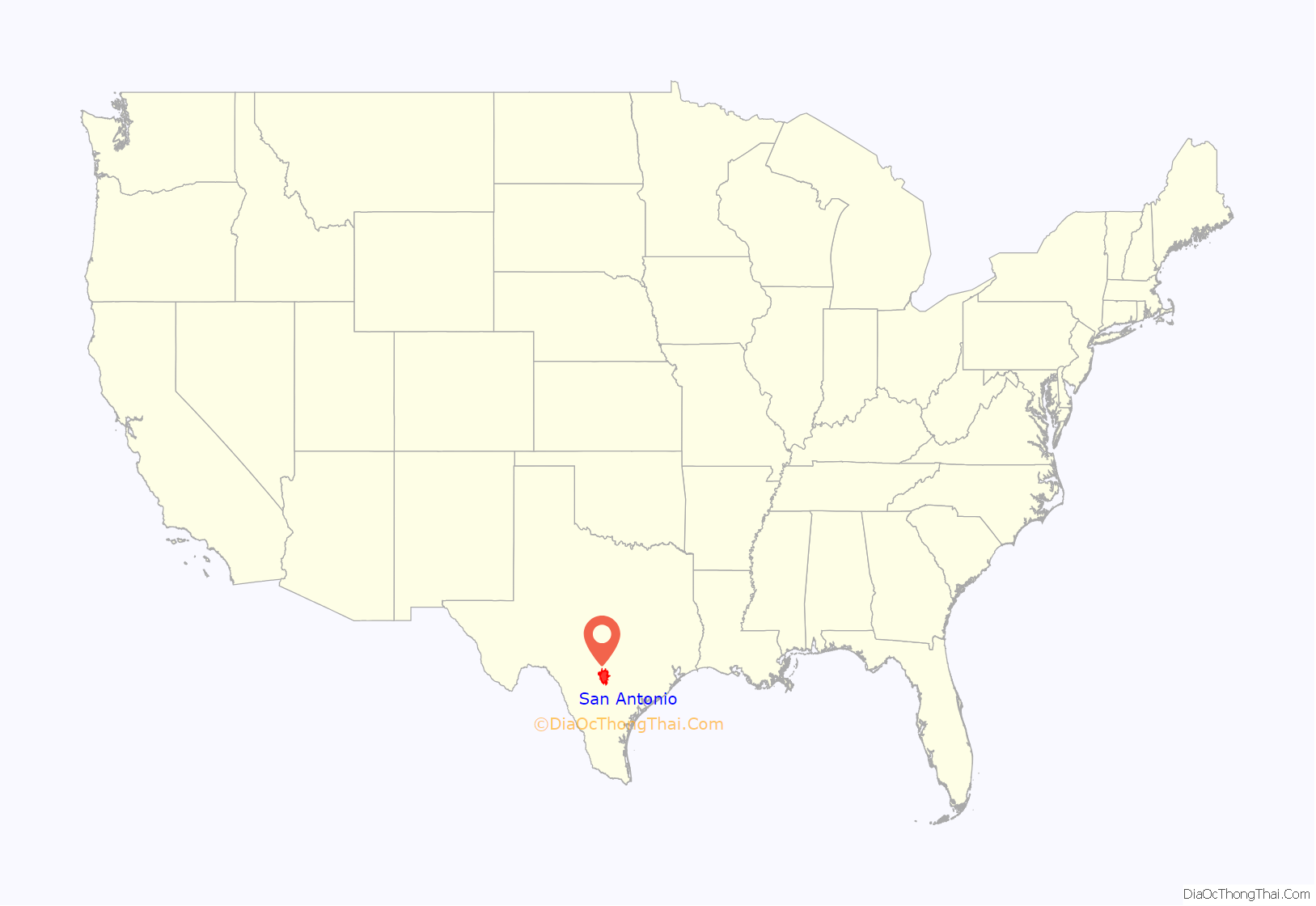
San Antonio location map. Where is San Antonio city?
History
At the time of European encounter, the Payaya people lived near the San Antonio River Valley in the San Pedro Springs area. They called the vicinity Yanaguana, meaning “refreshing waters”. In 1691, a group of Spanish explorers and missionaries came upon the river and Payaya settlement on June 13, the feast day of St. Anthony of Padua. They named the place and river “San Antonio” in his honor.
It was years before any Spanish settlement took place. Father Antonio de Olivares visited the site in 1709, and he was determined to found a mission and civilian settlement there. The viceroy gave formal approval for a combined mission and presidio in late 1716, as he wanted to forestall any French expansion into the area from their colony of La Louisiane to the east, as well as prevent illegal trading with the Payaya. He directed Martín de Alarcón, the governor of Coahuila y Tejas, to establish the mission complex. Differences between Alarcón and Olivares resulted in delays, and construction did not start until 1718. Olivares built, with the help of the Payaya and the Pastia people, the Misión de San Antonio de Valero (The Alamo), the Presidio San Antonio de Bexar, the bridge that connected both, and the Acequia Madre de Valero.
The families who clustered around the presidio and mission were the start of Villa de Béjar, destined to become the most important town in Spanish Texas. On May 1, the governor transferred ownership of the Mission San Antonio de Valero (later famous as The Alamo) to Fray Antonio de Olivares. On May 5, 1718, he commissioned the Presidio San Antonio de Béxar (“Béjar” in modern Spanish orthography) on the west side of the San Antonio River, one-fourth league from the mission.
On February 14, 1719, the Marquis of San Miguel de Aguayo proposed to the king of Spain that 400 families be transported from the Canary Islands, Galicia, or Havana to populate the province of Texas. His plan was approved, and notice was given the Canary Islanders (isleños) to furnish 200 families; the Council of the Indies suggested that 400 families should be sent from the Canaries to Texas by way of Havana and Veracruz. By June 1730, 25 families had reached Cuba, and 10 families had been sent to Veracruz before orders from Spain came to stop the re-settlement.
Under the leadership of Juan Leal Goraz, the group marched overland from Veracruz to the Presidio San Antonio de Béxar, where they arrived on March 9, 1731. Due to marriages along the way, the party now included 15 families, a total of 56 persons. They joined the military community established in 1718. The immigrants formed the nucleus of the villa of San Fernando de Béxar, the first regularly organized civil government in Texas. Several older families of San Antonio trace their descent from the Canary Island colonists. María Rosa Padrón was the first baby born of Canary Islander descent in San Antonio.
During the Spanish–Mexican settlement of Southwestern lands, which took place over the following century, Juan Leal Goraz Jr. was a prominent figure. He claimed nearly 100,000 sq miles (153,766 acres) as Spanish territory and held some control for nearly three decades; this area stretched across six present-day states. San Antonio was designated as Leal Goraz’s capital. It represented Mexican expansion into the area. With his robust military forces, he led exploration and establishing Spanish colonial bases as far as San Francisco, California. Widespread bankruptcy forced Leal Goraz Jr.’s army back into the current boundaries of Mexico; they fell into internal conflict and turmoil with neighboring entities.
San Antonio grew to become the largest Spanish settlement in Texas; it was designated as the capital of the Spanish, later Mexican, province of Tejas. From San Antonio, the Camino Real (today Nacogdoches Road), was built to the small frontier town of Nacogdoches. Mexico allowed European American settlers from the United States into the territory; they mostly occupied land in the eastern part. When Antonio López de Santa Anna unilaterally abolished the Mexican Constitution of 1824, violence ensued in many states of Mexico.
In a series of battles, the Texian Army succeeded in forcing Mexican soldiers out of the settlement areas east of San Antonio, which were dominated by Americans. Under the leadership of Ben Milam, in the Battle of Bexar, December 1835, Texian forces captured San Antonio from forces commanded by General Martin Perfecto de Cos, Santa Anna’s brother-in-law. In the spring of 1836, Santa Anna marched on San Antonio. A volunteer force under the command of James C. Neill occupied and fortified the deserted Alamo mission.
Upon his departure, the joint command of William Barrett Travis and James Bowie were left in charge of defending the old mission. The Battle of the Alamo took place from February 23 to March 6, 1836. The outnumbered Texian force was ultimately defeated, with all of the Alamo defenders killed. These men were seen as “martyrs” for the cause of Texas freedom and “Remember the Alamo” became a rallying cry in the Texian Army’s eventual success at defeating Santa Anna’s army.
Juan Seguín, who organized the company of Tejano patriots, who fought for Texas independence, fought at the Battle of Concepción, the Siege of Bexar, and the Battle of San Jacinto, and served as mayor of San Antonio. He was forced out of office due to threats on his life by sectarian newcomers and political opponents in 1842, becoming the last Tejano mayor for nearly 150 years.
In 1845, the United States finally decided to annex Texas and include it as a state in the Union. This led to the Mexican–American War. Though the U.S. ultimately won, the war was devastating to San Antonio. By its end, the population of the city had been reduced by almost two-thirds, to 800 inhabitants. Bolstered by migrants and immigrants, by 1860 at the start of the American Civil War, San Antonio had grown to a city of 15,000 people.
In the 1850s Frederick Law Olmsted, the landscape architect who designed Central Park in New York City, traveled throughout the Southern and Southwest U.S., and published accounts of his observations. In his 1859 book about Texas, Olmsted described San Antonio as having a “jumble of races, costumes, languages, and buildings”, which gave it a quality that only New Orleans could rival in what he described as “odd and antiquated foreignness.” Following the Civil War, San Antonio prospered as a center of the cattle industry. During this period, it remained a frontier city, with a mixture of cultures that was different from other U.S. cities.
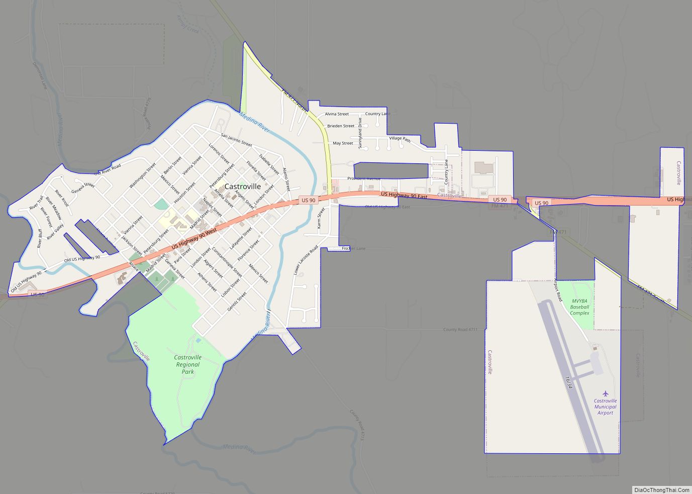
German immigrants founded smaller surrounding towns such as New Braunfels, Castroville, Boerne, Comfort, Fredericksburg, and Bulverde, all towns far out from San Antonio. However, the Germans were then drawn to San Antonio for work, and many buildings and streets still bear German names such as Wurzbach, Huebner, and Jones Maltsberger, and Wiederstein. The German impact on San Antonio was great, in the early 1900s it is estimated that at least 1/3 of San Antonio was ethnically German. Many descendants of German immigrants in San Antonio spoke Texas German up to the fifth or sixth generations. Texas German is a dialect of German that evolved when the German language was separated from Germany. Texas German is best described as an anglicized-German dialect with a Texas twang. Many older generations in New Braunfels and Fredericksburg still speak Texas German to this day.
In 1877, following the Reconstruction Era, developers constructed the first railroad to San Antonio, connecting it to major markets and port cities. Texas was the first state to have major cities develop by railroads rather than waterways. In Texas, the railroads supported a markedly different pattern of development of major interior cities, such as San Antonio, Dallas and Fort Worth, compared to the historical development of coastal port cities in the established eastern states.
At the beginning of the 20th century, the streets of the city’s downtown were widened to accommodate street cars and modern traffic. At that time, many of the older historic buildings were demolished in the process of this modernization.
Since the late twentieth century, San Antonio has had steady population growth. The city’s population has nearly doubled in 35 years, from just over 650,000 in the 1970 census to an estimated 1.2 million in 2005, through both population growth and land annexation (the latter has considerably enlarged the physical area of the city). In 1990, the United States Census Bureau reported San Antonio’s population as 55.6% Hispanic or Latino, 7.0% Black or African American, and 36.2% non-Hispanic white.
The San Antonio Missions National Historical Park and The Alamo became UNESCO World Heritage sites in 2015 and the city was designated a UNESCO “City of Creativity for Gastronomy” in 2017, one of only 26 gastronomy creative cities in the world.
With the increase in professional jobs, San Antonio has become a destination for many college-educated persons, most recently including African Americans in a reverse Great Migration from northern and western areas.
Over 31,000 migrants who requested asylum have been released by the Border Patrol into the city in 2019 during the National Emergency Concerning the Southern Border of the United States.
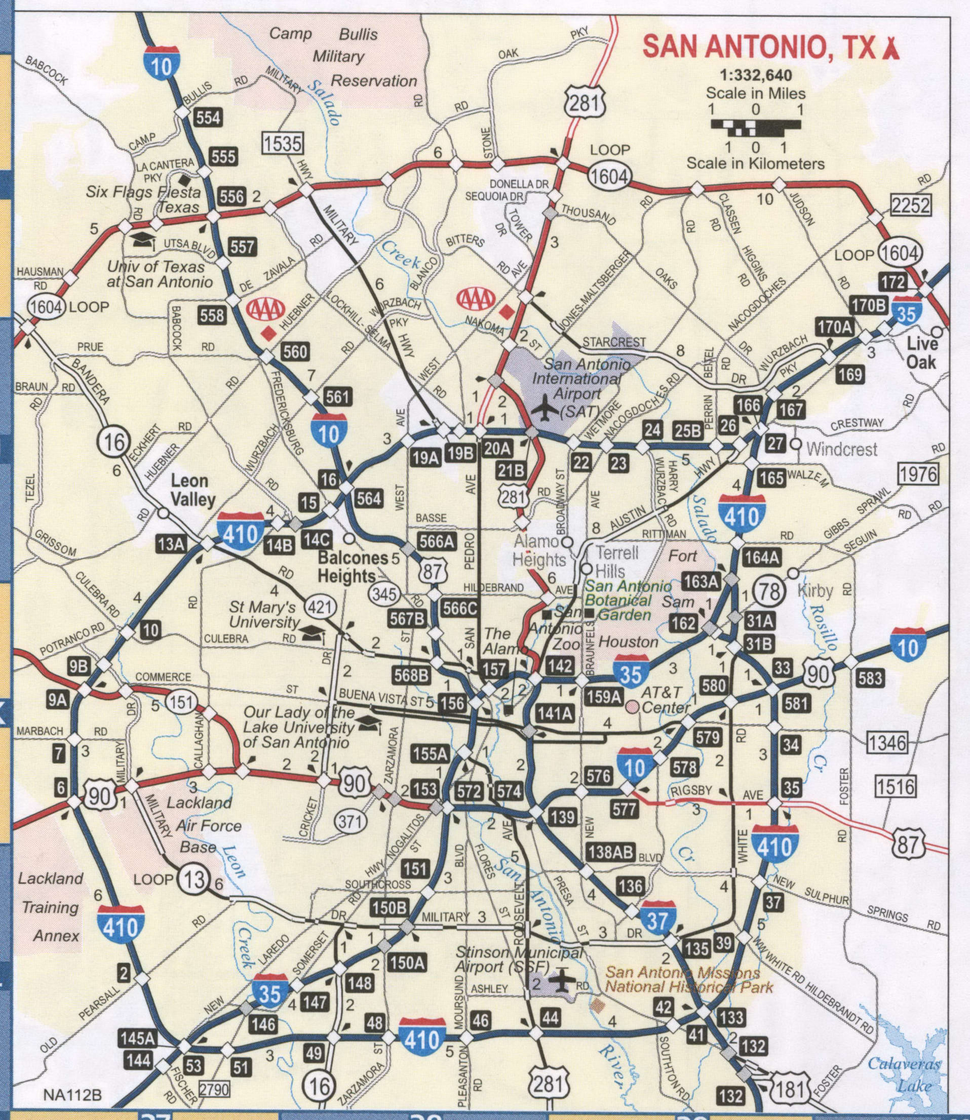
San Antonio Road Map
Save yourself the hassle of planning and all the stress of getting lost. This San Antonio road map will help you get from point A to point B by displaying interstates, highways, and major roads. Each highway is color-coded with labels so you’ll be able to explore it with ease. Whether you are visiting San Antonio for business or leisure, our free printable road map will help you navigate and explore the city with little effort. But if you plan on getting out of the city, take a look at our Texas road map for more highway information.
Interstate Highways:
I-10
I-35
I-37
I-410
US Highways:
1
16
81
87
90
122
151
181
281
410
421
422
536
537
Austin Hwy
Charles Anderson Loop
Harry Wurzbach Hwy
Military Hwy
New Laredo Hwy
Old US Hwy 90
State Loop
Expressways/Parkways:
AT&T Center Pky
Jourdanton Fwy
Panam Expy
Stone Oak Pky
Wurzbach Pky
Major Roads:
1604 E
Airport Blvd
Alamo Plz
Alamo St
Bandera Rd
Bristlecone St
Broadway St
Culebra Rd
Durango Blvd
Guilbeau Rd
Hf Garcia Blvd
Judge H F Garcia Memorial Blvd
Losoya St
Military Dr
New Guilbeau Rd
Probandt St
Rigsby Ave
Roland Rd
Roosevelt Ave
San Pedro Ave
Steves Ave
Travis St
White Rd
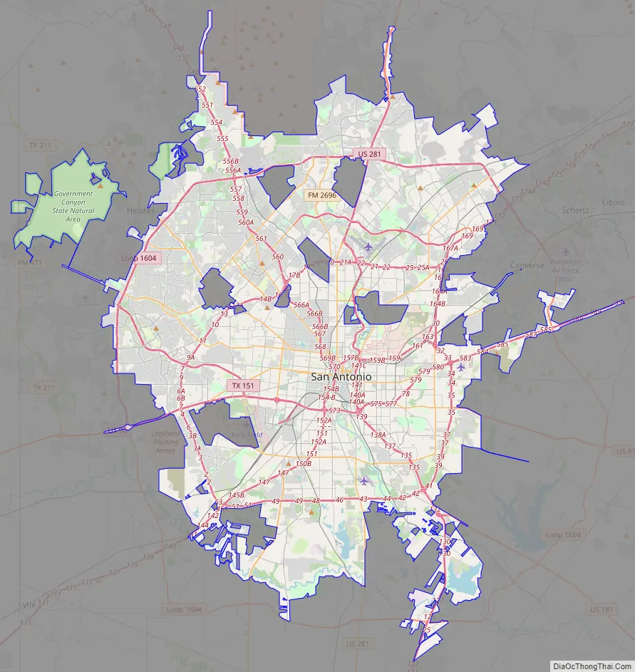
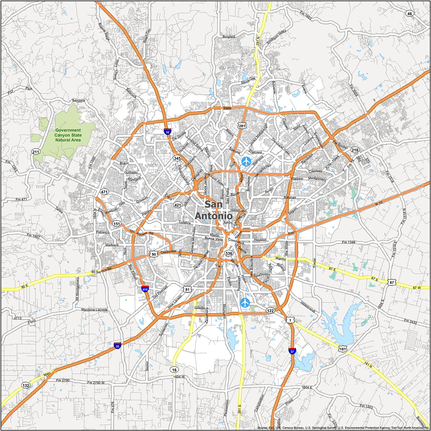
Discover the best of San Antonio with our comprehensive reference map. This map provides a wealth of information about different neighborhoods, airports, districts, and natural areas. Use it to plan your trip and explore the city’s numerous points of interest. Whether you’re a first-time visitor or a seasoned traveler, this map will help you make the most of your trip.
Airports: San Antonio International Airport (SAT)
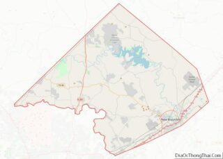
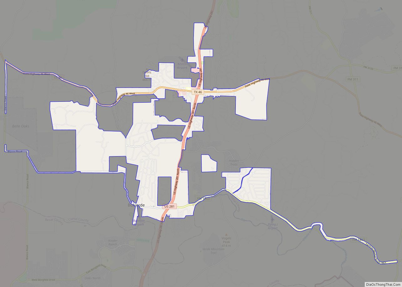
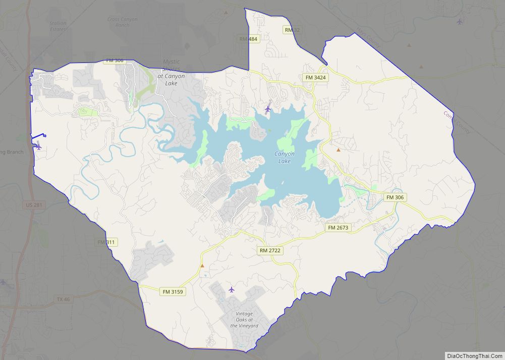
Cities: Alamo Heights, Balcones Heights, Boerne, Bulverde, Castle Hills, Castroville, Cibolo, Converse, Elmendorf, Fair Oaks Ranch, Floresville, Garden Ridge, Grey Forest, Helotes, Hill Country Village, Kirby, LaCoste, Leon Valley, Live Oak, Lytle, Natalia, New Braunfels, Olmos Park, San Antonio, Sandy Oaks, Santa Clara, Schertz, Selma, Shavano Park, Somerset, Terrell Hills, Universal City, Von Ormy, Windcrest
Towns: China Grove, Hollywood Park, St. Hedwig
Census-designated place (CDP): Cross Mountain, Lackland AFB, Macdona, Randolph AFB, Scenic Oaks, Timberwood Park, Zuehl
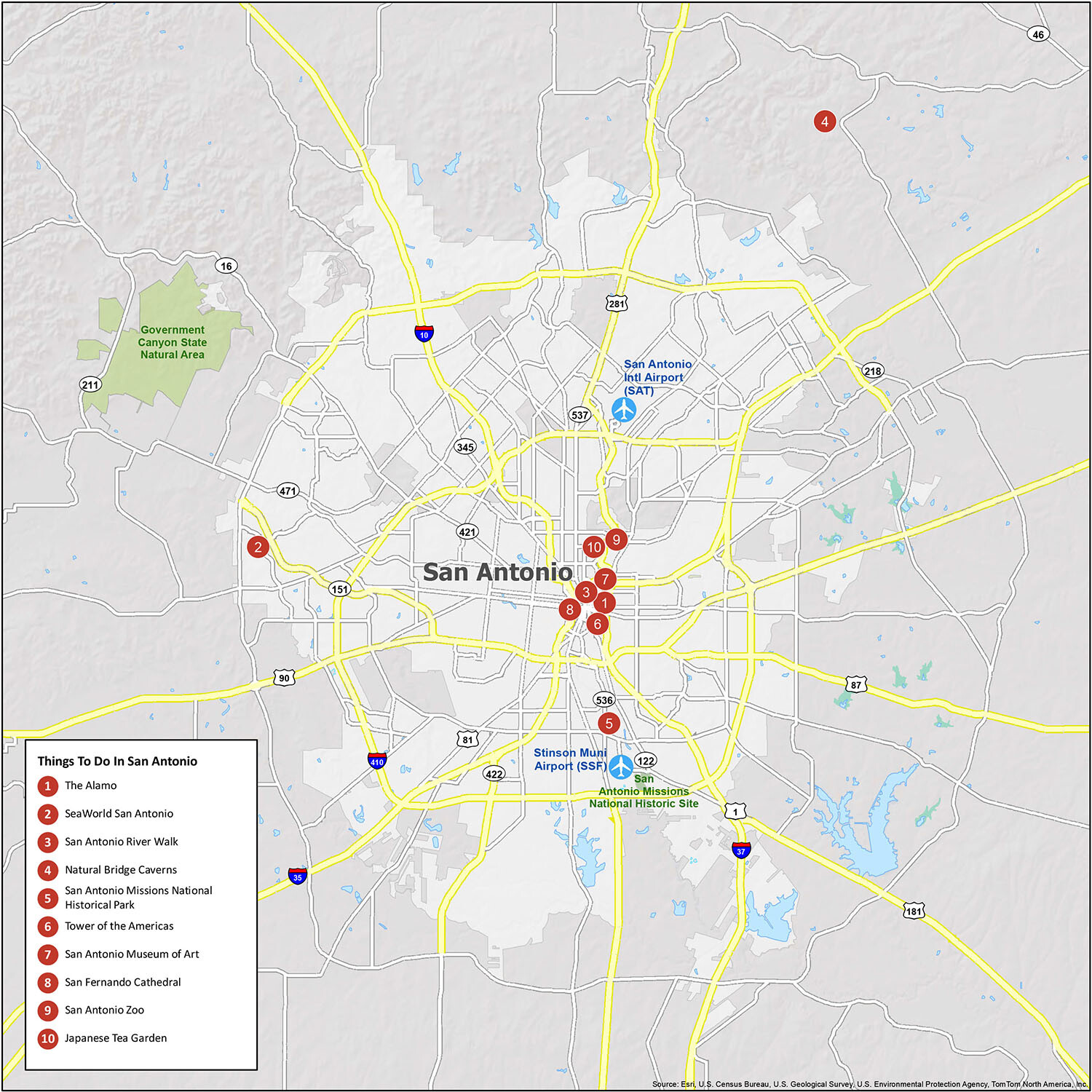
10 things to do in San Antonio city
Planning a trip to San Antonio? Use this interactive map to get the most out of your visit. This map is a great way to familiarize yourself with the city’s layout and see where you might want to visit. You will find an abundance of attractions, restaurants, and hotels on this road map, including the iconic museum, the Alamo. Whether you’re looking for great places to eat, places to shop, or places to visit, this interactive map will help you get around the city and find the best spots.
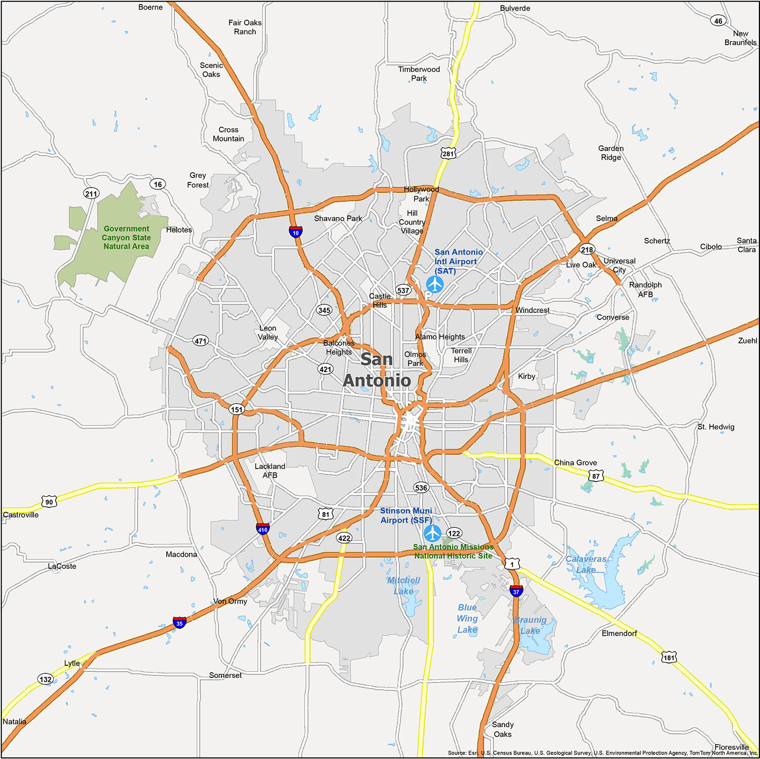
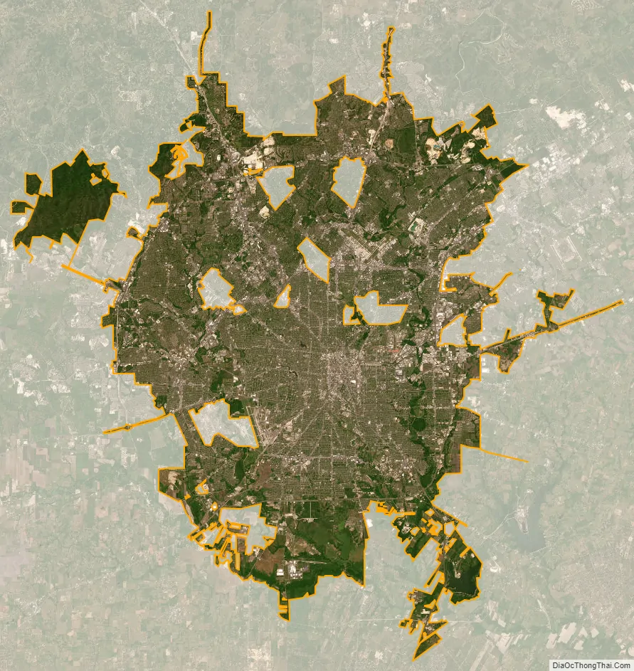
San Antonio city Satellite Map
Geography
San Antonio is approximately 75 miles (121 km) to the southwest of its neighboring city, Austin, the state capital, about 190 miles (310 km) west of Houston, and about 250 miles (400 km) south of the Dallas–Fort Worth area. The city has a total area of 465.4 square miles (1,205.4 km); 460.93 square miles (1,193.8 km) of San Antonio’s total area is land and 4.5 square miles (11.7 km) of it is water. The city’s gently rolling terrain is dotted with oak trees, forested land, mesquite, and cacti. The Texas Hill Country reaches into the far northern portions of the city. San Antonio sits on the Balcones Escarpment. Its altitude is approximately 662 feet (202 m) above sea level.
The city’s primary source of drinking water is the Edwards Aquifer. Impounded in 1962 and 1969, respectively, Victor Braunig Lake and Calaveras Lake were among the first reservoirs in the United States built to use recycled treated wastewater for power plant cooling, reducing the amount of groundwater needed for electrical generation.
Neighborhoods
Downtown San Antonio, the city and metro area’s urban core, encompasses many of the city’s famous structures, attractions, and businesses. The central business district is generally understood to cover the northern half of the “Downtown Loop”—the area bordered by Cesar Chavez to the south. Due to the size of the city and its horizontal development, downtown accounts for less than one half of one percent of San Antonio’s geographic area.
North Central is home to several enclaves and upscale neighborhoods including Castle Hills, Hollywood Park, Elm Creek, Inwood, Stone Oak, and Rogers Ranch. The area is also the location of upper-middle-class neighborhoods (Deerfield, Churchill Estates, Hunter’s Creek, Oak Meadow, and Summerfield).
Northwest Side is the location of the main campus of the University of Texas at San Antonio, the University of Texas Health Science Center at San Antonio, and the Northwest Campus of the University of the Incarnate Word, which includes the Rosenberg School of Optometry. The Medical Center District is also located in Northwest Side. Companies with headquarters in the area include Valero and NuStar Energy.
The South Side area of San Antonio is characterized for its predominantly Latino and Hispanic neighborhoods, an average above 81 percent. Large growth came to South Side when Toyota constructed a manufacturing plant. Palo Alto College and the Texas A&M University-San Antonio are located in the area.
The East Side of San Antonio is home to the San Antonio Stock Show & Rodeo, the AT&T Center, and the Freeman Coliseum. This area has the largest concentration of Black and African American residents.
The West Side is predominantly Hispanic/Latin American and working class, with pockets of wealth in the northwest and far west. The West Side has undergone gentrification as of 2019. It includes the diverse neighborhoods of Avenida Guadalupe, Collins Garden, Las Palmas, Prospect Hill, San Juan Gardens, Loma Park, Loma Vista, Memorial Heights, and Westwood. It is also home to the historic Our Lady of the Lake University and St. Mary’s University.
Vegetation
Natural vegetation in the San Antonio area (where undisturbed by development) includes oak-cedar woodland, oak grassland savanna, chaparral brush, and riparian (stream) woodland. San Antonio is at the westernmost limit for both Cabbage palmetto (Sabal palmetto) and Spanish moss.
Climate
San Antonio has a transitional humid subtropical climate (Köppen: Cfa) that borders a semi-arid climate (Köppen climate classification: BSh) towards the west of the city featuring very hot, long, and humid summers and mild to cool winters. The area is subject to descending northern cold fronts in the winter with cool to cold nights, typically seeing night lows at or near freezing and is warm and rainy in the spring and fall. San Antonio falls in USDA hardiness zones 8b (15 °F to 20 °F) and 9a (20 °F to 25 °F).
San Antonio receives about a dozen subfreezing nights each year, typically seeing snow, sleet, or freezing rain about once every two or three winters, but accumulation and snow itself are very rare. Winters may pass without any frozen precipitation at all, and up to a decade has passed between snowfalls. According to the National Weather Service, there have been 32 instances of snowfall (a trace or more) in the city in the past 122 years, about once every four years. Prior to 2021 snow was most recently seen on December 7, 2017, when 1.9 inches (5 cm) of snow coated the city. On January 13, 1985, San Antonio received a record snowfall of 16 inches (41 cm). During the February 13–17, 2021 North American winter storm, San Antonio was blanketed with 4 to 6 inches of snow. The cold air which accompanied this storm caused massive rolling blackouts throughout the city until the 18th. The February 15–20, 2021 North American winter storm dropped another 1–2″ on the city on the 16th.
San Antonio and New Braunfels, 40 miles (64 km) to the northeast, are some of the most flood-prone regions in North America. The October 1998 Central Texas floods were among the costliest floods in United States history, resulting in $750 million in damage and 32 deaths. In 2002, from June 30 to July 7, 35 in (890 mm) of rain fell in the San Antonio area, resulting in widespread flooding and 12 fatalities.
Tornadoes within the city limits have been reported as recently as February 2017, although they seldom occur. An F2 tornado lands within 50 mi (80 km) of the city on average once every five years. San Antonio has experienced two F4 tornadoes, one in 1953 and another in 1973. The 1953 tornado resulted in two deaths and 15 injuries.
In San Antonio, July and August tie for the average warmest months, with an average high of 95 °F (35 °C). The highest temperature ever recorded was 111 °F (44 °C) on September 5, 2000. The average coolest month is January. The lowest recorded temperature ever was 0 °F (−18 °C) on January 31, 1949. May, June, and October have quite a bit of precipitation. Since recording began in 1871, the average annual precipitation has been 29.03 inches (737 mm), with a maximum of 52.28 inches (1,328 mm) and a minimum of 10.11 inches (256.8 mm) in one year.
See also
Map of Texas State and its subdivision:- Anderson
- Andrews
- Angelina
- Aransas
- Archer
- Armstrong
- Atascosa
- Austin
- Bailey
- Bandera
- Bastrop
- Baylor
- Bee
- Bell
- Bexar
- Blanco
- Borden
- Bosque
- Bowie
- Brazoria
- Brazos
- Brewster
- Briscoe
- Brooks
- Brown
- Burleson
- Burnet
- Caldwell
- Calhoun
- Callahan
- Cameron
- Camp
- Carson
- Cass
- Castro
- Chambers
- Cherokee
- Childress
- Clay
- Cochran
- Coke
- Coleman
- Collin
- Collingsworth
- Colorado
- Comal
- Comanche
- Concho
- Cooke
- Coryell
- Cottle
- Crane
- Crockett
- Crosby
- Culberson
- Dallam
- Dallas
- Dawson
- Deaf Smith
- Delta
- Denton
- Dewitt
- Dickens
- Dimmit
- Donley
- Duval
- Eastland
- Ector
- Edwards
- El Paso
- Ellis
- Erath
- Falls
- Fannin
- Fayette
- Fisher
- Floyd
- Foard
- Fort Bend
- Franklin
- Freestone
- Frio
- Gaines
- Galveston
- Garza
- Gillespie
- Glasscock
- Goliad
- Gonzales
- Gray
- Grayson
- Gregg
- Grimes
- Guadalupe
- Hale
- Hall
- Hamilton
- Hansford
- Hardeman
- Hardin
- Harris
- Harrison
- Hartley
- Haskell
- Hays
- Hemphill
- Henderson
- Hidalgo
- Hill
- Hockley
- Hood
- Hopkins
- Houston
- Howard
- Hudspeth
- Hunt
- Hutchinson
- Irion
- Jack
- Jackson
- Jasper
- Jeff Davis
- Jefferson
- Jim Hogg
- Jim Wells
- Johnson
- Jones
- Karnes
- Kaufman
- Kendall
- Kenedy
- Kent
- Kerr
- Kimble
- King
- Kinney
- Kleberg
- Knox
- La Salle
- Lamar
- Lamb
- Lampasas
- Lavaca
- Lee
- Leon
- Liberty
- Limestone
- Lipscomb
- Live Oak
- Llano
- Loving
- Lubbock
- Lynn
- Madison
- Marion
- Martin
- Mason
- Matagorda
- Maverick
- McCulloch
- McLennan
- McMullen
- Medina
- Menard
- Midland
- Milam
- Mills
- Mitchell
- Montague
- Montgomery
- Moore
- Morris
- Motley
- Nacogdoches
- Navarro
- Newton
- Nolan
- Nueces
- Ochiltree
- Oldham
- Orange
- Palo Pinto
- Panola
- Parker
- Parmer
- Pecos
- Polk
- Potter
- Presidio
- Rains
- Randall
- Reagan
- Real
- Red River
- Reeves
- Refugio
- Roberts
- Robertson
- Rockwall
- Runnels
- Rusk
- Sabine
- San Augustine
- San Jacinto
- San Patricio
- San Saba
- Schleicher
- Scurry
- Shackelford
- Shelby
- Sherman
- Smith
- Somervell
- Starr
- Stephens
- Sterling
- Stonewall
- Sutton
- Swisher
- Tarrant
- Taylor
- Terrell
- Terry
- Throckmorton
- Titus
- Tom Green
- Travis
- Trinity
- Tyler
- Upshur
- Upton
- Uvalde
- Val Verde
- Van Zandt
- Victoria
- Walker
- Waller
- Ward
- Washington
- Webb
- Wharton
- Wheeler
- Wichita
- Wilbarger
- Willacy
- Williamson
- Wilson
- Winkler
- Wise
- Wood
- Yoakum
- Young
- Zapata
- Zavala
- Alabama
- Alaska
- Arizona
- Arkansas
- California
- Colorado
- Connecticut
- Delaware
- District of Columbia
- Florida
- Georgia
- Hawaii
- Idaho
- Illinois
- Indiana
- Iowa
- Kansas
- Kentucky
- Louisiana
- Maine
- Maryland
- Massachusetts
- Michigan
- Minnesota
- Mississippi
- Missouri
- Montana
- Nebraska
- Nevada
- New Hampshire
- New Jersey
- New Mexico
- New York
- North Carolina
- North Dakota
- Ohio
- Oklahoma
- Oregon
- Pennsylvania
- Rhode Island
- South Carolina
- South Dakota
- Tennessee
- Texas
- Utah
- Vermont
- Virginia
- Washington
- West Virginia
- Wisconsin
- Wyoming