Map of Heeia CDP

Map of Heeia CDP

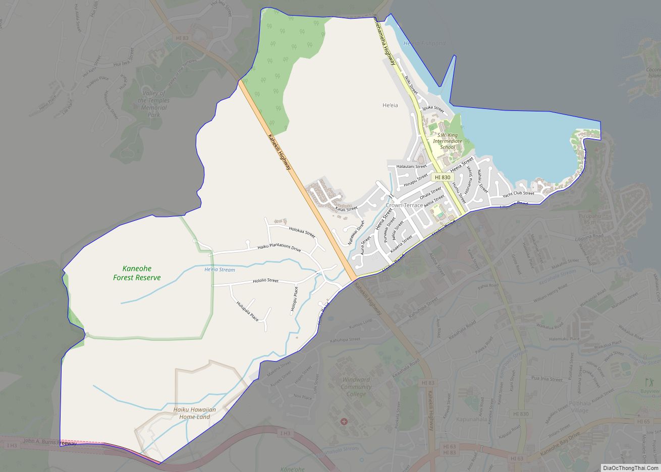
Heʻeia (Hawaiian pronunciation: [hɛˈʔɛjə]) is a census-designated place comprising several neighborhoods located in the City & County of Honolulu and the Koʻolaupoko District on the island of Oʻahu north of Kāneʻohe. In Hawaiian the words heʻe ʻia mean “washed away”, alluding to a victory achieved by the populace against others from leeward Oʻahu, aided by a … Read more

Map of Hawi CDP

Map of Hawi CDP

Hawi (Hawaiian: Hāwī; Hawaiian pronunciation: [həˈvi]) is a census-designated place (CDP) in Hawaiʻi County, Hawaii. The population was 2,268 at the time of the 2020 United States Census. Hawi is situated to the west of the community of Kapaau. Together, they comprise the most densely-populated region in the district of North Kohala. Historically this part of … Read more

Map of Honalo CDP

Map of Honalo CDP

Honalo is a census-designated place (CDP) in Hawaiʻi County, Hawaiʻi, United States. The population was 2,423 at the 2010 census, up from 1,987 at the 2000 census. Honalo CDP overview: Name: Honalo CDP LSAD Code: 57 LSAD Description: CDP (suffix) State: Hawaii County: Hawaii County Elevation: 1,391 ft (424 m) Total Area: 27.17 sq mi (70.38 km²) Land Area: 27.17 sq mi … Read more

Map of Holualoa CDP

Map of Holualoa CDP

Holualoa (Hawaiian: Hōlualoa) is a census-designated place (CDP) in Hawaii County, Hawaii, United States. The population was 8,538 at the 2010 census, up from 6,107 at the 2000 census. Holualoa’s boundaries were altered significantly for the 2020 census. The western portion of the CDP near the coast became part of the neighboring Kailua-Kona CDP, while … Read more

Map of Hilo CDP

Map of Hilo CDP

Hilo CDP overview: Name: Hilo CDP LSAD Code: 57 LSAD Description: CDP (suffix) State: Hawaii County: Hawaii County FIPS code: 1514650 Online Interactive Map Hilo online map. Source: Basemap layers from Google Map, Open Street Map (OSM), Arcgisonline, Wmflabs. Boundary Data from Database of Global Administrative Areas. Hilo location map. Where is Hilo CDP? Hilo … Read more

Map of Honomu CDP

Map of Honomu CDP

Honomū (Hawaiian: Honomū) is a census-designated place (CDP) in Hawaiʻi County, Hawaii, United States. The population was 509 at the 2010 census, down from 541 at the 2000 census. Honomu CDP overview: Name: Honomu CDP LSAD Code: 57 LSAD Description: CDP (suffix) State: Hawaii County: Hawaii County Elevation: 300 ft (90 m) Total Area: 0.49 sq mi (1.26 km²) Land … Read more

Map of Honokaa CDP

Map of Honokaa CDP

Honokaʻa is a census-designated place (CDP) in the Hamakua District of Hawaiʻi County, Hawaiʻi, United States. The population was 2,699 at the 2020 census. Honokaa CDP overview: Name: Honokaa CDP LSAD Code: 57 LSAD Description: CDP (suffix) State: Hawaii County: Hawaii County Elevation: 994 ft (303 m) Total Area: 2.11 sq mi (5.45 km²) Land Area: 2.11 sq mi (5.45 km²) Water Area: … Read more

Map of Honaunau-Napoopoo CDP

Map of Honaunau-Napoopoo CDP

Hōnaunau-Nāpōʻopoʻo (Hawaiian: Hōnaunau-Nāpōʻopoʻo) is a census-designated place (CDP) in Hawaiʻi County, Hawaii, United States. The population was 2,416 at the 2020 census. Honaunau-Napoopoo CDP overview: Name: Honaunau-Napoopoo CDP LSAD Code: 57 LSAD Description: CDP (suffix) State: Hawaii County: Hawaii County Elevation: 750 ft (230 m) Total Area: 41.89 sq mi (108.49 km²) Land Area: 38.01 sq mi (98.43 km²) Water Area: 3.88 sq mi (10.06 km²) … Read more

Map of Kaanapali CDP

Map of Kaanapali CDP

Kaanapali (Hawaiian: Kāʻanapali) is a census-designated place (CDP) in Maui County, Hawaii, United States, on the island of Maui. The population was 1,161 at the 2020 census. The master-planned town is located in the Old Hawaii ahupuaa of Hanakaʻōʻō, as in the same name of the southern end of Kaanapali Beach’s Hanakaʻōʻō Canoe Beach. Kaanapali … Read more

Map of Kaaawa CDP

Map of Kaaawa CDP

Kaʻaʻawa is a small community and census-designated place (CDP) located in the windward district of Koʻolauloa, City & County of Honolulu on the island of Oʻahu, Hawaiʻi, United States. As of the 2010 Census, the total population for Kaʻaʻawa was 1,379. In Hawaiian, kaʻaʻawa means “the wrasse (fish)”. From the Hawaiian spelling Kaʻaʻawa it is … Read more

Map of Iroquois Point CDP

Map of Iroquois Point CDP

Iroquois Point is a census-designated place (CDP) in Honolulu County, Hawaii, United States, on the island of Oahu near Pearl Harbor. The population was 4,549 at the 2020 census. “Iroquois Point” refers to the geographic land area that is occupied by the Kapilina Beach Homes (known as “Waterfront at Pu’uloa” until 2015 and “Iroquois Point … Read more

Map of Kahuku CDP

Map of Kahuku CDP

Kahuku (Hawaiian pronunciation: [kəˈhuku]) is a census-designated place (CDP) in Honolulu, Hawaii, United States. In the Hawaiian language, ka huku means “the projection”, presumably a reference to Kahuku Point nearby, the northernmost point of land on the island of Oahu. As of the 2010 Census, Kahuku had a population of 2,614. Kahuku CDP overview: Name: Kahuku … Read more