Map of Kingston CDP, New Mexico

Map of Kingston CDP, New Mexico

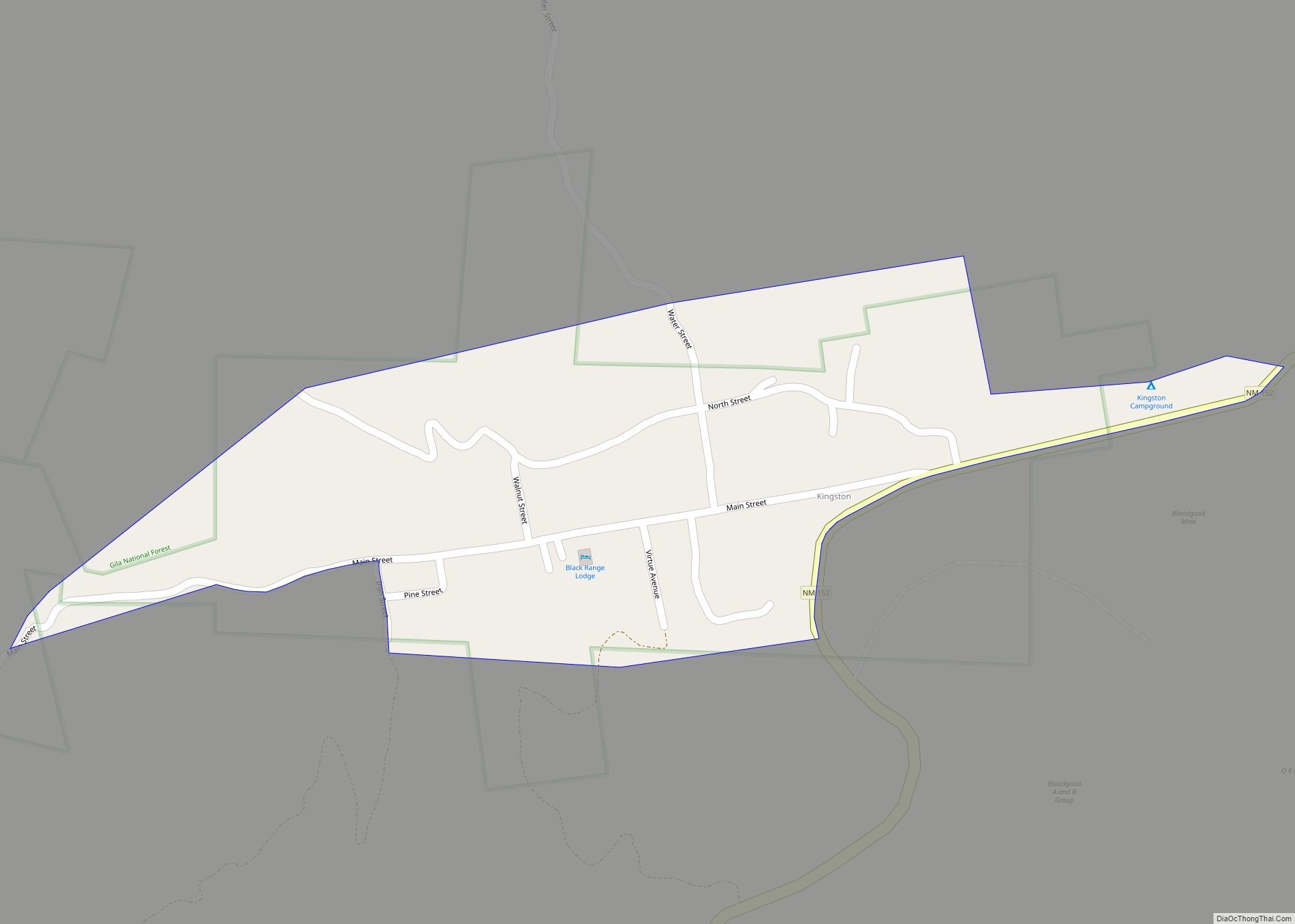
Kingston is a census-designated place (CDP) in Sierra County, New Mexico, United States. Its population was 32 as of the 2010 census. The community is located in the Black Range along New Mexico State Road 152. Kingston CDP overview: Name: Kingston CDP LSAD Code: 57 LSAD Description: CDP (suffix) State: New Mexico County: Sierra County … Read more

Map of Keeler Farm CDP

Map of Keeler Farm CDP

Keeler Farm is a census-designated place in Luna County, New Mexico, United States. Its population was 1,305 as of the 2010 census. Like other areas in Luna County, the community is in the Deming Public Schools school district. Keeler Farm CDP overview: Name: Keeler Farm CDP LSAD Code: 57 LSAD Description: CDP (suffix) State: New … Read more

Map of Jemez Springs village

Map of Jemez Springs village

Jemez Springs (pronounced HEH-mes) is a village in Sandoval County, New Mexico, United States. The population was 250 at the 2010 census. Named for the nearby Pueblo of Jemez, the village is the site of Jemez State Monument and the headquarters of the Jemez Ranger District. The village and nearby locations in the Jemez Valley … Read more

Map of Jemez Pueblo CDP

Map of Jemez Pueblo CDP

Jemez Pueblo (/ˈhɛmɛz/; Jemez: Walatowa, Navajo: Mąʼii Deeshgiizh) is a census-designated place (CDP) in Sandoval County, New Mexico, United States. The population was 1,788 at the 2010 census. It is part of the Albuquerque Metropolitan Statistical Area. The CDP is named after the pueblo at its center. Among Pueblo members, it is known as Walatowa. … Read more

Map of Jarales CDP

Map of Jarales CDP

Jarales is a census-designated place (CDP) in Valencia County, New Mexico, United States. The population was 2,475 at the 2010 census. It is part of the Albuquerque Metropolitan Statistical Area. Jarales CDP overview: Name: Jarales CDP LSAD Code: 57 LSAD Description: CDP (suffix) State: New Mexico County: Valencia County Elevation: 4,790 ft (1,460 m) Total Area: 8.72 sq mi … Read more

Map of Jal city

Map of Jal city

Jal is a small city located in Lea County, New Mexico, United States. It is New Mexico’s south-easternmost city, and shares a border with eastward state Texas. The population was 2,047 at the 2010 census. Jal is historically important in the natural gas industry, from the early 1900s to the present day. Jal city overview: … Read more

Map of Jaconita CDP

Map of Jaconita CDP

Jaconita is a census-designated place (CDP) in Santa Fe County, New Mexico, United States. It is part of the Santa Fe, New Mexico Metropolitan Statistical Area. The population was 332 at the 2010 census. It is considered to be a part of the Pojoaque Valley. Jaconita CDP overview: Name: Jaconita CDP LSAD Code: 57 LSAD … Read more

Map of Jacona CDP

Map of Jacona CDP

Jacona is an unincorporated community and census-designated place in Santa Fe County, New Mexico, United States. Its population was 412 as of the 2010 census. The name is a Spanish approximation of Sakona, the Tewa name of the pueblo which was abandoned in 1696. Jacona CDP overview: Name: Jacona CDP LSAD Code: 57 LSAD Description: … Read more

Map of Isleta Village Proper CDP

Map of Isleta Village Proper CDP

Isleta Village Proper is a census-designated place (CDP) in Bernalillo County, New Mexico, United States. The population was 491 at the 2010 census. It is part of the Albuquerque Metropolitan Statistical Area. Isleta Village Proper CDP overview: Name: Isleta Village Proper CDP LSAD Code: 57 LSAD Description: CDP (suffix) State: New Mexico County: Bernalillo County … Read more

Map of Indian Hills CDP, New Mexico

Map of Indian Hills CDP, New Mexico

Indian Hills is an unincorporated community and census-designated place in Torrance County, New Mexico, United States. Its population was 892 as of the 2010 census. Indian Hills CDP overview: Name: Indian Hills CDP LSAD Code: 57 LSAD Description: CDP (suffix) State: New Mexico County: Torrance County Elevation: 6,460 ft (1,970 m) Total Area: 5.71 sq mi (14.79 km²) Land Area: … Read more

Map of La Cueva CDP

Map of La Cueva CDP

La Cueva is a census-designated place in Sandoval County, New Mexico, United States. Its population was 168 as of the 2010 census. New Mexico State Road 126 passes through the community. La Cueva CDP overview: Name: La Cueva CDP LSAD Code: 57 LSAD Description: CDP (suffix) State: New Mexico County: Sandoval County Elevation: 7,680 ft (2,340 m) … Read more

Map of La Cienega CDP

Map of La Cienega CDP

La Cienega is a census-designated place (CDP) in Santa Fe County, New Mexico, United States. It is part of the Santa Fe, New Mexico, metropolitan statistical area. The population was 3,007 at the 2000 census. La Cienega is located on the site of a Keres pueblo that took part in the 1680 Pueblo Revolt. La … Read more