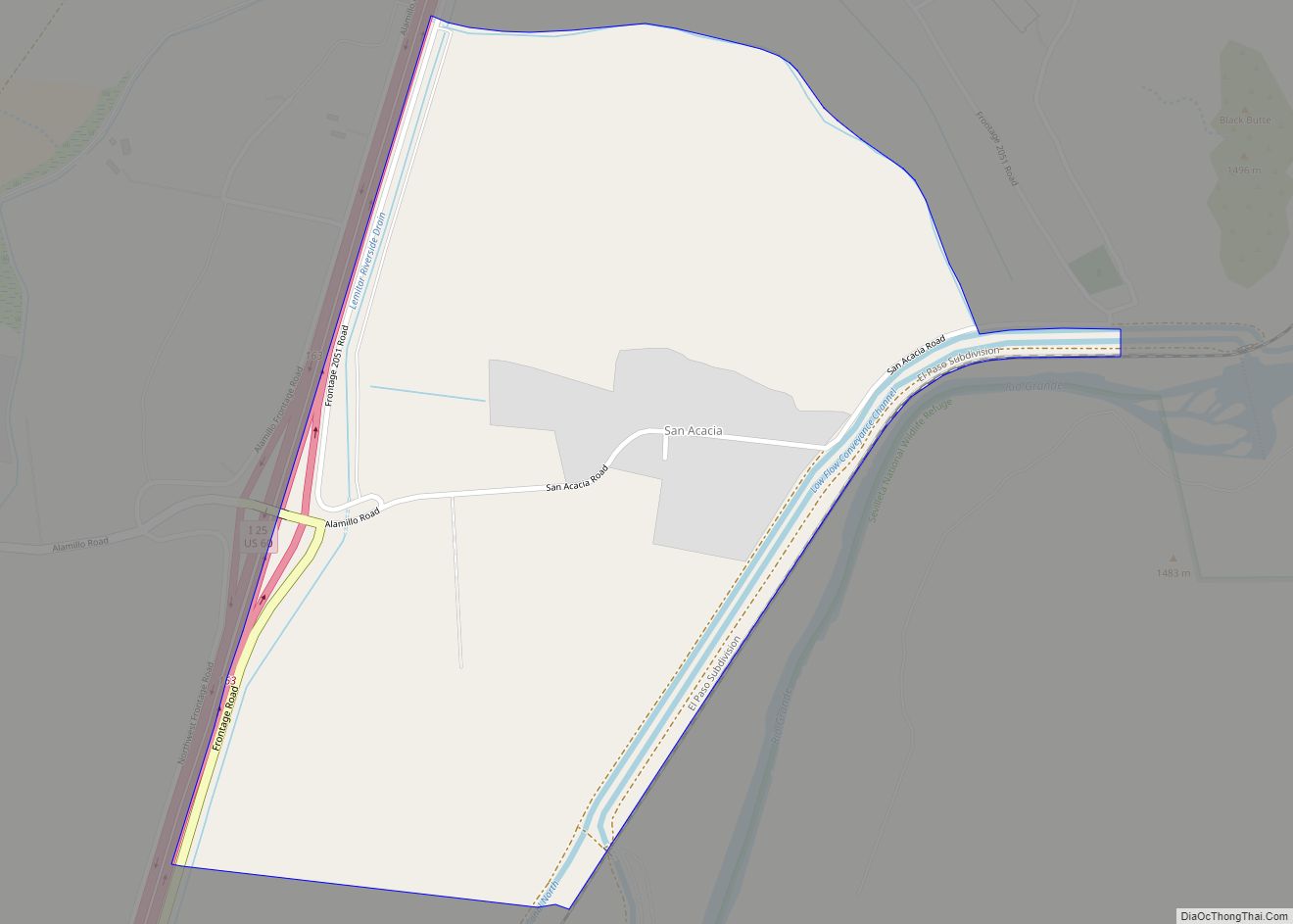
Map of Rowe CDP

Map of Rowe CDP

Rowe is a census-designated place (CDP) in San Miguel County, New Mexico, United States. Rowe CDP overview: Name: Rowe CDP LSAD Code: 57 LSAD Description: CDP (suffix) State: New Mexico County: San Miguel County Elevation: 6,821 ft (2,079 m) Total Area: 6.11 sq mi (15.83 km²) Land Area: 6.11 sq mi (15.83 km²) Water Area: 0.00 sq mi (0.00 km²) Total Population: 304 Population Density: 49.74/sq mi … Read more

Map of Rosedale CDP, New Mexico

Map of Rosedale CDP, New Mexico

Rosedale is a census-designated place in Grant County, New Mexico, United States. Its population was 394 as of the 2010 census. Rosedale was established in 1882 by prospector Jack Richardson and his wife Rose. Rosedale CDP overview: Name: Rosedale CDP LSAD Code: 57 LSAD Description: CDP (suffix) State: New Mexico County: Grant County Elevation: 5,968 ft … Read more

Map of San Jose CDP, New Mexico

Map of San Jose CDP, New Mexico

San Jose is a census-designated place in San Miguel County, New Mexico, United States. Its population was 137 as of the 2010 census. San Jose has a post office, with ZIP code 87565. Exit 319 of Interstate 25 serves the community. San Jose was founded in 1803 when allotments of land were made to 45 … Read more

Map of San Jon village

Map of San Jon village

San Jon (/ˌsæn ˈhoʊn/) is a village in Quay County, New Mexico, United States. The population was 216 at the 2010 census. San Jon village overview: Name: San Jon village LSAD Code: 47 LSAD Description: village (suffix) State: New Mexico County: Quay County Elevation: 4,032 ft (1,229 m) Total Area: 2.93 sq mi (7.58 km²) Land Area: 2.93 sq mi (7.58 km²) Water … Read more

Map of San Ildefonso Pueblo CDP

Map of San Ildefonso Pueblo CDP

San Ildefonso Pueblo (Tewa: Pʼohwhogeh Ówîngeh [p’òhxʷógè ʔówîŋgè] “where the water cuts through”) is a census-designated place (CDP) in Santa Fe County, New Mexico, United States, and a federally recognized tribe, established c. 1300 C.E. The Pueblo is self-governing and is part of the Santa Fe, New Mexico Metropolitan Statistical Area. The population was 524 … Read more

Map of San Fidel CDP

Map of San Fidel CDP

San Fidel is a census-designated place in Cibola County, New Mexico, United States. Its population was 138 as of the 2010 census. San Fidel has a post office with ZIP code 87049, which opened on December 24, 1910. New Mexico State Road 124, the original Route 66, also known as the “Old Road,” passes through … Read more

Map of San Felipe Pueblo CDP

Map of San Felipe Pueblo CDP

San Felipe Pueblo (Eastern Keres: Katishtya, Navajo Tsédááʼkin) is a census-designated place (CDP) in Sandoval County, New Mexico, United States, and is located 10 miles (16 km) north of Bernalillo. As of the 2000 census, the CDP population was 2,080. It is part of the Albuquerque Metropolitan Statistical Area. San Felipe Pueblo CDP overview: Name: San … Read more

Map of San Cristobal CDP

Map of San Cristobal CDP

San Cristobal is a census-designated place in Taos County, New Mexico. Its population was 273 as of the 2010 census. San Cristobal has a post office with ZIP code 87564, which opened on February 16, 1932. San Cristobal CDP overview: Name: San Cristobal CDP LSAD Code: 57 LSAD Description: CDP (suffix) State: New Mexico County: … Read more

Map of San Miguel CDP, New Mexico

Map of San Miguel CDP, New Mexico

San Miguel is a census-designated place in Doña Ana County, New Mexico, United States. Its population was 1,153 as of the 2010 census. San Miguel has a post office with ZIP code 88058. The community is located at the junction of state routes 28 and 192. San Miguel CDP overview: Name: San Miguel CDP LSAD … Read more

Map of San Mateo CDP, New Mexico

Map of San Mateo CDP, New Mexico

San Mateo is a census-designated place in Cibola County, New Mexico, United States. The population was 161 at the 2010 census. The community has a Catholic church, a Baptist church, a Morada, a cemetery, a Volunteer Fire Department(McKinley County funded) and an old abandoned elementary school. It is also coined “the Uranium Capital of the … Read more

Map of San Luis CDP, New Mexico

Map of San Luis CDP, New Mexico

San Luis is an unincorporated community and census-designated place in Sandoval County, New Mexico, United States. Its population was 59 as of the 2010 census. New Mexico State Road 279 passes through the community. San Luis CDP overview: Name: San Luis CDP LSAD Code: 57 LSAD Description: CDP (suffix) State: New Mexico County: Sandoval County … Read more

Map of San Lorenzo CDP, New Mexico

Map of San Lorenzo CDP, New Mexico

San Lorenzo is a census-designated place in Grant County, New Mexico, United States. San Lorenzo is 13 miles (21 km) east-northeast of Bayard. Its population was 97 as of the 2010 census. A post office operated from 1886 to 1963. San Lorenzo CDP overview: Name: San Lorenzo CDP LSAD Code: 57 LSAD Description: CDP (suffix) State: … Read more