Map of Bayard city, New Mexico

Map of Bayard city, New Mexico

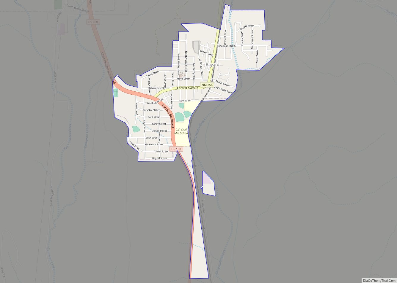
Bayard is a city in Grant County, New Mexico, United States. It is near Santa Rita, east of Silver City. The population was 2,328 at the 2010 census, down from 2,534 in 2000. This city was incorporated on August 20, 1938. Bayard city overview: Name: Bayard city LSAD Code: 25 LSAD Description: city (suffix) State: … Read more

Map of Aztec city, New Mexico

Map of Aztec city, New Mexico

Aztec (Navajo: Kinteel) is a city in, and the county seat of, San Juan County, New Mexico, United States. The city population was 6,201 as of the 2020 census. The Aztec Ruins National Monument is located on the north side of the city. Aztec city overview: Name: Aztec city LSAD Code: 25 LSAD Description: city … Read more

Map of Bluewater Acres CDP

Map of Bluewater Acres CDP

Las Tusas is a census-designated place (CDP) in Cibola County, New Mexico, United States. At the 2010 census the CDP was known as Bluewater Acres and had a population of 206. Bluewater Acres CDP overview: Name: Bluewater Acres CDP LSAD Code: 57 LSAD Description: CDP (suffix) State: New Mexico County: Cibola County Elevation: 7,475 ft (2,278 m) … Read more

Map of Bloomfield city, New Mexico

Map of Bloomfield city, New Mexico

Bloomfield (Navajo: Naabiʼání) is a city in northeastern San Juan County, New Mexico, United States. It is part of the Farmington Metropolitan Statistical Area. The population was 8,112 at the 2010 census. It is on the Trails of the Ancients Byway, one of the designated New Mexico Scenic Byways. Bloomfield city overview: Name: Bloomfield city … Read more

Map of Canjilon CDP

Map of Canjilon CDP

Canjilon is a census-designated place in Rio Arriba County, New Mexico, United States. Its population was 256 as of the 2010 census. Canjilon has a post office with ZIP code 87515. The community is located along New Mexico State Road 115. Canjilon was first settled in 1870, and by 1880, 35 families lived here. Canjilon … Read more

Map of Caballo CDP

Map of Caballo CDP

Caballo is a census-designated place in Sierra County, New Mexico, United States. Its population was 112 as of the 2010 census. Caballo has a post office with ZIP code 87931. The community is located along New Mexico State Road 187, north and south of Exit 63 on Interstate 25. Caballo was founded in 1908, when … Read more

Map of Buckhorn CDP, New Mexico

Map of Buckhorn CDP, New Mexico

Buckhorn is a census-designated place in Grant County, New Mexico, United States. Its population was 200 as of the 2010 census. Buckhorn has a post office with ZIP code 88025. U.S. Route 180 passes through the community. The post office was established in 1913. Buckhorn was named for the nearby Buckhorn Creek. Buckhorn CDP overview: … Read more

Map of Brimhall Nizhoni CDP

Map of Brimhall Nizhoni CDP

Brimhall Nizhoni (Navajo: Maʼii Tééh Yitłizhí) is a census-designated place (CDP) in McKinley County, New Mexico, United States. The population was 199 at the 2010 census. The Navajo Coyote Canyon Chapter House is located in Brimhall. Brimhall Nizhoni CDP overview: Name: Brimhall Nizhoni CDP LSAD Code: 57 LSAD Description: CDP (suffix) State: New Mexico County: … Read more

Map of Brazos CDP

Map of Brazos CDP

Brazos is an unincorporated community and census-designated place in Rio Arriba County, New Mexico, United States. Its population was 44 as of the 2010 census. U.S. Route 64 passes through the community. See Los Brazos Historic District. Brazos CDP overview: Name: Brazos CDP LSAD Code: 57 LSAD Description: CDP (suffix) State: New Mexico County: Rio … Read more

Map of Bosque Farms village

Map of Bosque Farms village

Bosque Farms is a village in Valencia County, New Mexico, United States. The population was 3,904 at the 2010 census. It is part of the Albuquerque Metropolitan Statistical Area. Bosque Farms village overview: Name: Bosque Farms village LSAD Code: 47 LSAD Description: village (suffix) State: New Mexico County: Valencia County Elevation: 4,865 ft (1,483 m) Total Area: … Read more

Map of Boles Acres CDP

Map of Boles Acres CDP

Boles Acres is a census-designated place (CDP) in Otero County, New Mexico, United States. The population was 1,638 at the 2010 census. Boles Acres CDP overview: Name: Boles Acres CDP LSAD Code: 57 LSAD Description: CDP (suffix) State: New Mexico County: Otero County Elevation: 4,137 ft (1,261 m) Total Area: 12.24 sq mi (31.70 km²) Land Area: 12.24 sq mi (31.70 km²) Water … Read more

Map of Bluewater Village CDP

Map of Bluewater Village CDP

Bluewater Village is a census-designated place in Cibola County, New Mexico, United States. Its population in 2010 was 628. Bluewater Village CDP overview: Name: Bluewater Village CDP LSAD Code: 57 LSAD Description: CDP (suffix) State: New Mexico County: Cibola County Elevation: 6,749 ft (2,057 m) Total Area: 3.56 sq mi (9.22 km²) Land Area: 3.55 sq mi (9.18 km²) Water Area: 0.01 sq mi (0.03 km²) … Read more