Map of Aibonito zona urbana

Map of Aibonito zona urbana

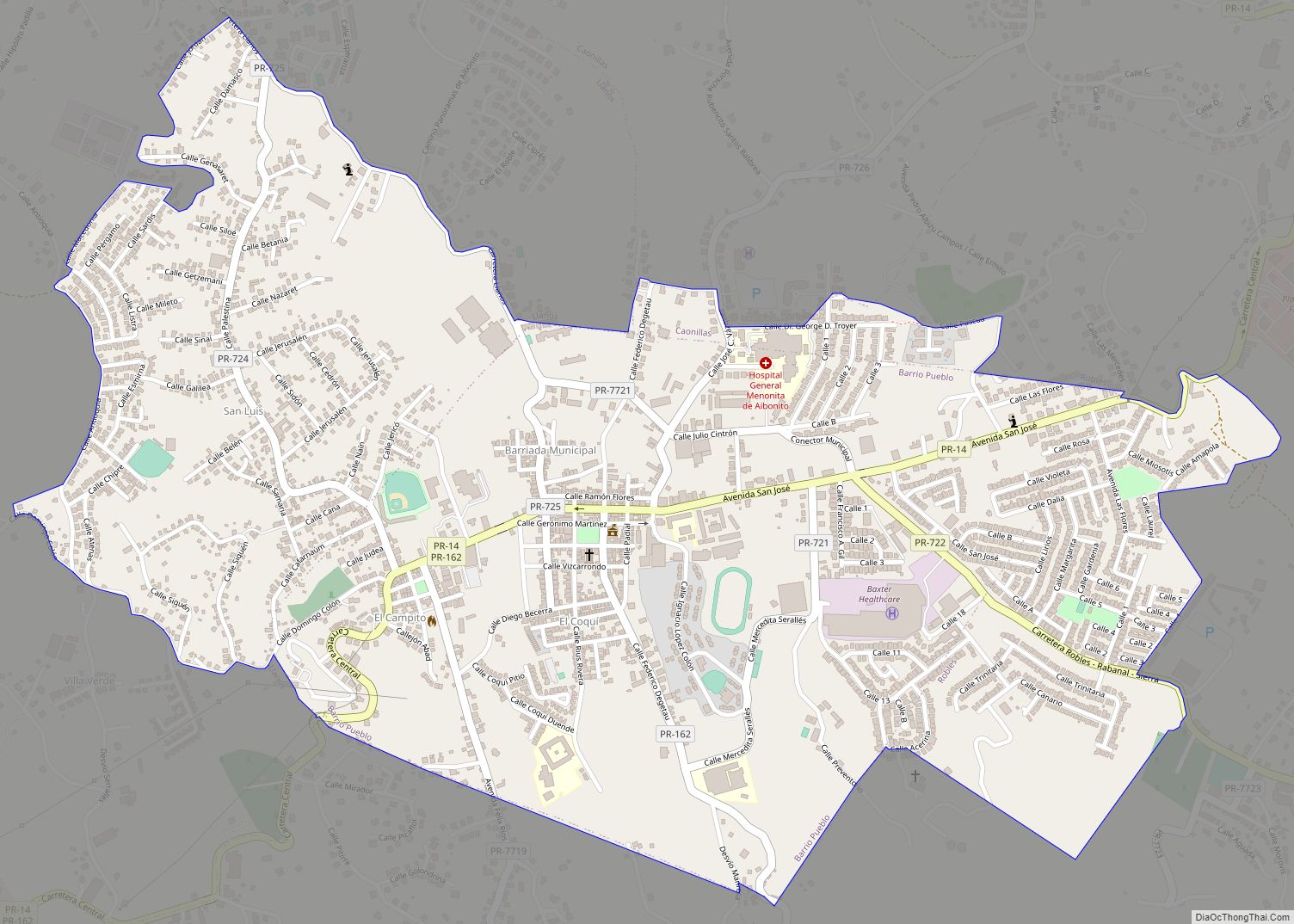
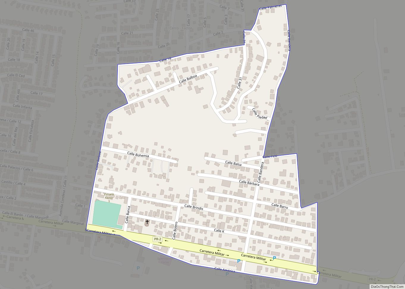
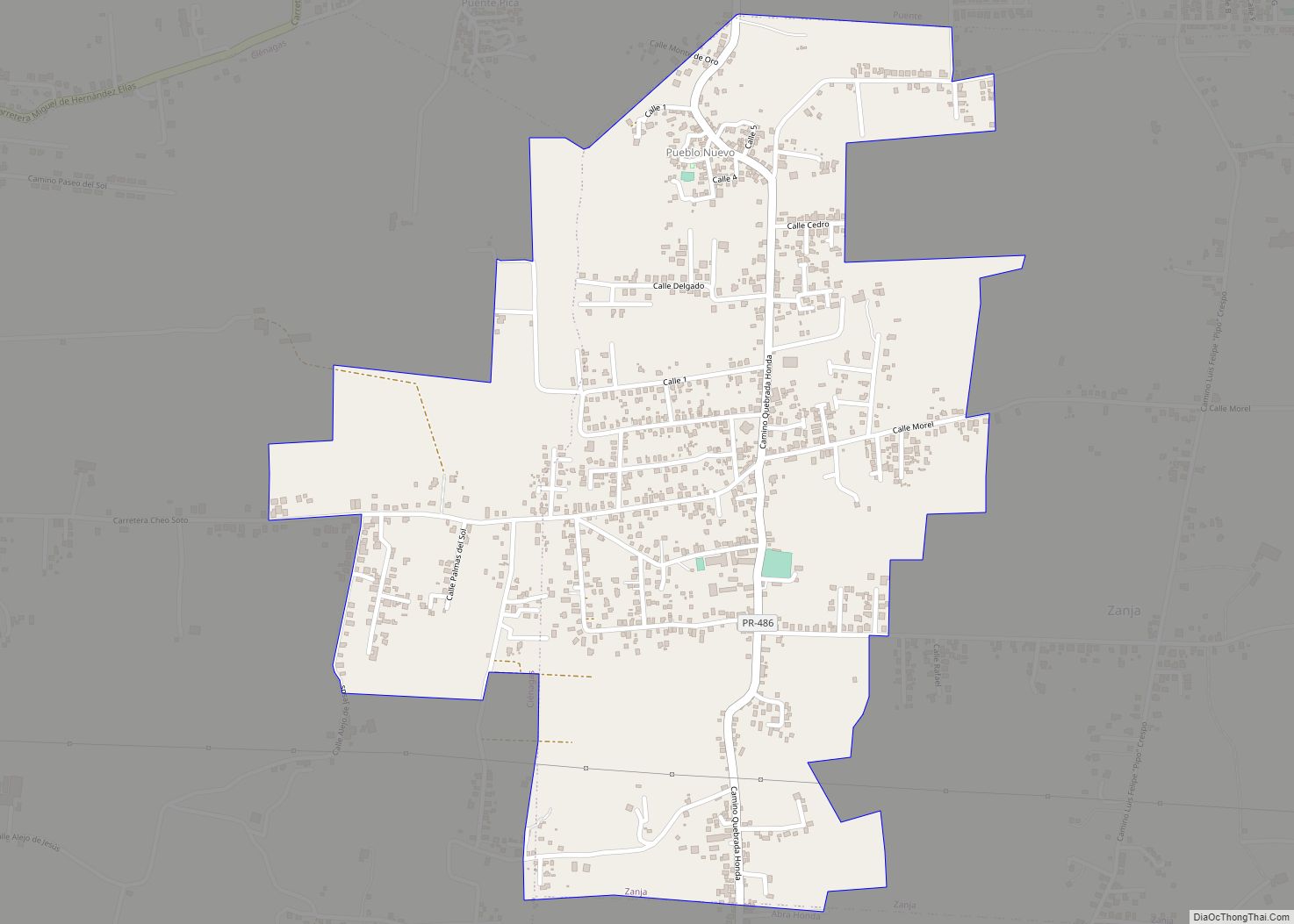
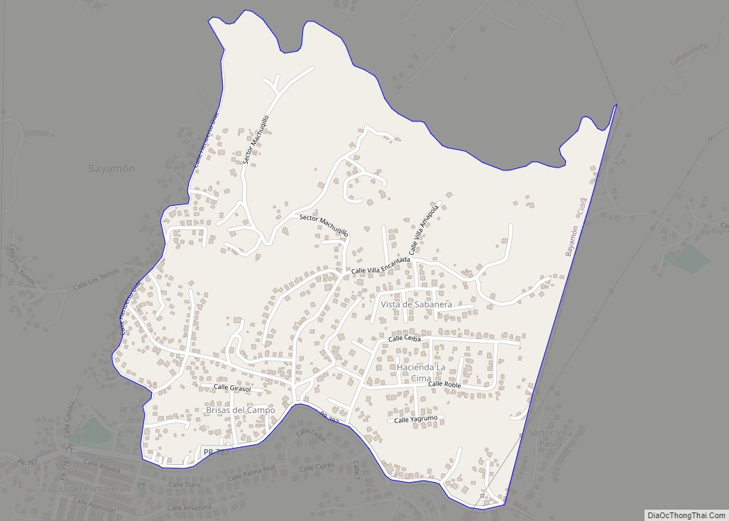
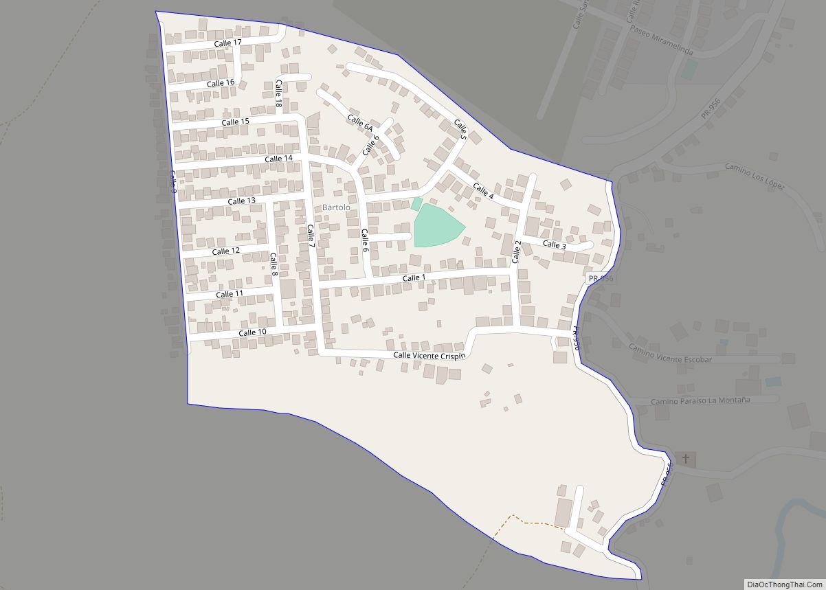
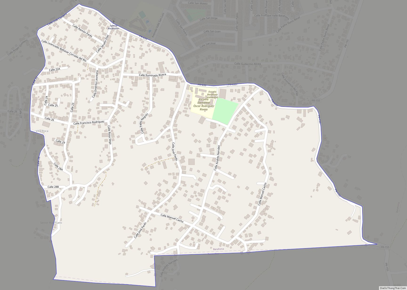
Aibonito zona urbana overview: Name: Aibonito zona urbana LSAD Code: 62 LSAD Description: zona urbana (suffix) State: Puerto Rico County: Aibonito Municipio FIPS code: 7201218 Online Interactive Map Aibonito online map. Source: Basemap layers from Google Map, Open Street Map (OSM), Arcgisonline, Wmflabs. Boundary Data from Database of Global Administrative Areas. Aibonito location map. Where … Read more

Map of Aguilita comunidad

Map of Aguilita comunidad

Aguilita comunidad overview: Name: Aguilita comunidad LSAD Code: 55 LSAD Description: comunidad (suffix) State: Puerto Rico County: Juana Díaz Municipio FIPS code: 7201089 Online Interactive Map Aguilita online map. Source: Basemap layers from Google Map, Open Street Map (OSM), Arcgisonline, Wmflabs. Boundary Data from Database of Global Administrative Areas. Aguilita location map. Where is Aguilita … Read more

Map of Aguas Claras comunidad

Map of Aguas Claras comunidad

Aguas Claras comunidad overview: Name: Aguas Claras comunidad LSAD Code: 55 LSAD Description: comunidad (suffix) State: Puerto Rico County: Ceiba Municipio FIPS code: 7201003 Online Interactive Map Aguas Claras online map. Source: Basemap layers from Google Map, Open Street Map (OSM), Arcgisonline, Wmflabs. Boundary Data from Database of Global Administrative Areas. Aguas Claras location map. … Read more

Map of Aceitunas comunidad

Map of Aceitunas comunidad

Aceitunas (Spanish for ‘olives’) is a barrio in the municipality of Moca, Puerto Rico with a population of 3,098 in 2010. The land area of this subdivision is 5.36 square miles (13.9 km). A neighborhood within Aceitunas barrio called Aceitunas community had a total population of 1,436 people in 2010, living in 0.26 square miles (0.67 km). … Read more

Map of Alianza comunidad

Map of Alianza comunidad

Alianza comunidad overview: Name: Alianza comunidad LSAD Code: 55 LSAD Description: comunidad (suffix) State: Puerto Rico County: Camuy Municipio FIPS code: 7201863 Online Interactive Map Alianza online map. Source: Basemap layers from Google Map, Open Street Map (OSM), Arcgisonline, Wmflabs. Boundary Data from Database of Global Administrative Areas. Alianza location map. Where is Alianza comunidad? … Read more

Map of Bayamón comunidad

Map of Bayamón comunidad

Bayamón is a barrio in the municipality of Cidra, Puerto Rico. Its population in 2010 was 5,995. Bayamón comunidad overview: Name: Bayamón comunidad LSAD Code: 55 LSAD Description: comunidad (suffix) State: Puerto Rico County: Cidra Municipio Elevation: 1,388 ft (423 m) Total Area: 3.15 sq mi (8.2 km²) Land Area: 2.85 sq mi (7.4 km²) Water Area: 0.30 sq mi (0.8 km²) Total Population: 5,995 Population … Read more

Map of Bartolo comunidad

Map of Bartolo comunidad

Bartolo is a barrio in the municipality of Lares, Puerto Rico. Its population in 2010 was 2,035. Bartolo is on the southeastern border of Lares and Adjuntas. Bartolo comunidad overview: Name: Bartolo comunidad LSAD Code: 55 LSAD Description: comunidad (suffix) State: Puerto Rico County: Río Grande Municipio Elevation: 1,818 ft (554 m) Total Area: 8.44 sq mi (21.9 km²) Land … Read more

Map of Barahona comunidad

Map of Barahona comunidad

Barahona is a barrio in the municipality of Morovis, Puerto Rico. Barahona has thirteen sectors and its population in 2010 was 5,244. Barahona comunidad overview: Name: Barahona comunidad LSAD Code: 55 LSAD Description: comunidad (suffix) State: Puerto Rico County: Morovis Municipio Elevation: 561 ft (171 m) Total Area: 3.76 sq mi (9.7 km²) Land Area: 3.76 sq mi (9.7 km²) Water Area: 0 sq mi … Read more

Map of Bajandas comunidad

Map of Bajandas comunidad

Bajandas comunidad overview: Name: Bajandas comunidad LSAD Code: 55 LSAD Description: comunidad (suffix) State: Puerto Rico County: Humacao Municipio FIPS code: 7204701 Online Interactive Map Bajandas online map. Source: Basemap layers from Google Map, Open Street Map (OSM), Arcgisonline, Wmflabs. Boundary Data from Database of Global Administrative Areas. Bajandas location map. Where is Bajandas comunidad? … Read more

Map of Bajadero comunidad

Map of Bajadero comunidad

Bajadero is a community in the municipality of Arecibo, Puerto Rico. Its population in 2010 was 3,710. Three barrios border each other and each contains a section of the community. The Bajadero community in the barrio of Arenalejos had a population of 2,380 in 2010. The Bajadero community in the barrio of Carreras had a … Read more

Map of Bairoa La Veinticinco comunidad

Map of Bairoa La Veinticinco comunidad

Bairoa La Veinticinco comunidad overview: Name: Bairoa La Veinticinco comunidad LSAD Code: 55 LSAD Description: comunidad (suffix) State: Puerto Rico County: Caguas Municipio FIPS code: 7204620 Online Interactive Map Bairoa La Veinticinco online map. Source: Basemap layers from Google Map, Open Street Map (OSM), Arcgisonline, Wmflabs. Boundary Data from Database of Global Administrative Areas. Bairoa … Read more

Map of Antón Ruíz comunidad

Map of Antón Ruíz comunidad

Antón Ruíz is a barrio in the municipality of Humacao, Puerto Rico. Its population in 2010 was 3,496. Antón Ruíz comunidad overview: Name: Antón Ruíz comunidad LSAD Code: 55 LSAD Description: comunidad (suffix) State: Puerto Rico County: Humacao Municipio Elevation: 13 ft (4 m) Total Area: 8.4 sq mi (22 km²) Land Area: 8.4 sq mi (22 km²) Water Area: 0 sq mi (0 km²) Total … Read more