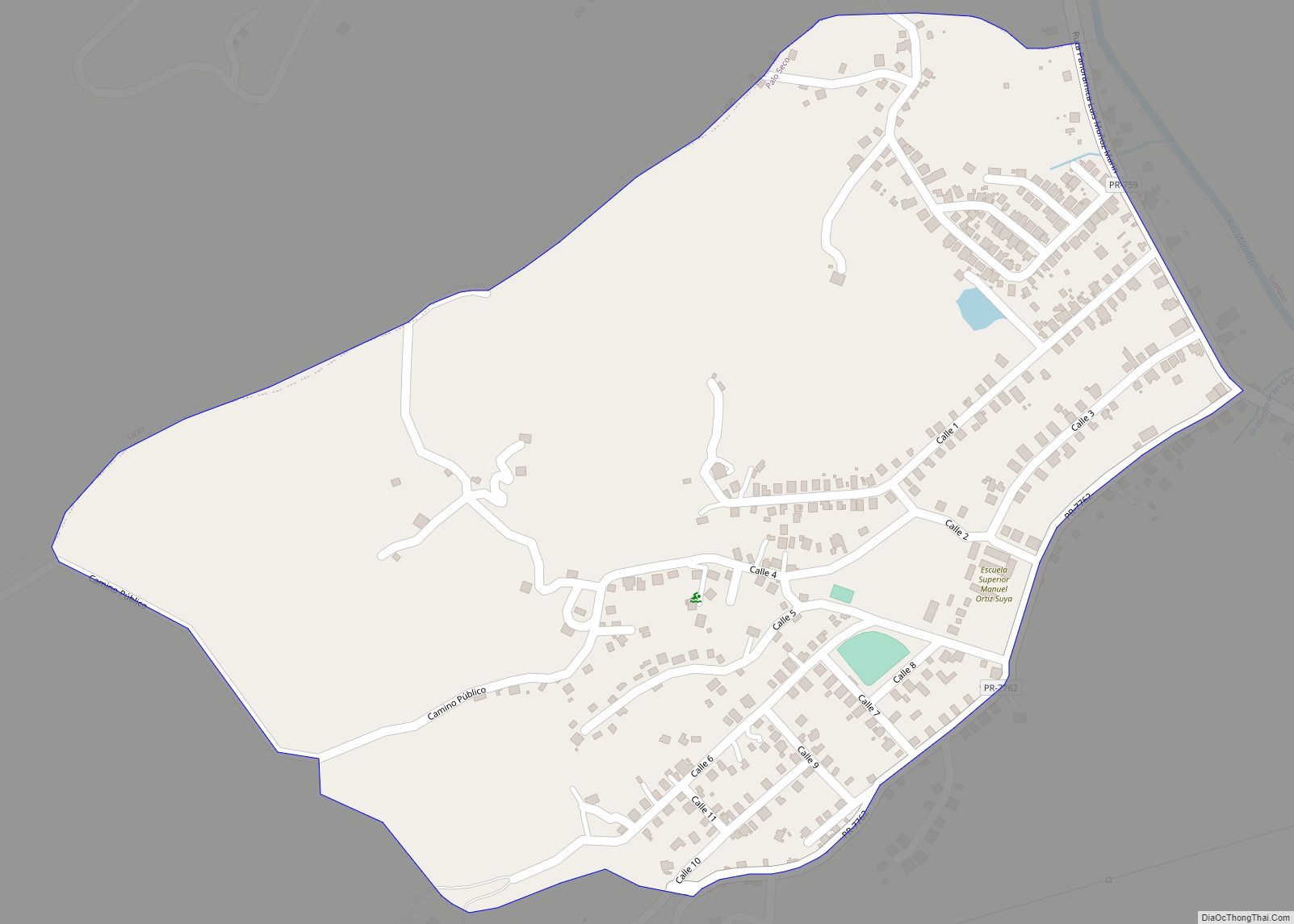
Pastos comunidad overview: Name: Pastos comunidad LSAD Code: 55 LSAD Description: comunidad (suffix) State: Puerto Rico County: Aibonito Municipio FIPS code: 7260257 Online Interactive Map Pastos online map. Source: Basemap layers from Google Map, Open Street Map (OSM), Arcgisonline, Wmflabs. Boundary Data from Database of Global Administrative Areas. Pastos location map. Where is Pastos comunidad? ... Read more
Puerto Rico Cities and Places
Parcelas Viejas Borinquen comunidad overview: Name: Parcelas Viejas Borinquen comunidad LSAD Code: 55 LSAD Description: comunidad (suffix) State: Puerto Rico County: Caguas Municipio FIPS code: 7259450 Online Interactive Map Parcelas Viejas Borinquen online map. Source: Basemap layers from Google Map, Open Street Map (OSM), Arcgisonline, Wmflabs. Boundary Data from Database of Global Administrative Areas. Parcelas ... Read more
Pueblito del Río comunidad overview: Name: Pueblito del Río comunidad LSAD Code: 55 LSAD Description: comunidad (suffix) State: Puerto Rico County: Las Piedras Municipio FIPS code: 7264500 Online Interactive Map Pueblito del Río online map. Source: Basemap layers from Google Map, Open Street Map (OSM), Arcgisonline, Wmflabs. Boundary Data from Database of Global Administrative Areas. ... Read more
Pueblito del Carmen comunidad overview: Name: Pueblito del Carmen comunidad LSAD Code: 55 LSAD Description: comunidad (suffix) State: Puerto Rico County: Guayama Municipio FIPS code: 7264400 Online Interactive Map Pueblito del Carmen online map. Source: Basemap layers from Google Map, Open Street Map (OSM), Arcgisonline, Wmflabs. Boundary Data from Database of Global Administrative Areas. Pueblito ... Read more
Potala Pastillo comunidad overview: Name: Potala Pastillo comunidad LSAD Code: 55 LSAD Description: comunidad (suffix) State: Puerto Rico County: Juana Díaz Municipio FIPS code: 7264127 Online Interactive Map Potala Pastillo online map. Source: Basemap layers from Google Map, Open Street Map (OSM), Arcgisonline, Wmflabs. Boundary Data from Database of Global Administrative Areas. Potala Pastillo location ... Read more
Pole Ojea comunidad overview: Name: Pole Ojea comunidad LSAD Code: 55 LSAD Description: comunidad (suffix) State: Puerto Rico County: Cabo Rojo Municipio FIPS code: 7263697 Online Interactive Map Pole Ojea online map. Source: Basemap layers from Google Map, Open Street Map (OSM), Arcgisonline, Wmflabs. Boundary Data from Database of Global Administrative Areas. Pole Ojea location ... Read more
Playita comunidad overview: Name: Playita comunidad LSAD Code: 55 LSAD Description: comunidad (suffix) State: Puerto Rico County: Yabucoa Municipio FIPS code: 7263525 Online Interactive Map Playita online map. Source: Basemap layers from Google Map, Open Street Map (OSM), Arcgisonline, Wmflabs. Boundary Data from Database of Global Administrative Areas. Playita location map. Where is Playita comunidad? ... Read more
Playita Cortada comunidad overview: Name: Playita Cortada comunidad LSAD Code: 55 LSAD Description: comunidad (suffix) State: Puerto Rico County: Santa Isabel Municipio FIPS code: 7263568 Online Interactive Map Playita Cortada online map. Source: Basemap layers from Google Map, Open Street Map (OSM), Arcgisonline, Wmflabs. Boundary Data from Database of Global Administrative Areas. Playita Cortada location ... Read more
Playa Fortuna comunidad overview: Name: Playa Fortuna comunidad LSAD Code: 55 LSAD Description: comunidad (suffix) State: Puerto Rico County: Luquillo Municipio FIPS code: 7263310 Online Interactive Map Playa Fortuna online map. Source: Basemap layers from Google Map, Open Street Map (OSM), Arcgisonline, Wmflabs. Boundary Data from Database of Global Administrative Areas. Playa Fortuna location map. ... Read more
Piedra Gorda is a barrio in the municipality of Camuy, Puerto Rico. Its population in 2010 was 1,846. Piedra Gorda comunidad overview: Name: Piedra Gorda comunidad LSAD Code: 55 LSAD Description: comunidad (suffix) State: Puerto Rico County: Camuy Municipio Elevation: 676 ft (206 m) Total Area: 3.92 sq mi (10.2 km²) Land Area: 3.92 sq mi (10.2 km²) Water Area: 0.00 sq mi (0.0 km²) Total ... Read more
Piedra Aguza comunidad overview: Name: Piedra Aguza comunidad LSAD Code: 55 LSAD Description: comunidad (suffix) State: Puerto Rico County: Juana Díaz Municipio FIPS code: 7261545 Online Interactive Map Piedra Aguza online map. Source: Basemap layers from Google Map, Open Street Map (OSM), Arcgisonline, Wmflabs. Boundary Data from Database of Global Administrative Areas. Piedra Aguza location ... Read more
Peña Pobre is a barrio in the municipality of Naguabo, Puerto Rico. Its population in 2010 was 4,131. Peña Pobre comunidad overview: Name: Peña Pobre comunidad LSAD Code: 55 LSAD Description: comunidad (suffix) State: Puerto Rico County: Naguabo Municipio Elevation: 413 ft (126 m) Total Area: 4.38 sq mi (11.3 km²) Land Area: 4.38 sq mi (11.3 km²) Water Area: 0 sq mi (0 km²) Total ... Read more