Map of Charlotte Amalie West CDP

Map of Charlotte Amalie West CDP

Charlotte Amalie West CDP overview: Name: Charlotte Amalie West CDP LSAD Code: 57 LSAD Description: CDP (suffix) FIPS code: 7819000 Online Interactive Map Charlotte Amalie West online map. Source: Basemap layers from Google Map, Open Street Map (OSM), Arcgisonline, Wmflabs. Boundary Data from Database of Global Administrative Areas. Charlotte Amalie West location map. Where is … Read more

Map of Charlotte Amalie East CDP

Map of Charlotte Amalie East CDP

Charlotte Amalie East CDP overview: Name: Charlotte Amalie East CDP LSAD Code: 57 LSAD Description: CDP (suffix) FIPS code: 7818100 Online Interactive Map Charlotte Amalie East online map. Source: Basemap layers from Google Map, Open Street Map (OSM), Arcgisonline, Wmflabs. Boundary Data from Database of Global Administrative Areas. Charlotte Amalie East location map. Where is … Read more

Map of Charlotte Amalie town

Map of Charlotte Amalie town

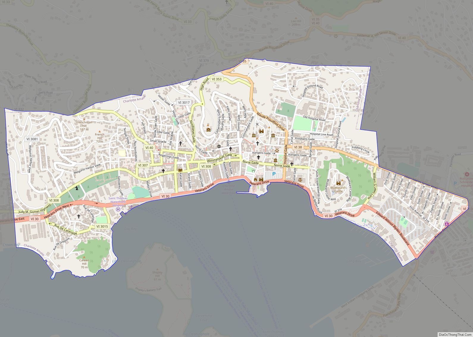
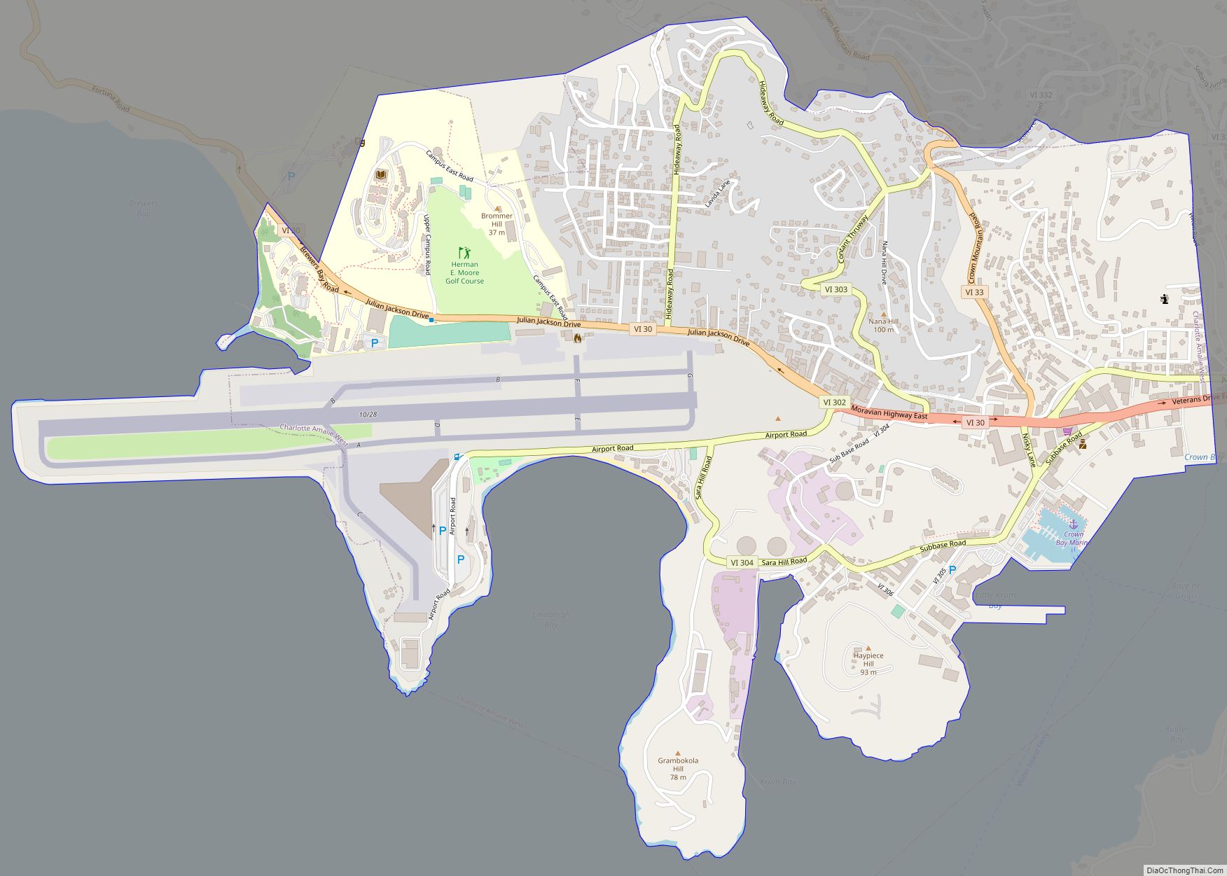
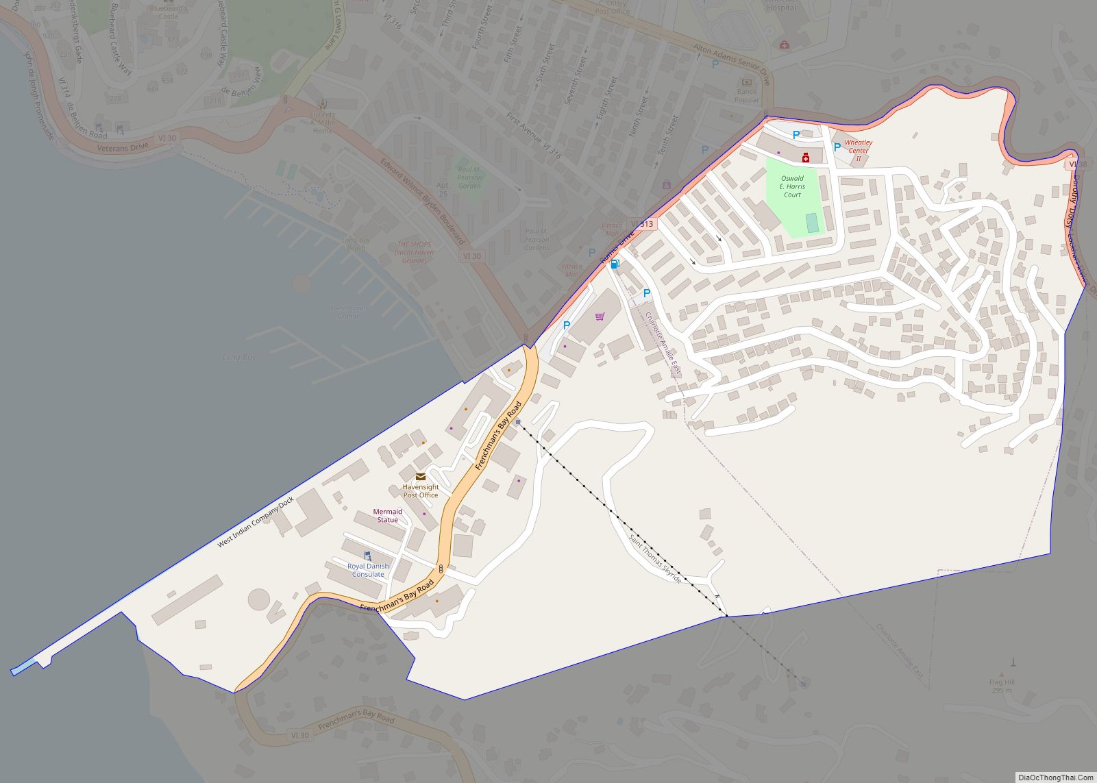
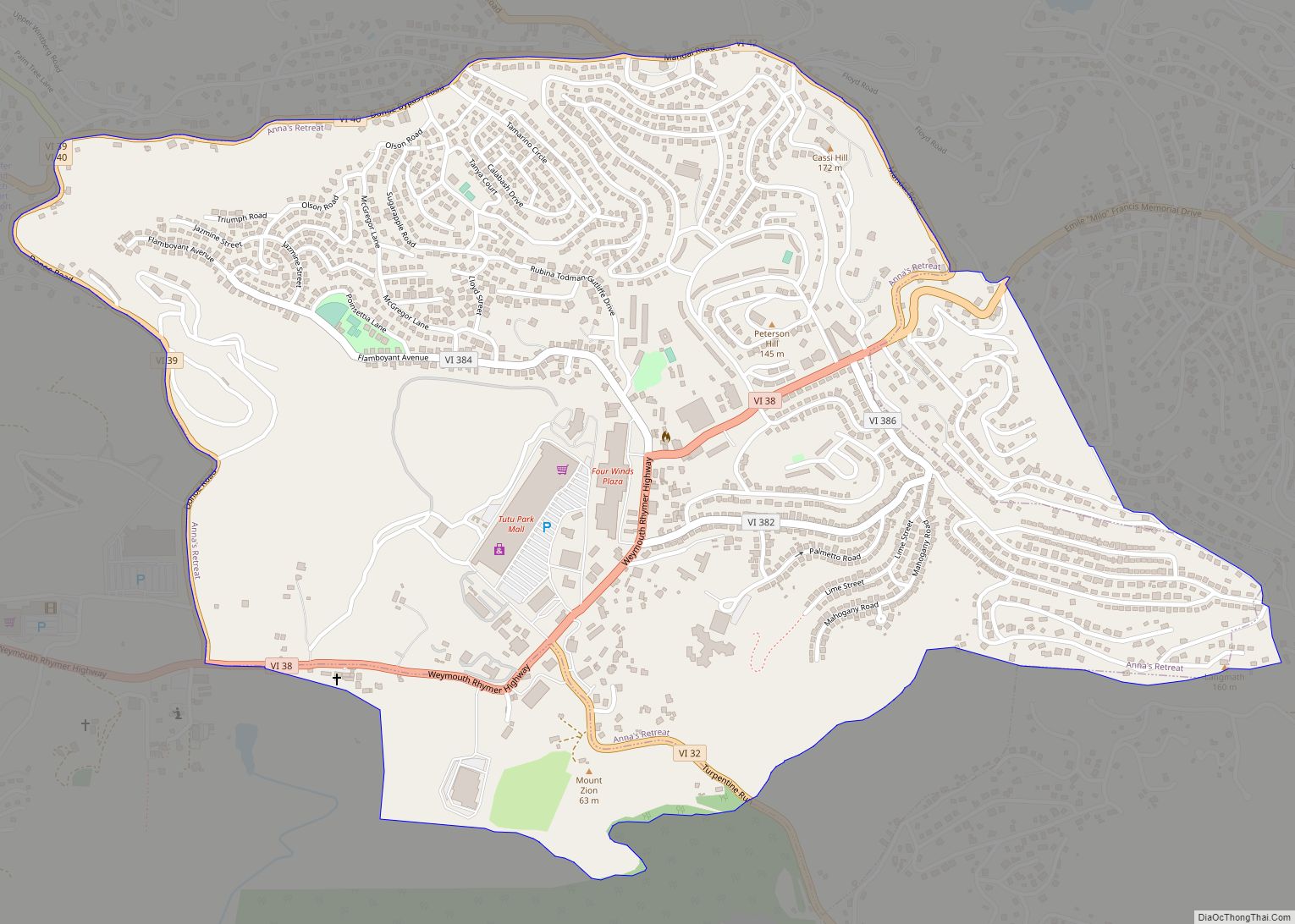
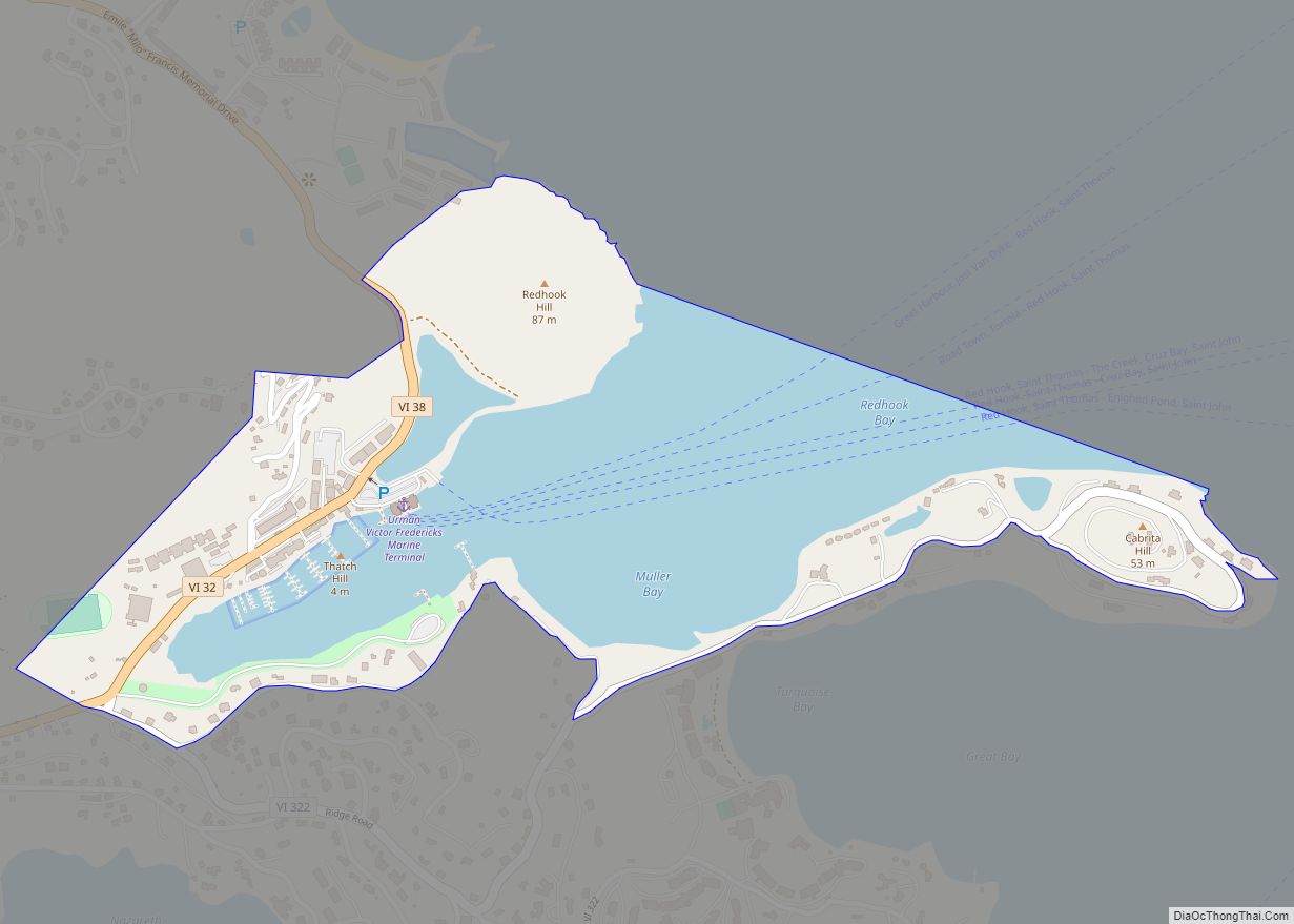
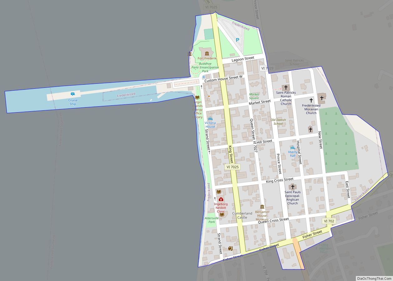
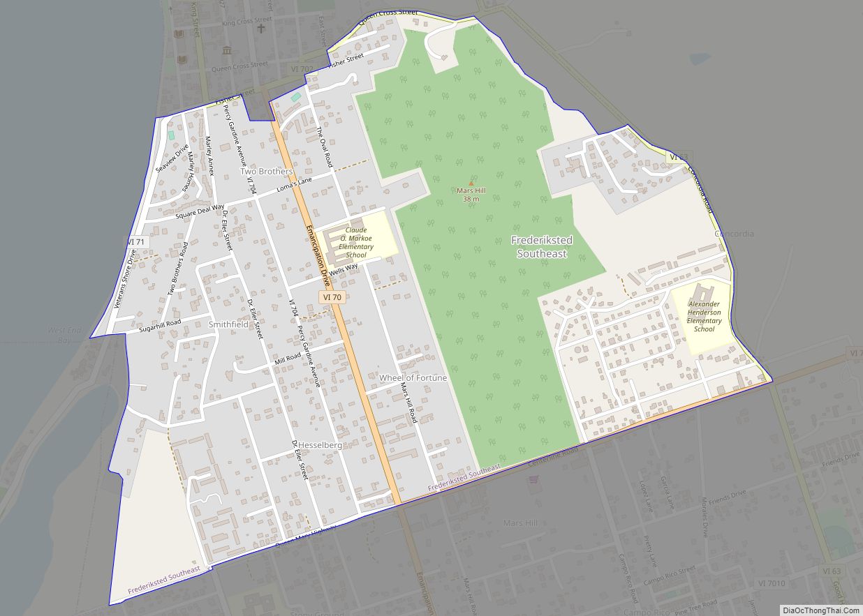
Charlotte Amalie town overview: Name: Charlotte Amalie town LSAD Code: 43 LSAD Description: town (suffix) FIPS code: 7816300 Online Interactive Map Charlotte Amalie online map. Source: Basemap layers from Google Map, Open Street Map (OSM), Arcgisonline, Wmflabs. Boundary Data from Database of Global Administrative Areas. Charlotte Amalie location map. Where is Charlotte Amalie town? Charlotte … Read more

Map of Tutu CDP

Map of Tutu CDP

Tutu CDP overview: Name: Tutu CDP LSAD Code: 57 LSAD Description: CDP (suffix) FIPS code: 7878300 Online Interactive Map Tutu online map. Source: Basemap layers from Google Map, Open Street Map (OSM), Arcgisonline, Wmflabs. Boundary Data from Database of Global Administrative Areas. Tutu location map. Where is Tutu CDP? Tutu Road Map Tutu city Satellite … Read more

Map of Red Hook CDP, Virgin Islands

Map of Red Hook CDP, Virgin Islands

Red Hook CDP overview: Name: Red Hook CDP LSAD Code: 57 LSAD Description: CDP (suffix) FIPS code: 7865530 Online Interactive Map Red Hook online map. Source: Basemap layers from Google Map, Open Street Map (OSM), Arcgisonline, Wmflabs. Boundary Data from Database of Global Administrative Areas. Red Hook location map. Where is Red Hook CDP? Red … Read more

Map of Frederiksted town

Map of Frederiksted town

Frederiksted town overview: Name: Frederiksted town LSAD Code: 43 LSAD Description: town (suffix) FIPS code: 7837900 Online Interactive Map Frederiksted online map. Source: Basemap layers from Google Map, Open Street Map (OSM), Arcgisonline, Wmflabs. Boundary Data from Database of Global Administrative Areas. Frederiksted location map. Where is Frederiksted town? Frederiksted Road Map Frederiksted city Satellite … Read more

Map of Frederiksted Southeast CDP

Map of Frederiksted Southeast CDP

Frederiksted Southeast CDP overview: Name: Frederiksted Southeast CDP LSAD Code: 57 LSAD Description: CDP (suffix) FIPS code: 7839700 Online Interactive Map Frederiksted Southeast online map. Source: Basemap layers from Google Map, Open Street Map (OSM), Arcgisonline, Wmflabs. Boundary Data from Database of Global Administrative Areas. Frederiksted Southeast location map. Where is Frederiksted Southeast CDP? Frederiksted … Read more

Map of Cruz Bay CDP

Map of Cruz Bay CDP

Cruz Bay CDP overview: Name: Cruz Bay CDP LSAD Code: 57 LSAD Description: CDP (suffix) FIPS code: 7828000 Online Interactive Map Cruz Bay online map. Source: Basemap layers from Google Map, Open Street Map (OSM), Arcgisonline, Wmflabs. Boundary Data from Database of Global Administrative Areas. Cruz Bay location map. Where is Cruz Bay CDP? Cruz … Read more

Map of Coral Bay CDP

Map of Coral Bay CDP

Coral Bay CDP overview: Name: Coral Bay CDP LSAD Code: 57 LSAD Description: CDP (suffix) FIPS code: 7827000 Online Interactive Map Coral Bay online map. Source: Basemap layers from Google Map, Open Street Map (OSM), Arcgisonline, Wmflabs. Boundary Data from Database of Global Administrative Areas. Coral Bay location map. Where is Coral Bay CDP? Coral … Read more

Map of Christiansted town

Map of Christiansted town

Christiansted town overview: Name: Christiansted town LSAD Code: 43 LSAD Description: town (suffix) FIPS code: 7819900 Online Interactive Map Christiansted online map. Source: Basemap layers from Google Map, Open Street Map (OSM), Arcgisonline, Wmflabs. Boundary Data from Database of Global Administrative Areas. Christiansted location map. Where is Christiansted town? Christiansted Road Map Christiansted city Satellite … Read more