Map of Siquijor Province
Siquijor (/ˌsɪkiˈhɔːr/ SIK-ee-HOR, Tagalog: [sɪkɪˈhɔɾ]), officially the Province of Siquijor (Cebuano: Lalawigan sa Siquijor; Tagalog: Lalawigan ng Siquijor), is a Philippine island province (the third smallest in the country, in terms of population and land area) located within the Negros Island Region. Its largest town and capital is the municipality of Siquijor. The province lies ... Read more
Map of Siquijor Province
Map of Sorsogon Province
Sorsogon, officially the Province of Sorsogon (Bikol: Probinsya kan Sorsogon; Waray: Probinsya han Sorsogon; Tagalog: Lalawigan ng Sorsogon), is a province in the Philippines located in the Bicol Region. It is the southernmost province in the island of Luzon and is subdivided into fourteen municipalities (towns) and one city. Its capital (and largest city) is ... Read more
Map of Sorsogon Province
Map of South Cotabato Province
South Cotabato (Hiligaynon: Bagatnan Cotabato; Cebuano: Habagatang Cotabato; Ilocano: Abagatan a Cotabato; Maguindanaon: Salatan Kutawatu, Jawi: سلاتن كوتوات; Filipino: Timog Cotabato), officially the Province of South Cotabato, is a province in the Philippines located in the Soccsksargen region in Mindanao. Its capital is Koronadal (the regional center of Soccsksargen), and it borders Sultan Kudarat to ... Read more
Map of South Cotabato Province
Map of Southern Leyte Province
Southern Leyte (Cebuano: Habagatang Leyte; Kabalian: Habagatan nga Leyte; Waray: Salatan nga Leyte; Tagalog: Timog Leyte), officially the Province of Southern Leyte, is a province in the Philippines located in the Eastern Visayas region. Its capital and largest city is Maasin. Southern Leyte comprised the third congressional district Leyte until it was made into an ... Read more
Map of Southern Leyte Province
Map of Sultan Kudarat Province
Sultan Kudarat, officially the Province of Sultan Kudarat (Hiligaynon: Kapuoran sang Sultan Kudarat; Maguindanaon: Dairat nu Sultan Kudarat, Jawi: دايرت نو سولتان كودرت; Cebuano: Lalawigan sa Sultan Kudarat; Ilocano: Probinsia ti Sultan Kudarat; Filipino: Lalawigan ng Sultan Kudarat), is a province in the Philippines located in the Soccsksargen region in Mindanao. Its capital is Isulan ... Read more
Map of Sultan Kudarat Province
Map of Sulu Province
Sulu ([sʊˈlu]), officially the Province of Sulu (Tausūg: Wilāya sin Lupa’ Sūg; Tagalog: Lalawigan ng Sulu), is a province of the Philippines in the Sulu Archipelago and part of the Bangsamoro Autonomous Region in Muslim Mindanao (BARMM). Its capital is Jolo on the island of the same name. Maimbung, the royal capital of the Sultanate ... Read more
Map of Sulu Province
Map of Surigao del Norte Province
Surigao del Norte (Surigaonon: Probinsya nan Surigao del Norte; Cebuano: Amihanang Surigao; Tagalog: Hilagang Surigao), officially the Province of Surigao del Norte, is a province in the Philippines located in the Caraga region of Mindanao. The province was formerly under the jurisdiction of Region 10 (Northern Mindanao) until 1995. Its capital is Surigao City, the ... Read more
Map of Surigao del Norte Province
Map of Palawan Province
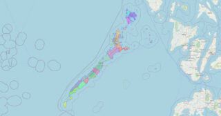
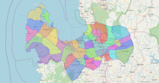
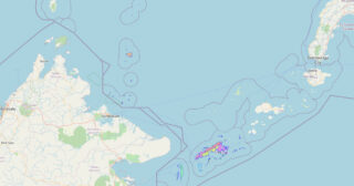
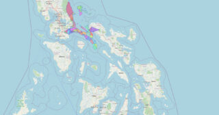
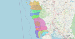
Palawan (/pəˈlɑːwən/, Tagalog: [pɐˈlaː.wan]), officially the Province of Palawan (Cuyonon: Probinsya i’ang Palawan; Tagalog: Lalawigan ng Palawan), is an archipelagic province of the Philippines that is located in the region of Mimaropa. It is the largest province in the country in terms of total area of 14,649.73 km (5,656.29 sq mi). The capital and largest city is Puerto ... Read more
Map of Palawan Province
Map of Surigao del Sur Province
Surigao del Sur (Surigaonon: Probinsya nan Surigao del Sur; Cebuano: Habagatang Surigao; Tagalog: Timog Surigao), officially the Province of Surigao del Sur, is a province in the Philippines located in the Caraga region in Mindanao. Its capital is Tandag City while Bislig is the most populous city in the province. Surigao del Sur is situated ... Read more
Map of Surigao del Sur Province
Map of Pampanga Province
Pampanga, officially the Province of Pampanga (Kapampangan: Lalawigan ning Pampanga; Tagalog: Lalawigan ng Pampanga IPA: [pɐmˈpaŋɡa] pəm-PAHNG-ga), is a province in Central Luzon in the Philippines. Lying on the northern shore of Manila Bay, Pampanga is bordered by Tarlac to the north, Nueva Ecija to the northeast, Bulacan to the east, Manila Bay to the ... Read more
Map of Pampanga Province
Map of Tarlac Province
Tarlac, officially the Province of Tarlac (Kapampangan: Lalawigan ning Tarlac; Pangasinan: Luyag/Probinsia na Tarlac; Ilocano: Probinsia ti Tarlac; Tagalog: Lalawigan ng Tarlac; [tɐɾˈlak]), is a landlocked province in the Philippines located in the Central Luzon region. Its capital is the city of Tarlac, which is the most populous in the province. It is bounded on ... Read more
Map of Tarlac Province
Map of Marinduque Province
Marinduque (/ˌmærənˈduːkeɪ/; Tagalog pronunciation: [maɾinˈduke]), officially the Province of Marinduque, is an island province in the Philippines located in Southwestern Tagalog Region or Mimaropa, formerly designated as Region IV-B. Its capital is the municipality of Boac, the most populous in the province. Marinduque lies between Tayabas Bay to the north and Sibuyan Sea to the ... Read more
Map of Marinduque Province