Map of Nueva Ecija Province
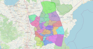
Nueva Ecija, officially the Province of Nueva Ecija (Tagalog: Lalawigan ng Nueva Ecija [ˌnwɛː.bɐ ʔɛˈsiː.ha], also [ˌnwɛː.vɐ-]; Ilocano: Probinsia ti Nueva Ecija; Pangasinan: Luyag/Probinsia na Nueva Ecija), is a landlocked province in the Philippines located in the Central Luzon region. Its capital is the city of Palayan, while Cabanatuan, its former capital, is the largest ... Read more
Map of Nueva Ecija Province
Map of Lanao del Norte Province
Lanao del Norte (Cebuano: Amihanang Lanao; Tagalog: Hilagang Lanao; Maranao: Pangotaraan Ranao), officially the Province of Lanao del Norte, is a province in the Philippines located in the Northern Mindanao region. Its capital is Tubod. The province borders Lanao del Sur to the southeast, Zamboanga del Sur to the west, Illana Bay to the southwest, ... Read more
Map of Lanao del Norte Province
Map of Nueva Vizcaya Province
Nueva Vizcaya, officially the Province of Nueva Vizcaya (Ilocano: Probinsia ti Nueva Vizcaya; Gaddang: Probinsia na Nueva Vizcaya; Pangasinan: Luyag/Probinsia na Nueva Vizcaya; Tagalog: Lalawigan ng Nueva Vizcaya [ˈnwɛva vɪsˈkaja]), is a landlocked province in the Philippines located in the Cagayan Valley region in Luzon. Its capital and largest town is Bayombong. It is bordered ... Read more
Map of Nueva Vizcaya Province
Map of Lanao del Sur Province
Lanao del Sur (Tagalog: Timog Lanao; Meranaw and Iranun: Pagabagatan Ranao), officially the Province of Lanao del Sur, is a province in the Philippines located in the Bangsamoro Autonomous Region in Muslim Mindanao (BARMM). The capital is the city of Marawi (the most populous in the province), and it borders Lanao del Norte to the ... Read more
Map of Lanao del Sur Province
Map of Occidental Mindoro Province
Occidental Mindoro (Tagalog: Kanlurang Mindoro), officially the Province of Occidental Mindoro (Tagalog: Lalawigan ng Kanlurang Mindoro), is a province in the Philippines located in the Mimaropa region. The province occupies the western half of the island of Mindoro. Its capital is Mamburao, but the most populous municipality is San Jose. Sablayan is its largest municipality ... Read more
Map of Occidental Mindoro Province
Map of Leyte Province
Leyte (also Northern Leyte; Waray: Norte san/Amihanan nga Leyte; Cebuano: Amihanang Leyte; Tagalog: Hilagang Leyte), officially the Province of Leyte, is a province in the Philippines located in the Eastern Visayas region occupying the northern three-quarters of Leyte Island (with the remaining portion being the province of Southern Leyte). Its capital and largest city is ... Read more
Map of Leyte Province
Map of Oriental Mindoro Province
Oriental Mindoro (Tagalog: Silangang Mindoro), officially the Province of Oriental Mindoro (Tagalog: Lalawigan ng Silangang Mindoro (Oriental Mindoro)), is a province in the Philippines located on the island of Mindoro under Mimaropa region in Luzon, about 140 kilometres (87 mi) southwest of Manila. The province is bordered by the Verde Island Passage and the rest of ... Read more
Map of Oriental Mindoro Province
Map of Davao Occidental
Davao Occidental (Cebuano: Kasadpang Dabaw; Filipino: Kanluraning Davao), officially the Province of Davao Occidental (Cebuano: Lalawigan sa Kasadpang Dabaw, Lalawigan sa Davao Occidental; Filipino: Lalawigan ng Kanluraning Davao, Lalawigan ng Davao Occidental), is a province in the Philippines located in the Davao Region in Mindanao. Its capital is the municipality of Malita, the most populous ... Read more
Map of Davao Occidental
Map of Davao Oriental Province
Davao Oriental (Cebuano: Sidlakang Dabaw; Filipino: Silangang Davao), officially the Province of Davao Oriental (Cebuano: Lalawigan sa Sidlakang Dabaw, Lalawigan sa Davao Oriental; Filipino: Lalawigan ng Silangang Davao, Lalawigan ng Davao Oriental), is a province in the Philippines located in the Davao Region in Mindanao. Its capital is the city of Mati which is the ... Read more
Map of Davao Oriental Province
Map of Dinagat Islands Province
Dinagat Islands (Cebuano: Mga Pulo sa Dinagat; Surigaonon: Mga Puyo nan Dinagat; Kabalian: Mga Puyo san Dinagat; Waray: Mga Purô han Dinagat; Filipino: Mga Islang Dinagat), officially the Province of Dinagat Islands, is an island province in the Caraga region of the Philippines, located on the south side of Leyte Gulf. The island of Leyte ... Read more
Map of Dinagat Islands Province
Map of Eastern Samar Province
Eastern Samar (Waray-Waray: Sinirangan Samar; Tagalog: Silangang Samar), officially the Province of Eastern Samar, is a province in the Philippines located in the Eastern Visayas region. Its capital is the city of Borongan, which is the most populous. Eastern Samar occupies the eastern portion of the island of Samar. Bordering the province to the north ... Read more
Map of Eastern Samar Province
Map of Guimaras Province
Guimaras ([ɡimaˈɾas]), officially the Province of Guimaras (Hiligaynon: Kapuoran sang Guimaras; Tagalog: Lalawigan ng Guimaras), is an island province in the Philippines located in the Western Visayas region. The capital is Jordan, while the largest local government unit is the municipality of Buenavista. The province is situated in Panay Gulf, between the islands of Panay ... Read more
Map of Guimaras Province