Map of Guimaras Province
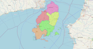
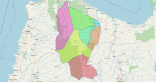
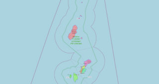
Guimaras ([ɡimaˈɾas]), officially the Province of Guimaras (Hiligaynon: Kapuoran sang Guimaras; Tagalog: Lalawigan ng Guimaras), is an island province in the Philippines located in the Western Visayas region. The capital is Jordan, while the largest local government unit is the municipality of Buenavista. The province is situated in Panay Gulf, between the islands of Panay ... Read more
Map of Guimaras Province
Map of Ifugao Province
Ifugao, officially the Province of Ifugao (Ilocano: Probinsia ti Ifugao; Tagalog: Lalawigan ng Ifugao), is a landlocked province of the Philippines in the Cordillera Administrative Region in Luzon. Its capital is Lagawe and it borders Benguet to the west, Mountain Province to the north, Isabela to the east, and Nueva Vizcaya to the south. Alfonso ... Read more
Map of Ifugao Province
Map of Ilocos Norte Province
Ilocos Norte, officially the Province of Ilocos Norte (Ilocano: Probinsia ti Ilocos Norte; Tagalog: Lalawigan ng Ilocos Norte), is a province of the Philippines located in the Ilocos Region. It is located in the northwest corner of Luzon Island, bordering Cagayan and Apayao to the east, and Abra to the southeast, and Ilocos Sur to ... Read more
Map of Ilocos Norte Province
Map of Aklan Province
Aklan, officially the Province of Aklan (Akeanon: Probinsya it Akean [ak’ɤan]; Hiligaynon: Kapuoran sang Aklan; Tagalog: Lalawigan ng Aklan), is a province in the Western Visayas region of the Philippines. Its capital and largest town is Kalibo. The province is situated in the northwest portion of Panay Island, bordering Antique to the southwest, and Capiz ... Read more
Map of Aklan Province
Map of Camarines Sur Province
Camarines Sur (Central Bikol: Habagatan na Camarines; Tagalog: Timog Camarines), officially the Province of Camarines Sur (Bikol: Probinsya kan Habagatan na Camarines (Camarines Sur); Tagalog: Lalawigan ng Timog Camarines (Camarines Sur)), is a province in the Philippines located in the Bicol Region on Luzon. Its capital is Pili and the province borders Camarines Norte and ... Read more
Map of Camarines Sur Province
Map of Albay Province
Albay (IPA: [ɐlˈbaɪ]), officially the Province of Albay (Central Bikol: Probinsya kan Albay; Tagalog: Lalawigan ng Albay), is a province in the Bicol Region of the Philippines, mostly on the southeastern part of the island of Luzon. Its capital (and largest city) is the city of Legazpi, the regional center of the whole Bicol Region, ... Read more
Map of Albay Province
Map of Antique Province
Antique, officially the Province of Antique ([ɐnˈtike]; Kinaray-a: Kapuoran kang Antique; Hiligaynon: Kapuoran sang Antique; Tagalog: Lalawigan ng Antique), is a province in the Philippines located in the Western Visayas region. Its capital is San Jose de Buenavista, the most populous town in Antique. The province is situated in the western section of Panay Island ... Read more
Map of Antique Province
Map of Apayao Province
Apayao, officially the Province of Apayao (Ilocano: Probinsia ti Apayao; Itawit: Provinsiya ya Apayao; Isnag: Provinsia nga Apayao; Tagalog: Lalawigan ng Apayao), is a landlocked province in the Philippines in the Cordillera Administrative Region in Luzon. Kabugao serves as its capital. The provincial capitol and its associated offices are located at the New Government Center ... Read more
Map of Apayao Province
Map of Aurora Province
Aurora, officially the Province of Aurora (Filipino: Lalawigan ng Aurora; Ilocano: Probinsia ti Aurora), is a province in the Philippines located in the eastern part of Central Luzon region, facing the Philippine Sea. Its capital is Baler and borders, clockwise from the south, the provinces of Quezon, Bulacan, Nueva Ecija, Nueva Vizcaya, Quirino, and Isabela. ... Read more
Map of Aurora Province
Map of Basilan Province
Basilan, officially the Province of Basilan (Chavacano: Provincia de Basilan; Yakan: Wilayah Basilanin; Tausug: Wilaya’ sin Basilan; Filipino: Lalawigan ng Basilan), is an island province of the Philippines located primarily in the Bangsamoro Autonomous Region. Basilan Island is the largest and northernmost of the major islands of the Sulu Archipelago. It is just off the ... Read more
Map of Basilan Province
Map of Bataan Province
Bataan (/bɑːtɑːˈʔɑːn/, /bɑːˈtɑːn/), officially the Province of Bataan (Filipino: Lalawigan ng Bataan IPA: [bɐtɐˈʔan]), is a province in the Central Luzon region of the Philippines. Its capital is the city of Balanga while Mariveles is the largest town in the province. Occupying the entire Bataan Peninsula on Luzon, Bataan is bordered by the provinces of ... Read more
Map of Bataan Province
Map of Batanes Province
Batanes, officially the Province of Batanes (Ivatan: Provinsiya nu Batanes; Ilocano: Probinsia ti Batanes; Filipino: Lalawigan ng Batanes, IPA: [bɐˈtanes]), is an archipelagic province in the Philippines, administratively part of the Cagayan Valley region. It is the northernmost province in the Philippines, and the smallest, both in population and land area. The capital is Basco, ... Read more
Map of Batanes Province