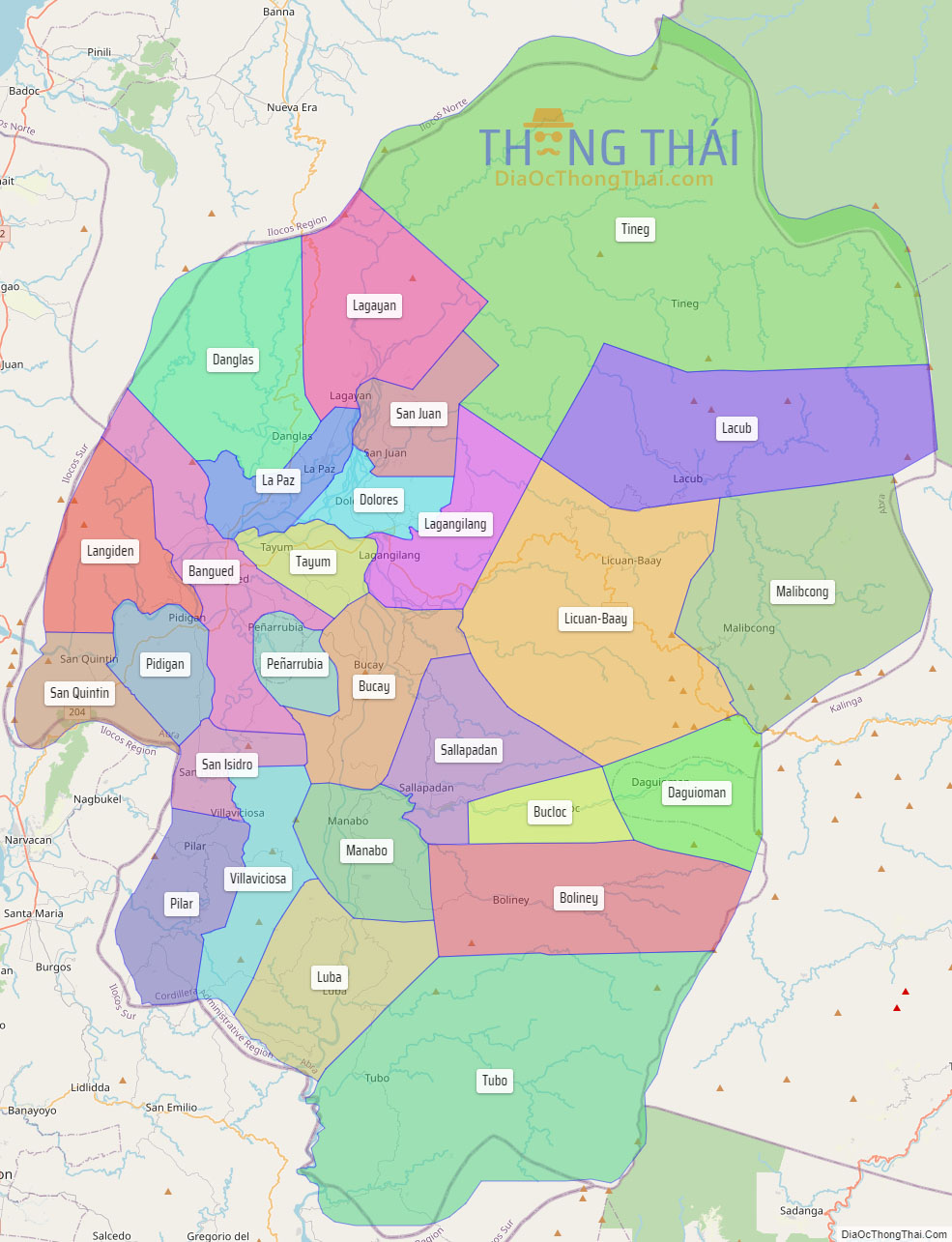
Abra, officially the Province of Abra (Ilocano: Probinsia ti Abra; Tagalog: Lalawigan ng Abra), is a province in the Cordillera Administrative Region of the Philippines. Its capital is the municipality of Bangued, the most populous in the province. It is bordered by Ilocos Norte on the northwest, Apayao on the northeast, Kalinga on the mid-east, Mountain Province on the southeast, and Ilocos Sur on the southwest.
| Type: | Province |
|---|---|
| Capital: | Bangued |
| Area: | 4,165.25 km (1,608.21 sq mi) |
| Area Rank: | 29th out of 81 |
| Population: | 250,985 |
| Population Rank: | 68th out of 81 |
| Density: | 0.23% |
| ZIP code: | 2800–2826 |
| ISO 3166 code: | PH-ABR |
| Website: | www.abra.gov.ph |
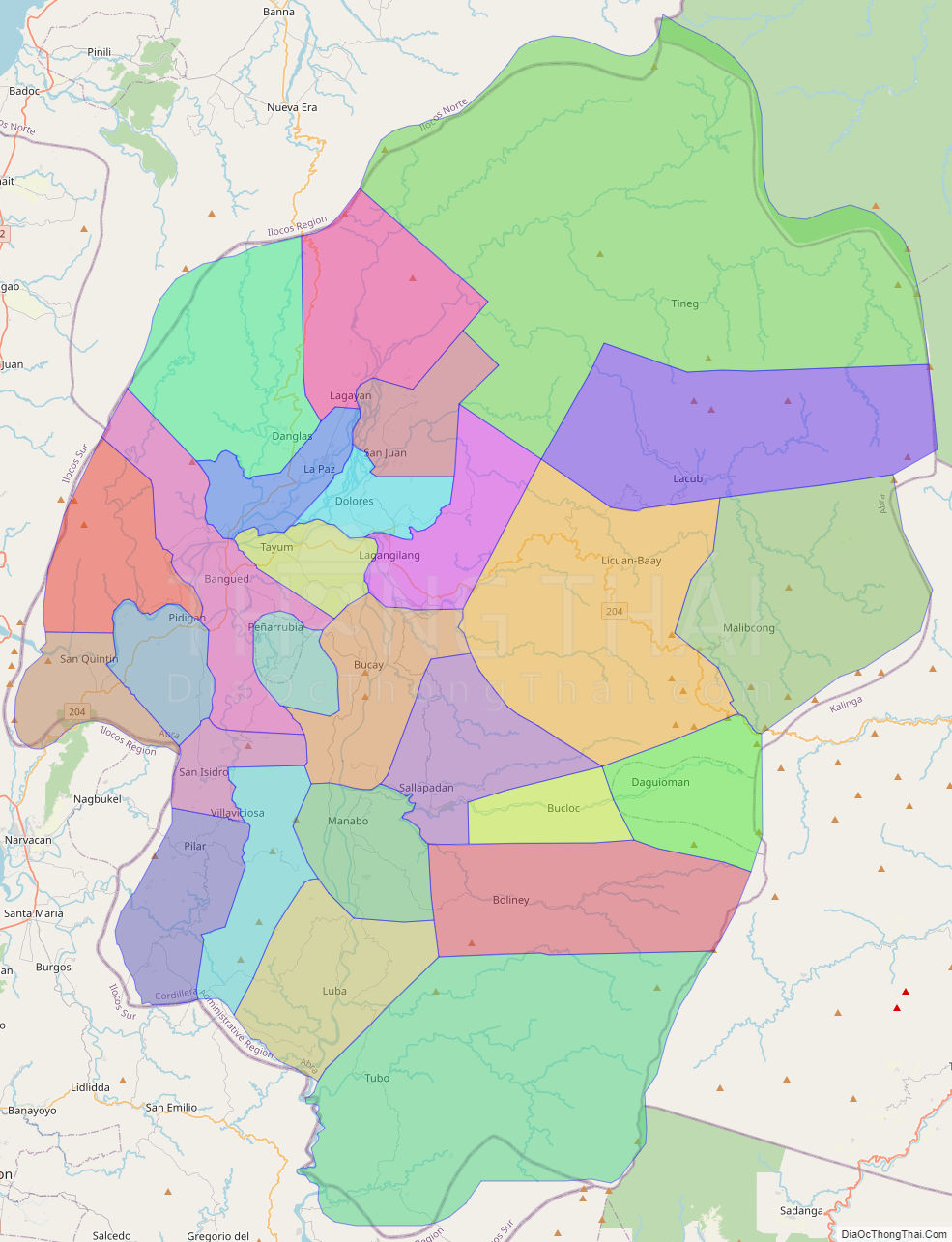
Online Interactive Map
Explore the interactive online map of Abra, which highlights the administrative boundaries with each sub-administrative unit distinctly colored for easy identification. Just click on the map, and the name of the sub-unit will display, providing an intuitive and engaging way to navigate the area. Users can also view the map in full screen and switch between different map views, including OpenStreetMap, Google Maps, and satellite imagery.
Click on ![]() to view map in "full screen" mode.
to view map in "full screen" mode.
Abra Political Map
Map of Abra Province, Philippines the administrative divisions, provincial boundaries, along with detailed depictions of streets, roads, rivers, landmarks, and other geographical features.