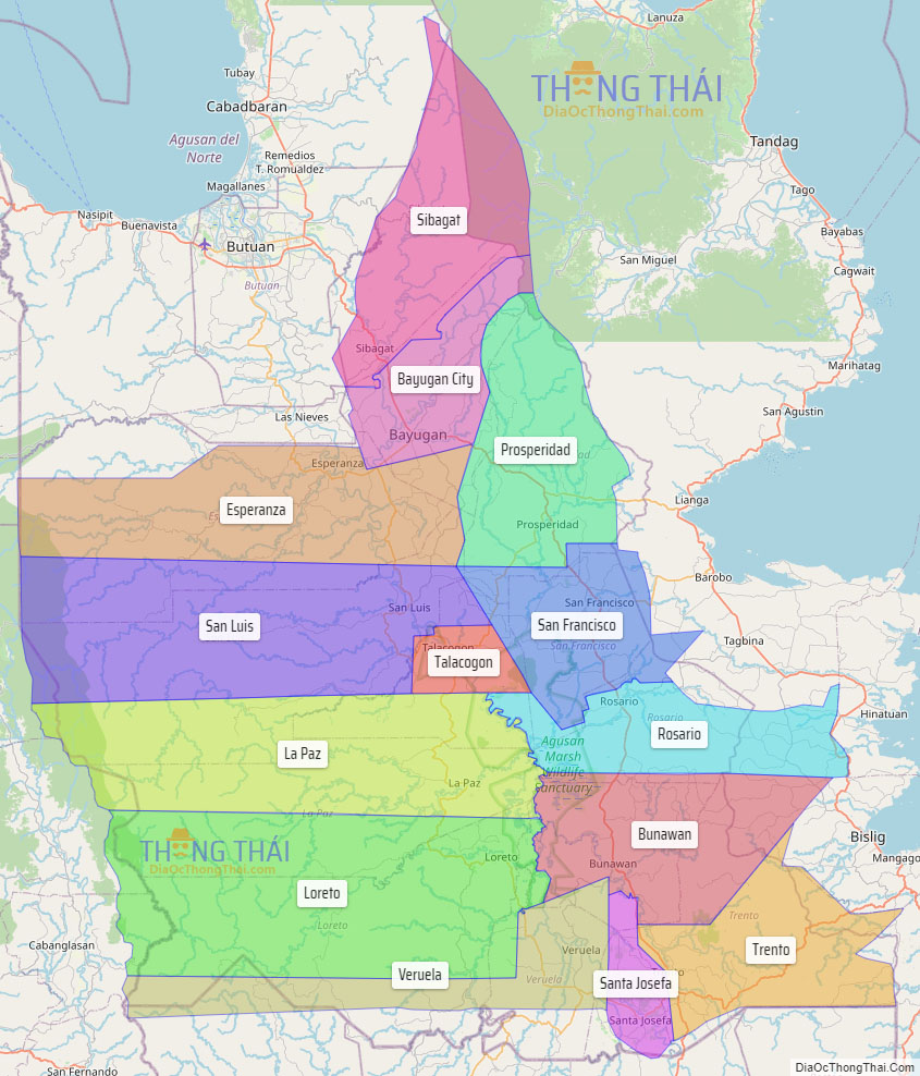
Agusan del Sur, officially the Province of Agusan del Sur (Cebuano: Habagatang Agusan; Butuanon: Probinsya hong Agusan del Sur; Tagalog: Timog Agusan), is a province in Caraga region, Mindanao, Philippines. Its capital is the municipality of Prosperidad. It is bordered on the northwest by Agusan del Norte and Misamis Oriental; east by Surigao del Sur; southeast by Davao Oriental; mid-south by Davao de Oro; southwest by Davao del Norte and, mid-west by Bukidnon. It is the fourth largest province in the country in terms of area, with the size of 3,856 sq miles.
Bayugan is the only city in the province and it is also the most populous.
| Type: | Province |
|---|---|
| Capital: | Prosperidad |
| Area: | 9,989.52 km (3,856.98 sq mi) |
| Area Rank: | 4th out of 81 |
| Population: | 739,367 |
| Population Rank: | 41st out of 81 |
| Density: | 0.68% |
| ZIP code: | 8500–8513 |
| ISO 3166 code: | PH-AGS |
| Website: | agusandelsur.gov.ph |
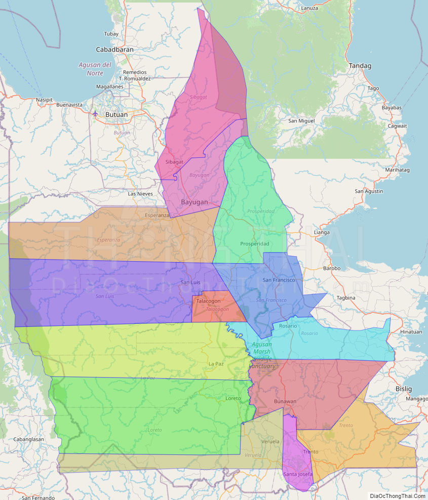
Online Interactive Map
Explore the interactive online map of Agusan del Sur, which highlights the administrative boundaries with each sub-administrative unit distinctly colored for easy identification. Just click on the map, and the name of the sub-unit will display, providing an intuitive and engaging way to navigate the area. Users can also view the map in full screen and switch between different map views, including OpenStreetMap, Google Maps, and satellite imagery.
Click on ![]() to view map in "full screen" mode.
to view map in "full screen" mode.
Agusan del Sur Political Map
Map of Agusan del Sur Province, Philippines the administrative divisions, provincial boundaries, along with detailed depictions of streets, roads, rivers, landmarks, and other geographical features.