Antique, officially the Province of Antique ([ɐnˈtike]; Kinaray-a: Kapuoran kang Antique; Hiligaynon: Kapuoran sang Antique; Tagalog: Lalawigan ng Antique), is a province in the Philippines located in the Western Visayas region. Its capital is San Jose de Buenavista, the most populous town in Antique. The province is situated in the western section of Panay Island and borders Aklan, Capiz and Iloilo to the east, while facing the Sulu Sea to the west.
The province is home to the indigenous Iraynun-Bukidnon, speakers of a dialect of the Kinaray-a language, who have crafted the only rice terrace clusters in the Visayas through indigenous knowledge and sheer vernacular capabilities. The rice terraces of the Iraynun-Bukidnon are divided into four terraced fields, namely, General Fullon rice terraces, Lublub rice terraces, Bakiang rice terraces, and San Agustin rice terraces. All of the rice terrace clusters have been researched by the National Commission for Culture and the Arts and various scholars from the University of the Philippines. There have been campaigns to nominate the Iraynun-Bukidnon Rice Terraces, along with the Central Panay Mountain Range, into the UNESCO World Heritage List.
| Type: | Province |
|---|---|
| Capital: | San Jose de Buenavista |
| Area: | 2,729.17 km (1,053.74 sq mi) |
| Area Rank: | 49th out of 81 |
| Population: | 612,974 |
| Population Rank: | 52nd out of 81 |
| Density: | 0.56% |
| ZIP code: | 5700–5717 |
| ISO 3166 code: | PH-ANT |
| Website: | antique.gov.ph |
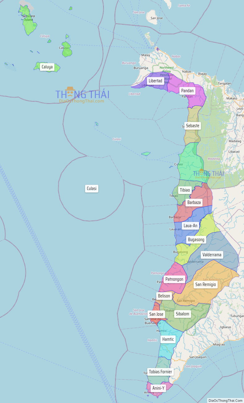
Online Interactive Map
Explore the interactive online map of Antique, which highlights the administrative boundaries with each sub-administrative unit distinctly colored for easy identification. Just click on the map, and the name of the sub-unit will display, providing an intuitive and engaging way to navigate the area. Users can also view the map in full screen and switch between different map views, including OpenStreetMap, Google Maps, and satellite imagery.
Click on ![]() to view map in "full screen" mode.
to view map in "full screen" mode.
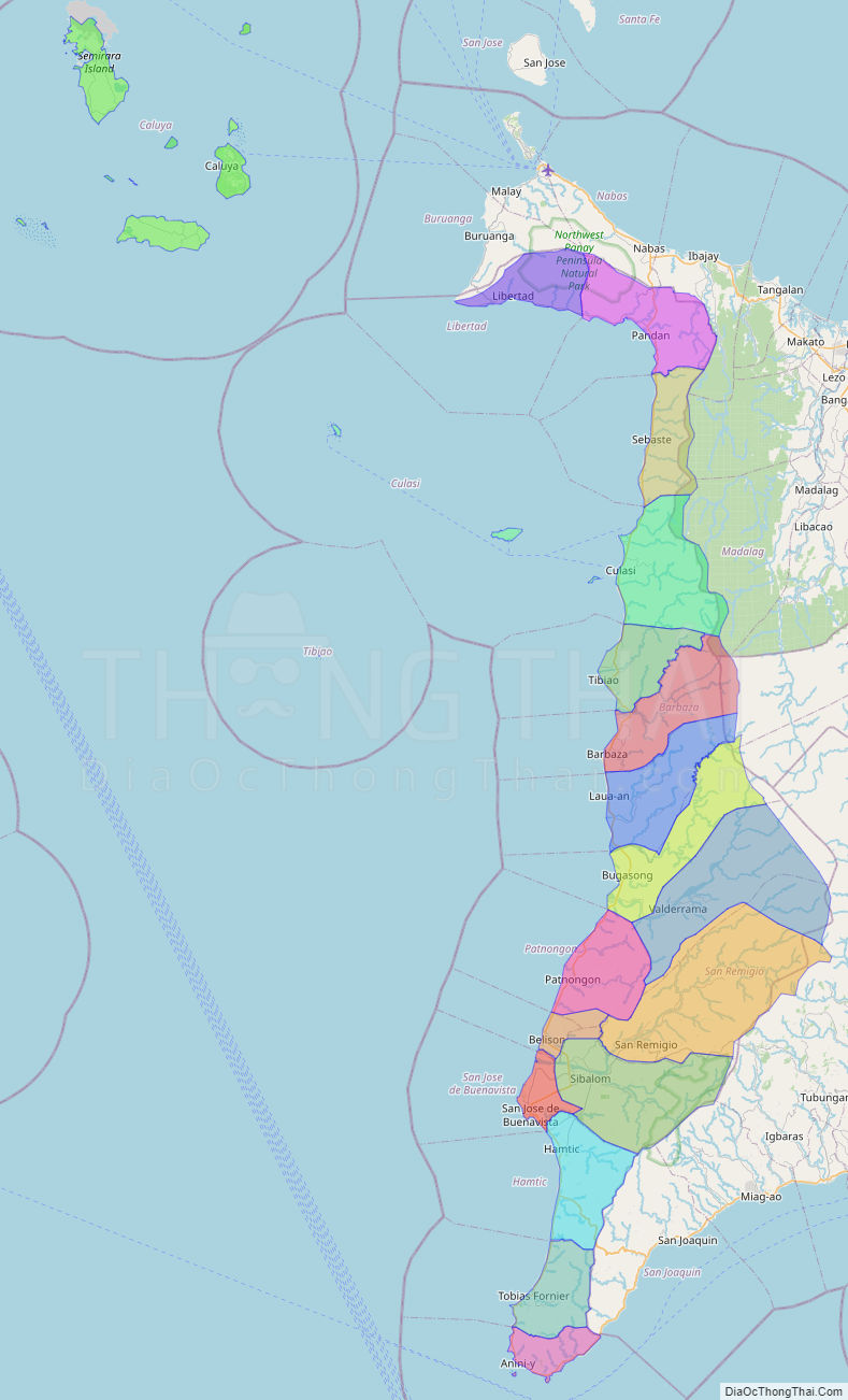
Antique Political Map
Map of Antique Province, Philippines the administrative divisions, provincial boundaries, along with detailed depictions of streets, roads, rivers, landmarks, and other geographical features.