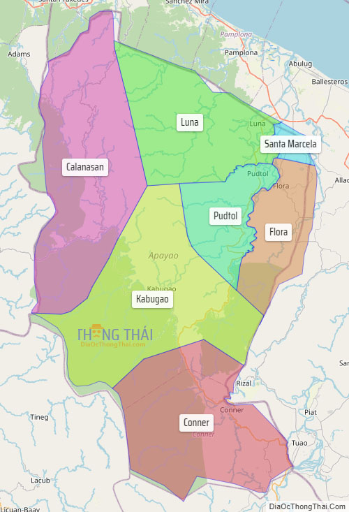
Apayao, officially the Province of Apayao (Ilocano: Probinsia ti Apayao; Itawit: Provinsiya ya Apayao; Isnag: Provinsia nga Apayao; Tagalog: Lalawigan ng Apayao), is a landlocked province in the Philippines in the Cordillera Administrative Region in Luzon. Kabugao serves as its capital. The provincial capitol and its associated offices are located at the New Government Center in Luna. Conner is the most populous town in the province.
The province borders Cagayan to the north and east, Abra and Ilocos Norte to the west, and Kalinga to the south. Prior to 1995, Kalinga and Apayao comprised a single province named Kalinga-Apayao, which was partitioned to better service the needs of individual ethnic groups.
With a population of 124,366 (as of the 2020 census) covering an area of 4,413.35 square kilometres (1,704.00 sq mi), Apayao is the least densely-populated province in the Philippines, the least developed province in Luzon and one of the poorest.
| Type: | Province |
|---|---|
| Capital: | Kabugao |
| Area: | 4,413.35 km (1,704.00 sq mi) |
| Area Rank: | 27th out of 81 |
| Population: | 124,366 |
| Population Rank: | 78th out of 81 |
| Density: | 0.11% |
| ZIP code: | 3807–3814 |
| ISO 3166 code: | PH-APA |
| Website: | www.apayao.gov.ph |
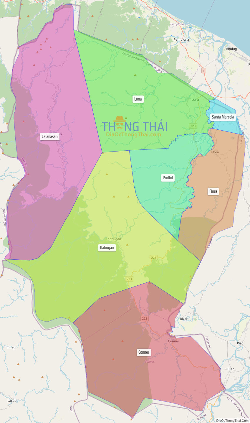
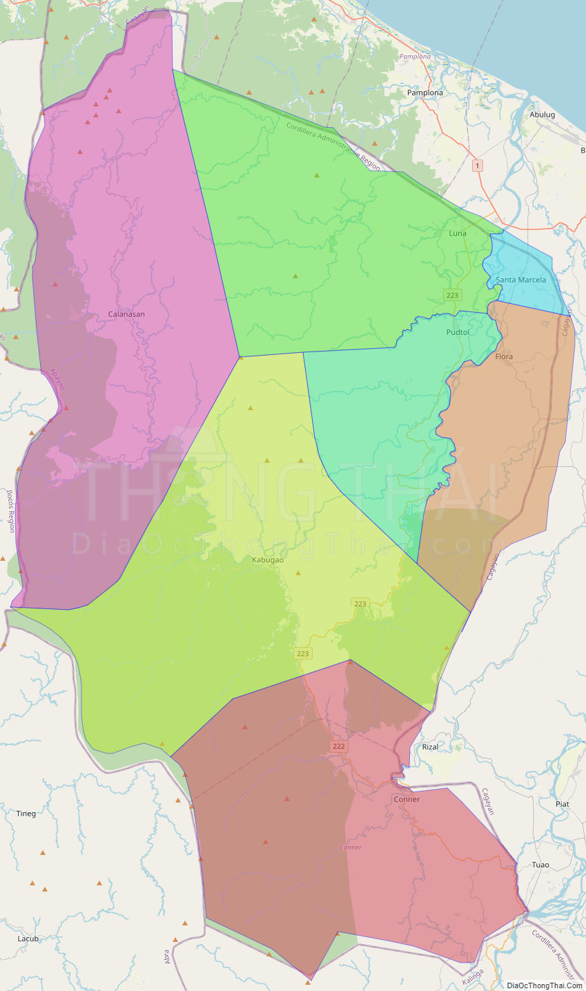
Online Interactive Map
Explore the interactive online map of Apayao, which highlights the administrative boundaries with each sub-administrative unit distinctly colored for easy identification. Just click on the map, and the name of the sub-unit will display, providing an intuitive and engaging way to navigate the area. Users can also view the map in full screen and switch between different map views, including OpenStreetMap, Google Maps, and satellite imagery.
Click on ![]() to view map in "full screen" mode.
to view map in "full screen" mode.
Apayao Political Map
Map of Apayao Province, Philippines the administrative divisions, provincial boundaries, along with detailed depictions of streets, roads, rivers, landmarks, and other geographical features.