Aurora, officially the Province of Aurora (Filipino: Lalawigan ng Aurora; Ilocano: Probinsia ti Aurora), is a province in the Philippines located in the eastern part of Central Luzon region, facing the Philippine Sea. Its capital is Baler and borders, clockwise from the south, the provinces of Quezon, Bulacan, Nueva Ecija, Nueva Vizcaya, Quirino, and Isabela. Maria Aurora is the only landlocked town in the province and yet, the most populous.
Before 1979, Aurora was part of the province of Quezon. Aurora was, in fact, named after Aurora Aragon, the wife of Manuel L. Quezon, the president of the Philippine Commonwealth, after whom the mother province was named.
| Type: | Province |
|---|---|
| Capital: | Baler |
| Area: | 3,147.32 km (1,215.19 sq mi) |
| Area Rank: | 42nd out of 81 |
| Population: | 235,750 |
| Population Rank: | 70th out of 81 |
| Density: | 0.22% |
| ZIP code: | 3200–3207 |
| ISO 3166 code: | PH-AUR |
| Website: | www.aurora.gov.ph |
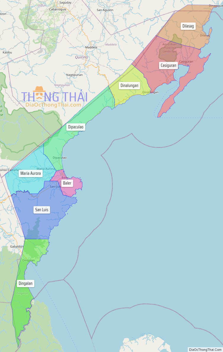
Online Interactive Map
Explore the interactive online map of Aurora, which highlights the administrative boundaries with each sub-administrative unit distinctly colored for easy identification. Just click on the map, and the name of the sub-unit will display, providing an intuitive and engaging way to navigate the area. Users can also view the map in full screen and switch between different map views, including OpenStreetMap, Google Maps, and satellite imagery.
Click on ![]() to view map in "full screen" mode.
to view map in "full screen" mode.
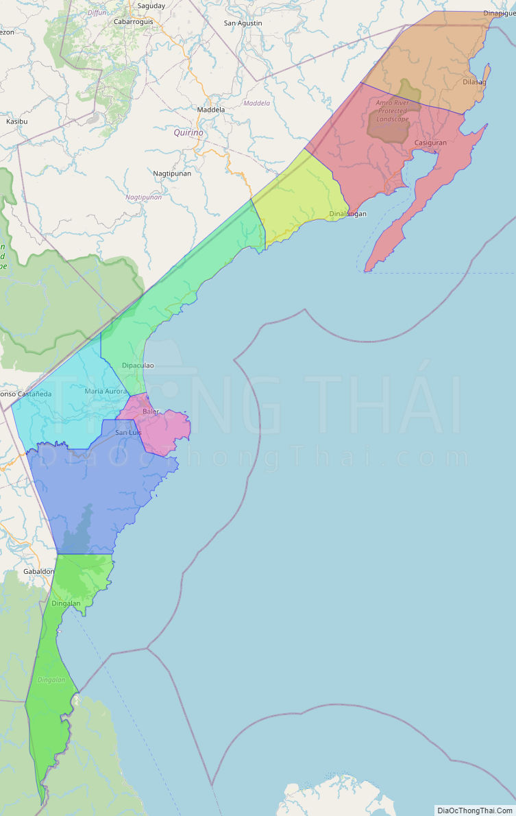
Aurora Political Map
Map of Aurora Province, Philippines the administrative divisions, provincial boundaries, along with detailed depictions of streets, roads, rivers, landmarks, and other geographical features.