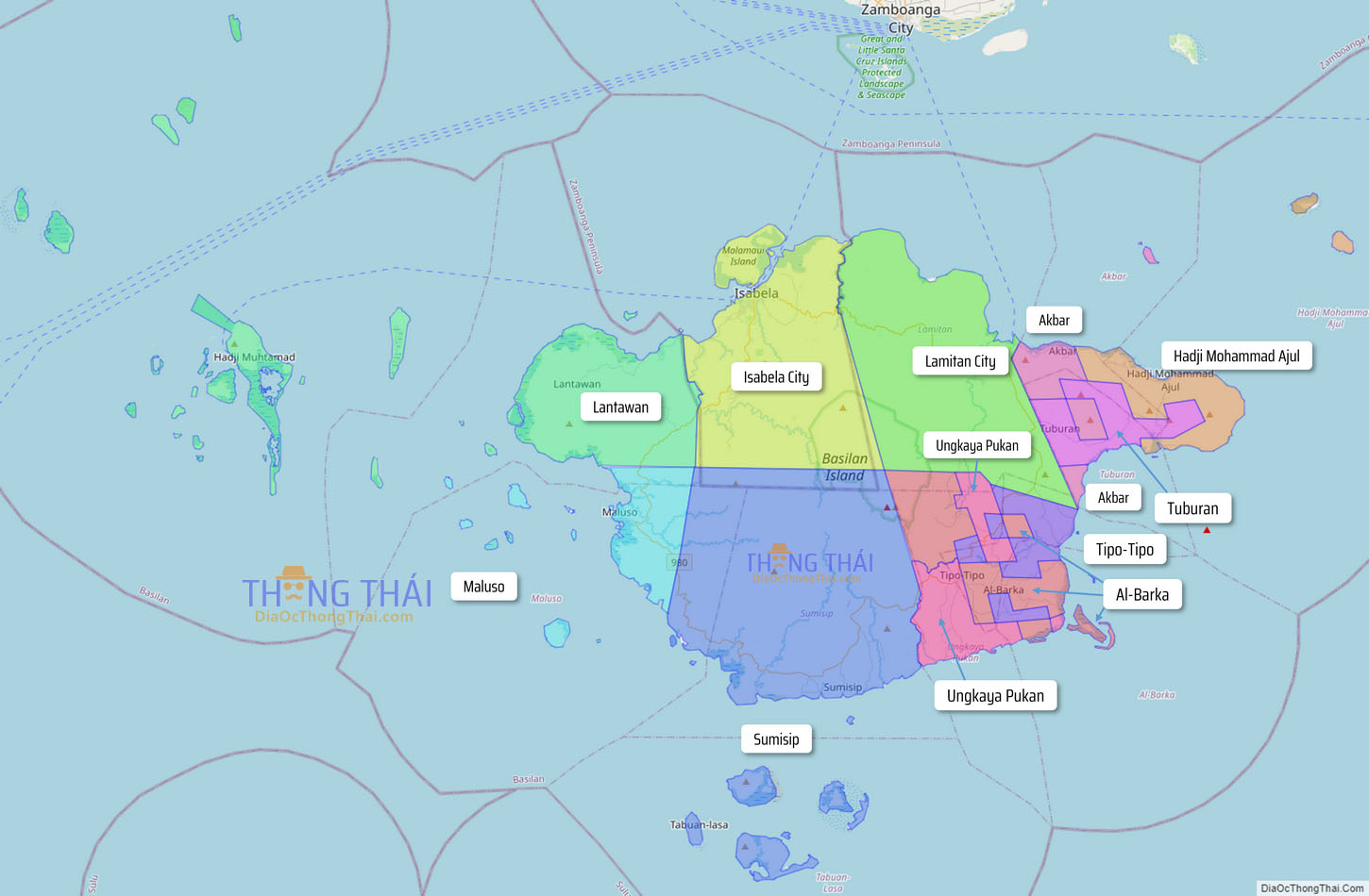
Basilan, officially the Province of Basilan (Chavacano: Provincia de Basilan; Yakan: Wilayah Basilanin; Tausug: Wilaya’ sin Basilan; Filipino: Lalawigan ng Basilan), is an island province of the Philippines located primarily in the Bangsamoro Autonomous Region. Basilan Island is the largest and northernmost of the major islands of the Sulu Archipelago. It is just off the southern coast of the geographic Zamboanga Peninsula.
Isabela, the most populous city and the former capital, is a component city under the provincial government of Basilan but is administered as part of the Zamboanga Peninsula Region and is listed statistically independent. The provincial capital has since been transferred to Lamitan. Despite this, the provincial Capitol and government offices are still located at Isabela.
Basilan is home to three main ethnolinguistic groups: the indigenous Yakans, and the later-arriving Tausugs and Chavacanos. The Yakans and Tausugs are predominantly Muslim, while the Chavacano are mainly Christian. There are also a number of smaller ethnic groups. Although the official languages are Filipino and English, the main native language is Yakan and lingua franca is Chavacano. Other languages include Tausug, Cebuano, and Sama.
Basilan, although classified as a 3rd-class province in terms of gross provincial income, has one of the lowest incidences of poverty in the Philippines (26.19% of the general population), ranked 20 among the Philippines’ 80 provinces. (In comparison, Maguindanao which is ranked last at number 80 has a poverty incidence of 44.24%.) The gap between Basilan’s rich and poor residents are among the narrowest in the country (ranked 3rd nationwide), pointing to one of the most equitable distributions of wealth anywhere in the country (Gini coefficient 0.2826, which is slightly better than the provinces of Pampanga, Bulacan, Nueva Ecija, Tarlac, Cavite, Batanes and Batangas).
| Type: | Province |
|---|---|
| Capital: | Lamitan |
| Area: | 1,327.23 km (512.45 sq mi) |
| Area Rank: | 72nd out of 81 |
| Population: | 556,586 |
| Population Rank: | 56th out of 81 |
| Density: | 0.51% |
| ZIP code: | 7300–7306 |
| ISO 3166 code: | PH-BAS |
| Website: | www.basilan.gov.ph |
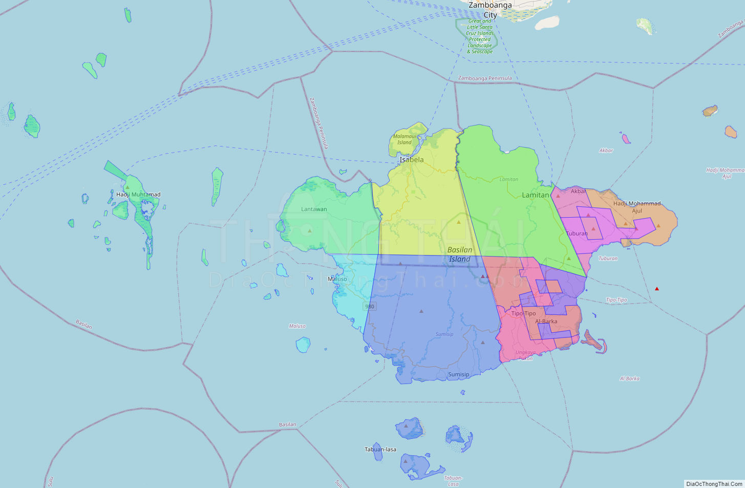
Online Interactive Map
Explore the interactive online map of Basilan, which highlights the administrative boundaries with each sub-administrative unit distinctly colored for easy identification. Just click on the map, and the name of the sub-unit will display, providing an intuitive and engaging way to navigate the area. Users can also view the map in full screen and switch between different map views, including OpenStreetMap, Google Maps, and satellite imagery.
Click on ![]() to view map in "full screen" mode.
to view map in "full screen" mode.
Basilan Political Map
Map of Basilan Province, Philippines the administrative divisions, provincial boundaries, along with detailed depictions of streets, roads, rivers, landmarks, and other geographical features.