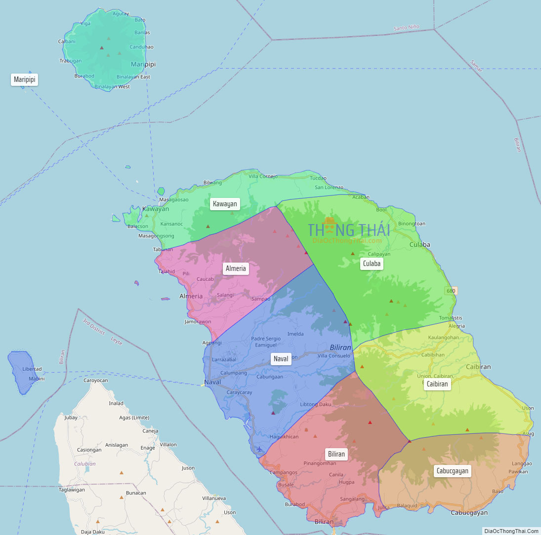
Biliran, officially the Province of Biliran (Waray-Waray: Probinsya han Biliran; Cebuano: Lalawigan sa Biliran; Tagalog: Lalawigan ng Biliran), is an island province in the Philippines located in the Eastern Visayas region (Region VIII). Biliran is one of the country’s smallest and newest provinces. Formerly a sub-province of Leyte, it became an independent province in 1992.
Biliran lies less than a kilometer north of the island of Leyte. A bridge-causeway fixed link over Poro Island in the gateway town of Biliran connects the province to Leyte. Its capital is the municipality of Naval on the western coast of the island which is the most populous in the province.
| Type: | Province |
|---|---|
| Capital: | Naval |
| Area: | 536.01 km (206.95 sq mi) |
| Area Rank: | 78th out of 81 |
| Population: | 179,312 |
| Population Rank: | 75th out of 81 |
| Density: | 0.16% |
| ISO 3166 code: | PH-BIL |
| Website: | biliran.gov.ph |
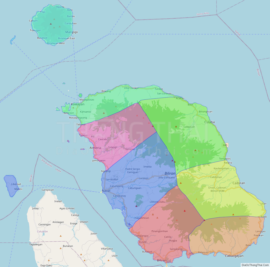
Online Interactive Map
Explore the interactive online map of Biliran, which highlights the administrative boundaries with each sub-administrative unit distinctly colored for easy identification. Just click on the map, and the name of the sub-unit will display, providing an intuitive and engaging way to navigate the area. Users can also view the map in full screen and switch between different map views, including OpenStreetMap, Google Maps, and satellite imagery.
Click on ![]() to view map in "full screen" mode.
to view map in "full screen" mode.
Biliran Political Map
Map of Biliran Province, Philippines the administrative divisions, provincial boundaries, along with detailed depictions of streets, roads, rivers, landmarks, and other geographical features.