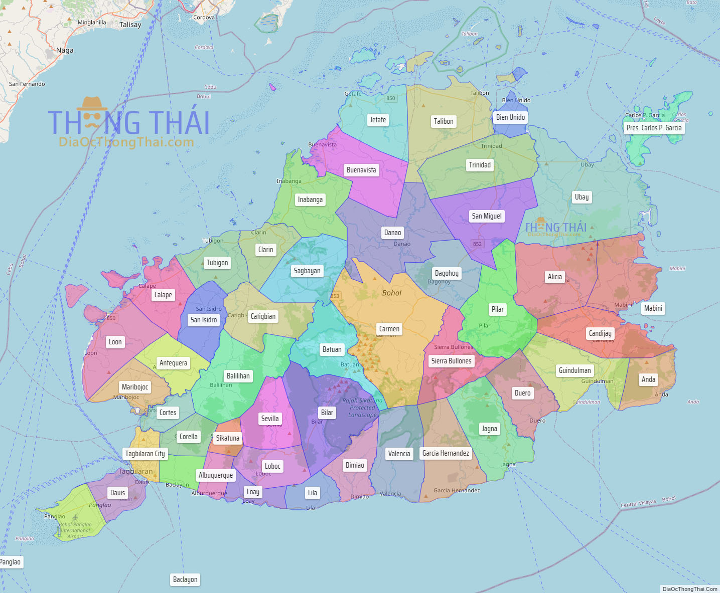
Bohol (Tagalog pronunciation: [buˈhol]), officially the Province of Bohol (Cebuano: Lalawigan sa Bohol; Hiligaynon: Kapuoran sang Bohol; Tagalog: Lalawigan ng Bohol), is an island province of the Philippines located in the Central Visayas region, consisting of the island itself and 75 minor surrounding islands. Its capital is Tagbilaran, the largest city of the province. With a land area of 4,821 km (1,861 sq mi) and a coastline 261 km (162 mi) long, Bohol is the tenth largest island of the Philippines.
The province of Bohol is a first-class province divided into 3 congressional districts, comprising 1 component city and 47 municipalities. It has 1,109 barangays.
The province is a popular tourist destination with its beaches and resorts. The Chocolate Hills, numerous mounds of brown-colored limestone formations, are the most popular attraction. The formations can be seen by land (climbing the highest point) or by air via ultralight air tours. Panglao Island, located just southwest of Tagbilaran, is famous for its diving locations and is routinely listed as one of the top ten diving locations in the world. Numerous tourist resorts and dive centers dot the southern beaches. The Philippine tarsier, among the world’s smallest primates, is indigenous to the island.
It was the home province of Carlos P. Garcia, the eighth president of the Republic of the Philippines (1957–1961) who was born in Talibon, Bohol.
On October 15, 2013, Bohol was devastated by a 7.2 magnitude earthquake whose epicenter was 6 km (3.7 mi) south of Sagbayan. The earthquake, which also hit southern Cebu, claimed 222 lives altogether and injured 374 people. It also destroyed or damaged a number of Bohol’s heritage churches.
In 2023, Bohol Island was designated as a UNESCO Global Geopark, the first in the Philippines.
Bohol is also the province with the most towns in the Philippines, totalling 47 towns, and 1 component city, Tagbilaran City.
| Type: | Province |
|---|---|
| Capital: | Tagbilaran |
| Area: | 4,820.95 km (1,861.38 sq mi) |
| Area Rank: | 20th out of 81 |
| Population: | 1,394,329 |
| Density: | 1.28% |
| ZIP code: | 6300–6346 |
| ISO 3166 code: | PH-BOH |
| Website: | www.bohol.gov.ph |
Online Interactive Map
Explore the interactive online map of Bohol, which highlights the administrative boundaries with each sub-administrative unit distinctly colored for easy identification. Just click on the map, and the name of the sub-unit will display, providing an intuitive and engaging way to navigate the area. Users can also view the map in full screen and switch between different map views, including OpenStreetMap, Google Maps, and satellite imagery.
Click on ![]() to view map in "full screen" mode.
to view map in "full screen" mode.
Bohol Political Map
Map of Bohol Province, Philippines the administrative divisions, provincial boundaries, along with detailed depictions of streets, roads, rivers, landmarks, and other geographical features.


