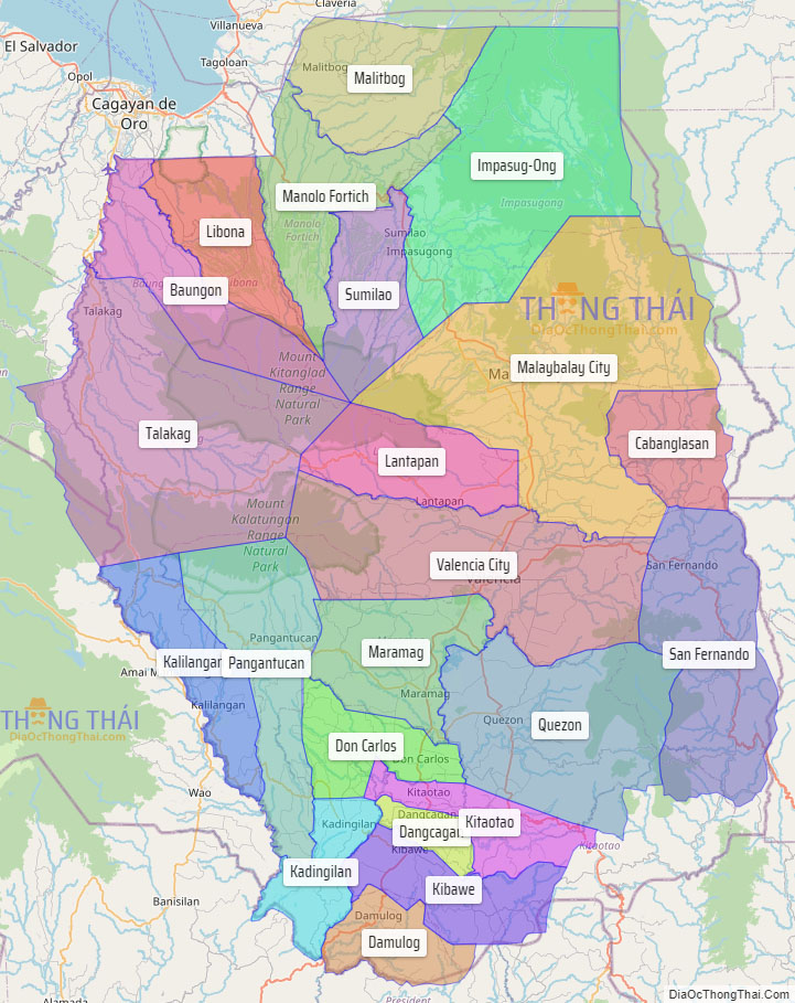
Bukidnon (/buːˈkɪdnɒn/), officially the Province of Bukidnon (Cebuano: Lalawigan sa Bukidnon; Filipino: Lalawigan ng Bukidnon; Hiligaynon: Kapuroan sang Bukidnon; Binukid and Higaonon: Probinsya ta Bukidnon), is a landlocked province in the Philippines located in the Northern Mindanao region. Its capital is the city of Malaybalay while Valencia is the largest city. The province borders, clockwise from the north, Misamis Oriental, Agusan del Sur, Davao del Norte, Cotabato, Lanao del Sur, and Lanao del Norte. According to the 2020 census, the province is inhabited by 1,541,308 residents. The province is composed of 2 component cities and 20 municipalities. It is the third largest province in the country in terms of total area of jurisdiction behind Palawan and Isabela respectively.
The name “Bukidnon” means “highlander” or “mountain dweller.” Occupying a wide plateau in the north central part of the island of Mindanao, the province is considered to be the food basket of the region, being the major producer of rice and corn. Products from plantations in the province also include pineapples, bananas and sugarcane.
Situated within Bukidnon is Mount Dulang-dulang, the 2nd highest mountain in the country, with an elevation of 2,938 metres (9,639 ft) located in the Kitanglad Mountain Range. Mount Kitanglad (2,899 m), Mount Kalatungan (2,860 m), Mount Maagnaw (2,742 m), Mount Lumuluyaw (2,612 m), and Mount Tuminungan (2,400 m), the 4th, 5th, 8th, 17th, and 30th highest mountains in the country respectively, are also found in the province.
Bukidnon was consecutively ranked 5th in the list of richest provinces in the Philippines for four straight years according to the Commission on Audit’s 2018, 2019, 2020, and 2021 Annual Financial Reports which were posted in 2019, early to late 2021, and 2022, respectively.
| Type: | Province |
|---|---|
| Capital: | Malaybalay |
| Area: | 10,498.59 km (4,053.53 sq mi) |
| Area Rank: | 3rd out of 81 |
| Population: | 1,541,308 |
| Population Rank: | 17th out of 81 |
| Density: | 1.41% |
| ZIP code: | 8700–8723 |
| ISO 3166 code: | PH-BUK |
| Website: | www.bukidnon.gov.ph |
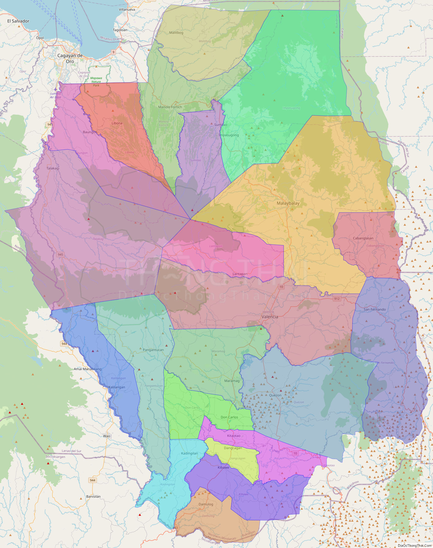
Online Interactive Map
Explore the interactive online map of Bukidnon, which highlights the administrative boundaries with each sub-administrative unit distinctly colored for easy identification. Just click on the map, and the name of the sub-unit will display, providing an intuitive and engaging way to navigate the area. Users can also view the map in full screen and switch between different map views, including OpenStreetMap, Google Maps, and satellite imagery.
Click on ![]() to view map in "full screen" mode.
to view map in "full screen" mode.
Bukidnon Political Map
Map of Bukidnon Province, Philippines the administrative divisions, provincial boundaries, along with detailed depictions of streets, roads, rivers, landmarks, and other geographical features.