Bulacan, officially the Province of Bulacan (Tagalog: Lalawigan ng Bulacan), is a province in the Philippines located in the Central Luzon region. Its capital is the city of Malolos. Bulacan was established on August 15, 1578, and part of the Metro Luzon Urban Beltway Super Region.
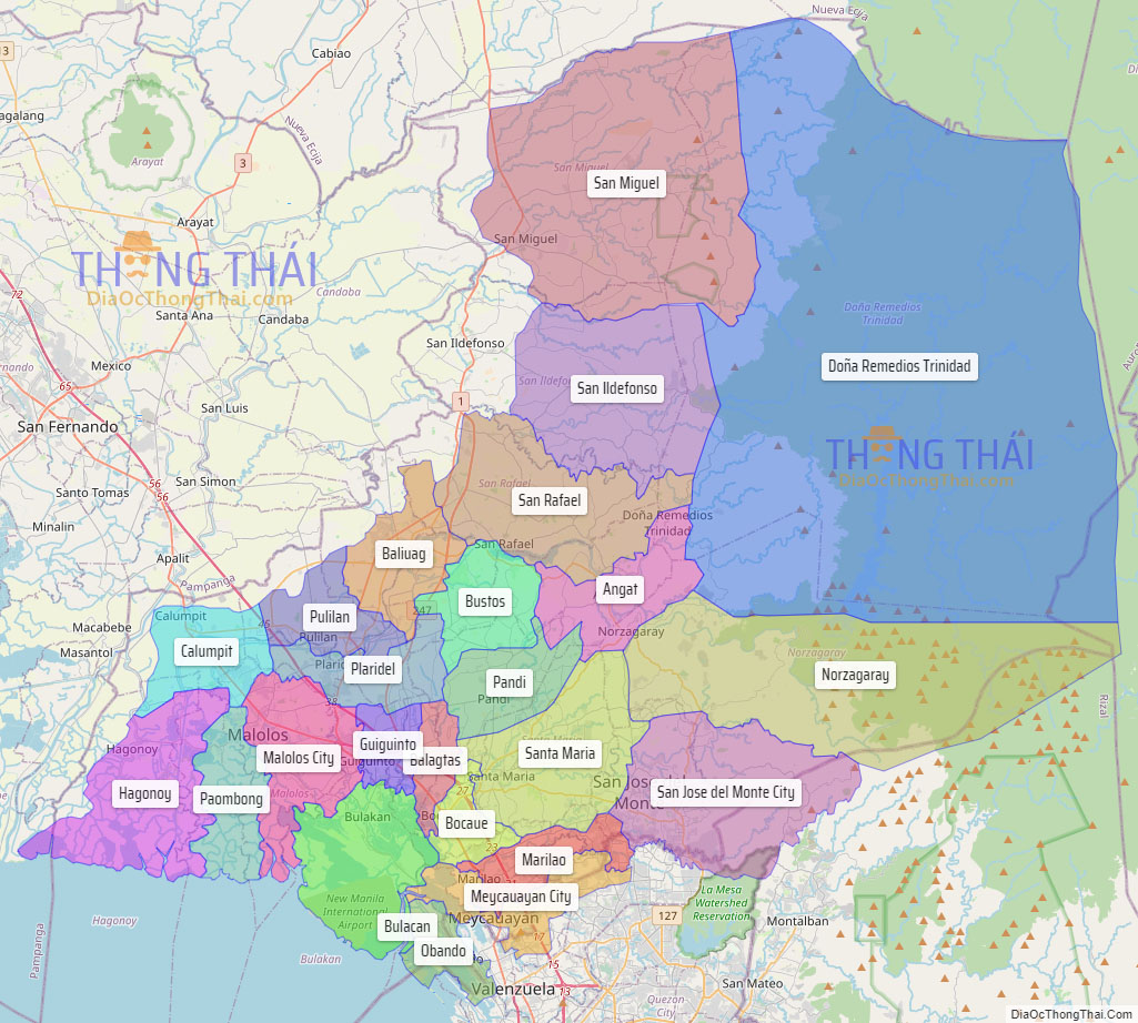
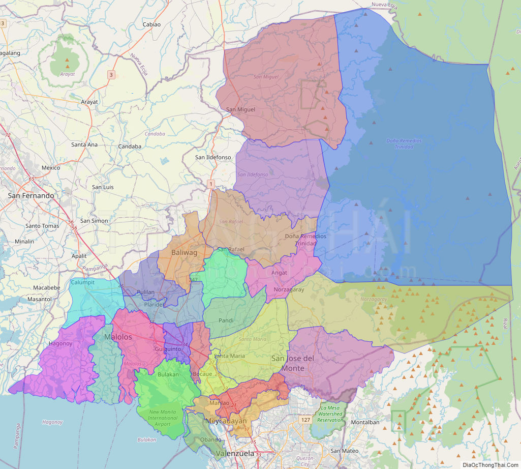
It has 569 barangays in 20 municipalities and four component cities (Baliwag, Malolos the provincial capital, Meycauayan, and San Jose del Monte the largest city). Bulacan is located immediately north of Metro Manila. Bordering Bulacan are the provinces of Pampanga to the west, Nueva Ecija to the north, Aurora and Quezon to the east, and Metro Manila and Rizal to the south. Bulacan also lies on the north-eastern shore of Manila Bay.
In the 2020 census, Bulacan had a population of 3,708,890 people, the most populous in Central Luzon and the third most populous in the Philippines, after Cebu and Cavite. Bulacan’s most populated city is San Jose del Monte, the most populated municipality is Santa Maria while the least populated is Doña Remedios Trinidad.
In 1899, the historic Barasoain Church in Malolos was the birthplace of the first constitutional democracy in Asia.
On November 7, 2018, the Provincial Government of Bulacan bagged its fourth Seal of Good Local Governance award. The SGLG award is a progressive assessment system that gives distinction to remarkable governance performance.
This province is a part of the Greater Manila Area.
| Type: | Province |
|---|---|
| Capital: | Malolos |
| Area: | 2,796.10 km (1,079.58 sq mi) |
| Area Rank: | 46th out of 81 |
| Population: | 3,708,890 |
| Population Rank: | 2nd out of 81 |
| Density: | 3.40% |
| ZIP code: | 3000–3024 |
| ISO 3166 code: | PH-BUL |
| Website: | www.bulacan.gov.ph |
Online Interactive Map
Explore the interactive online map of Bulacan, which highlights the administrative boundaries with each sub-administrative unit distinctly colored for easy identification. Just click on the map, and the name of the sub-unit will display, providing an intuitive and engaging way to navigate the area. Users can also view the map in full screen and switch between different map views, including OpenStreetMap, Google Maps, and satellite imagery.
Click on ![]() to view map in "full screen" mode.
to view map in "full screen" mode.
Bulacan Political Map
Map of Bulacan Province, Philippines the administrative divisions, provincial boundaries, along with detailed depictions of streets, roads, rivers, landmarks, and other geographical features.