Camarines Norte (Central Bikol: Amihanan na Camarines; Filipino: Hilagang Camarines), officially the Province of Camarines Norte (Bikol: Probinsya kan Amihanan na Camarines (Camarines Norte); Tagalog: Lalawigan ng Hilagang Camarines (Camarines Norte)), is a province in the Philippines located in the Bicol Region in Luzon. Its capital is Daet, the most populous town in the province. The province borders Quezon to the west, Camarines Sur to the south, and the Philippine Sea to the north. It has historically been a Bikol-speaking region. However, there has been a language shift in recent years to Tagalog, which is more commonly used nowadays.
| Type: | Province |
|---|---|
| Capital: | Daet |
| Area: | 2,320.07 km (895.78 sq mi) |
| Area Rank: | 55th out of 81 |
| Population: | 629,699 |
| Population Rank: | 51st out of 81 |
| Density: | 0.58% |
| ZIP code: | 4600–4612 |
| ISO 3166 code: | PH-CAN |
| Website: | www.camarinesnorte.gov.ph |
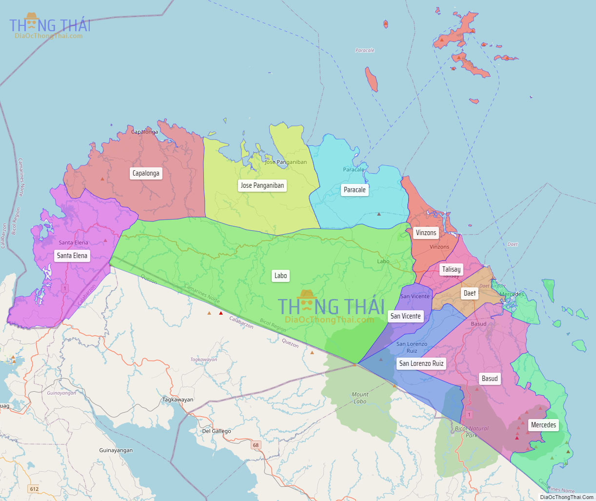
Online Interactive Map
Explore the interactive online map of Camarines Norte, which highlights the administrative boundaries with each sub-administrative unit distinctly colored for easy identification. Just click on the map, and the name of the sub-unit will display, providing an intuitive and engaging way to navigate the area. Users can also view the map in full screen and switch between different map views, including OpenStreetMap, Google Maps, and satellite imagery.
Click on ![]() to view map in "full screen" mode.
to view map in "full screen" mode.
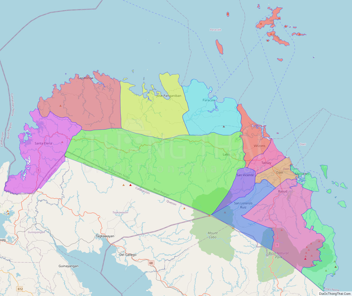
Camarines Norte Political Map
Map of Camarines Norte Province, Philippines the administrative divisions, provincial boundaries, along with detailed depictions of streets, roads, rivers, landmarks, and other geographical features.