Camiguin, officially the Province of Camiguin (Cebuano: Probinsya sa Camiguin; Tagalog: Lalawigan ng Camiguin; Kamigin: Probinsya ta Kamigin), is an island province in the Philippines located in the Bohol Sea, about 10 kilometers (6.2 mi) off the northern coast of mainland Mindanao. It is geographically part of Region X, the Northern Mindanao Region of the country and formerly a part of Misamis Oriental province.
Camiguin is the second-smallest province in the country in both population and land area after Batanes. The provincial capital is Mambajao, which is also the province’s largest municipality in both area and population.
The province is famous for its sweet lanzones, to which its annual Lanzones Festival is dedicated and celebrated every third weekend of October. It is home to lush interior forest reserves, collectively known as the Mount Hibok-Hibok Protected Landscape, which has been declared by all Southeast Asian nations as an ASEAN Heritage Park. The province also boasts three National Cultural Treasures, namely, the Old Bonbon Church ruins in Catarman, the Sunken Cemetery of Catarman, and the Spanish-era watchtower in Guinsiliban. The three sites were declared for “possessing outstanding historical, cultural, artistic and/or scientific value which is highly significant and important to the country and nation.”
Additionally, the island province has numerous Important Cultural Treasures, such as the Old Mambajao Fountain – situated in the town’s rotonda, the Old Mambajao Municipal Building, the façade of the Santo Rosario Church in Sagay, and 14 heritage and ancestral houses. The sites were declared for “having exceptional cultural, artistic and historical significance to the Philippines.” All cultural treasures were declared by the National Commission for Culture and the Arts. There have been moves to establish a dossier nomination for the province to be included in the UNESCO World Heritage List.
Camiguin is sometimes called Camiguin Sur (“South Camiguin”) or Camiguin de Mindanao to distinguish it from Camiguin de Babuyanes of the Babuyan Islands, which in turn is referred to as Camiguin Norte (“North Camiguin”). Both are volcanic islands.
| Type: | Province |
|---|---|
| Capital: | Mambajao |
| Area: | 241.44 km (93.22 sq mi) |
| Area Rank: | 80th out of 81 |
| Population: | 92,808 |
| Population Rank: | 80th out of 81 |
| Density: | 0.09% |
| ZIP code: | 9100–9104 |
| ISO 3166 code: | PH-CAM |
| Website: | www.camiguin.gov.ph |
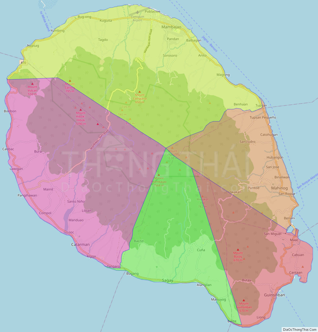
Online Interactive Map
Explore the interactive online map of Camiguin, which highlights the administrative boundaries with each sub-administrative unit distinctly colored for easy identification. Just click on the map, and the name of the sub-unit will display, providing an intuitive and engaging way to navigate the area. Users can also view the map in full screen and switch between different map views, including OpenStreetMap, Google Maps, and satellite imagery.
Click on ![]() to view map in "full screen" mode.
to view map in "full screen" mode.
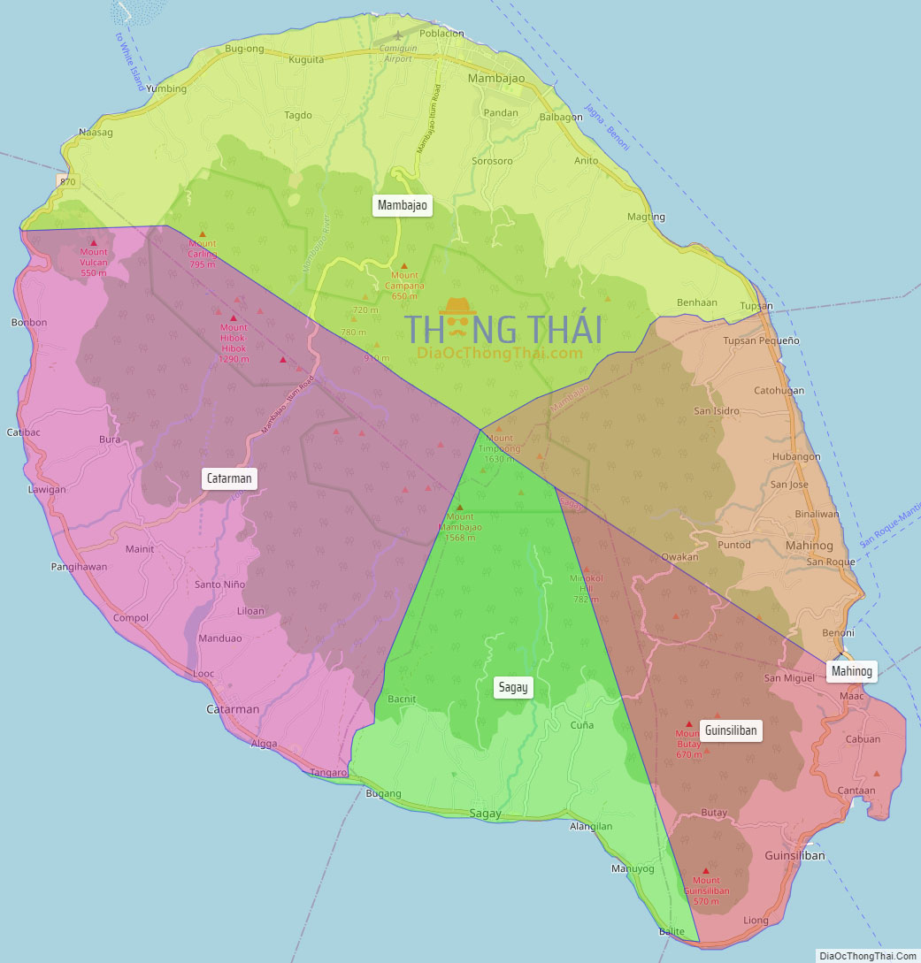
Camiguin Political Map
Map of Camiguin Province, Philippines the administrative divisions, provincial boundaries, along with detailed depictions of streets, roads, rivers, landmarks, and other geographical features.