Catanduanes (/ˌkɑːtɑːnˈdwɑːnɛs/; Tagalog pronunciation: [kɐtɐnˈdwɐnes]), officially the Province of Catanduanes (Filipino: Lalawigan ng Catanduanes), is an island province located in the Bicol Region of Luzon in the Philippines. It is the 12th-largest island in the Philippines, and lies to the east of Camarines Sur, across the Maqueda Channel. Its capital is Virac, the most populous town in the province. It had a population of 271,879 people as of the 2020 census.
The province comprises Catanduanes (mainland or main island), Panay Island, Lete Island, the Palumbanes group of islands (Porongpong, Tignob and Calabagio), and a few other small, surrounding islets and rocks. The province is also home to various mollusk fossil sites, notably the second-oldest ammonite site in the Philippines. These sites have certain species of ammonites that are found nowhere else in Southeast Asia. Because of the province’s importance and rich geologic history, various scholars have suggested that, if the province would take the initiative to put its name forward in nomination, it would stand a good chance of being named as a UNESCO Geopark Reserve.
In the early 1900s, Catanduanes was a sub-province of Ambos Camarines. Later, it was a sub-province of Albay. It became an autonomous province in 1945. Congressman Francisco Perfecto filed House Bill No. 301, which separated the province from Albay; the bill was approved on September 26, 1945, and signed into law by President Sergio Osmeña on October 24, 1945. Remigio Socito, previously the Lieutenant Governor, was appointed the first Provincial Governor. When elections were held in 1947, Alfonso V. Usero became the first elected Governor.
On April 15, 2022, President Rodrigo Duterte signed the Republic Act No. 11700 declaring Catanduanes province as the Philippines Abacá Capital.
| Type: | Province |
|---|---|
| Capital: | Virac |
| Area: | 1,492.16 km (576.13 sq mi) |
| Area Rank: | 70th out of 81 |
| Population: | 271,879 |
| Population Rank: | 67th out of 81 |
| Density: | 0.25% |
| ISO 3166 code: | PH-CAT |
| Website: | catanduanes.gov.ph |
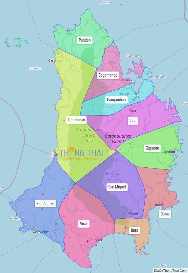
Online Interactive Map
Explore the interactive online map of Catanduanes, which highlights the administrative boundaries with each sub-administrative unit distinctly colored for easy identification. Just click on the map, and the name of the sub-unit will display, providing an intuitive and engaging way to navigate the area. Users can also view the map in full screen and switch between different map views, including OpenStreetMap, Google Maps, and satellite imagery.
Click on ![]() to view map in "full screen" mode.
to view map in "full screen" mode.
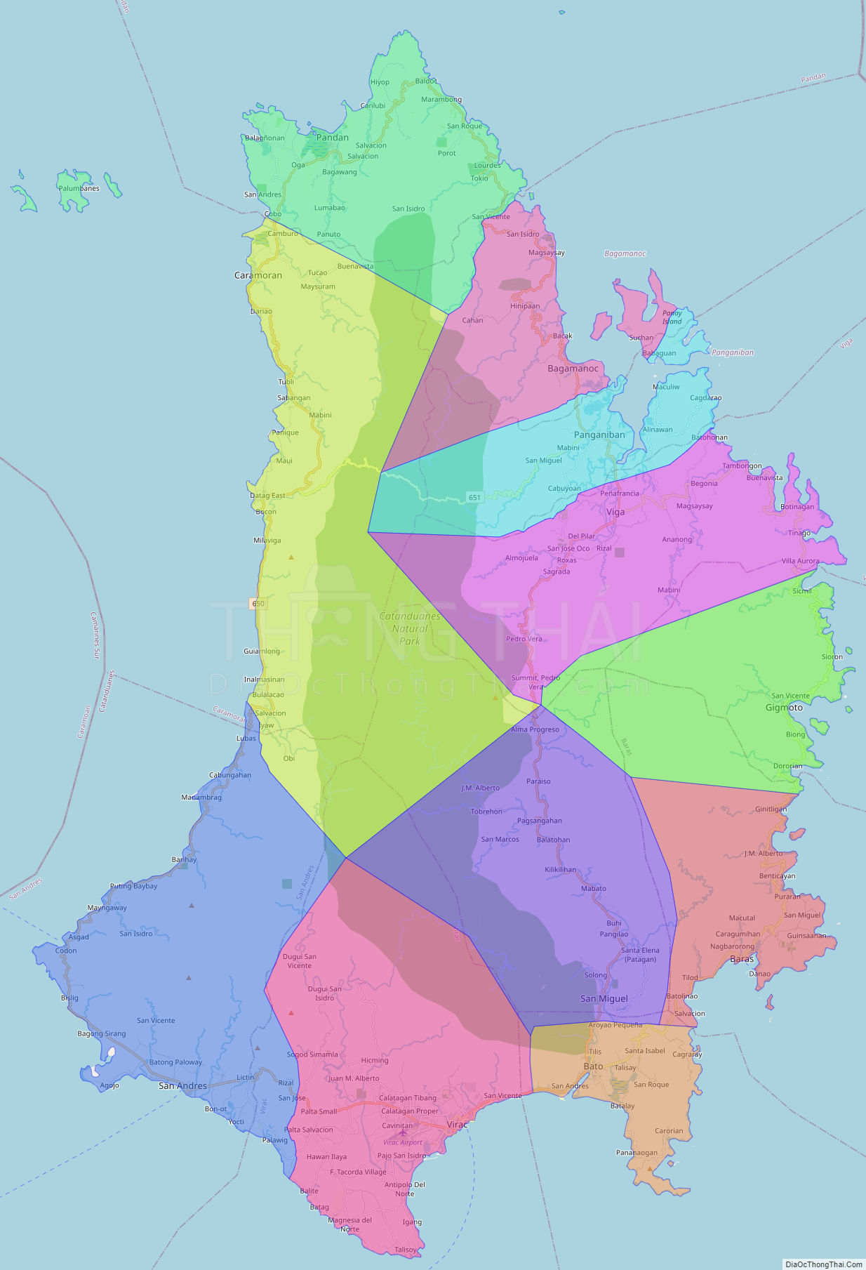
Catanduanes Political Map
Map of Catanduanes Province, Philippines the administrative divisions, provincial boundaries, along with detailed depictions of streets, roads, rivers, landmarks, and other geographical features.