Cavite, officially the Province of Cavite (Tagalog: Lalawigan ng Kabite; Chavacano: Provincia de Cavite), is a province in the Philippines located in the Calabarzon region in Luzon. Located on the southern shores of Manila Bay and southwest of Manila, it is one of the most industrialized and fastest-growing provinces in the Philippines. As of 2020, it has a population of 4,344,829, making it the most populated province in the country if the independent cities of Cebu are excluded from Cebu’s population figure.
The de facto capital and seat of the government of the province is Trece Martires, although Imus is the official (de jure) capital while the City of Dasmariñas is the largest city in the province.
For over 300 years, the province played an important role in both the country’s colonial past and eventual fight for independence, earning it the title “Historical Capital of the Philippines”. It became the cradle of the Philippine Revolution, which led to the renouncement of Spanish colonial control, finally culminating in the Philippine Declaration of Independence on June 12, 1898 in Kawit. The old provincial capital, Cavite City also hosted docks for the Manila galleon, becoming an essential part of commerce between Asia and Latin America.
Originally an agricultural province, its northern cities of Bacoor, Imus, and Dasmariñas (with a combined population of 1,864,560 at the 2020 Census) are now suburbs of Metro Manila due to increasing urbanization in the late 20th century. This province forms part of the Greater Manila Area.
| Type: | Province |
|---|---|
| Capital: | Imus |
| Area: | 1,574.17 km (607.79 sq mi) |
| Area Rank: | 67th out of 81 |
| Population: | 4,344,829 |
| Population Rank: | 1st out of 81 |
| Density: | 3.98% |
| ISO 3166 code: | PH-CAV |
| Website: | www.cavite.gov.ph |
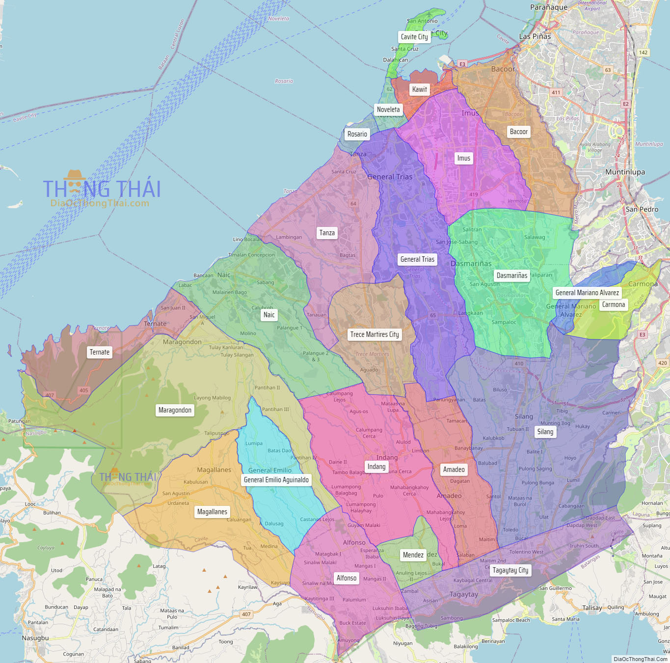
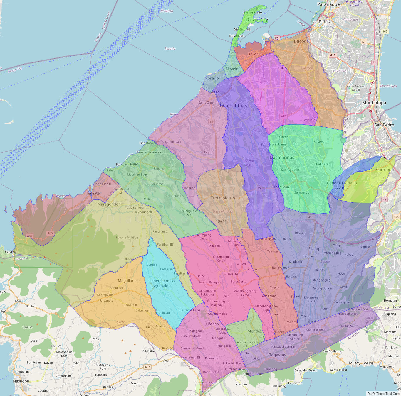
Online Interactive Map
Explore the interactive online map of Cavite, which highlights the administrative boundaries with each sub-administrative unit distinctly colored for easy identification. Just click on the map, and the name of the sub-unit will display, providing an intuitive and engaging way to navigate the area. Users can also view the map in full screen and switch between different map views, including OpenStreetMap, Google Maps, and satellite imagery.
Click on ![]() to view map in "full screen" mode.
to view map in "full screen" mode.
Cavite Political Map
Map of Cavite Province, Philippines the administrative divisions, provincial boundaries, along with detailed depictions of streets, roads, rivers, landmarks, and other geographical features.