Guimaras ([ɡimaˈɾas]), officially the Province of Guimaras (Hiligaynon: Kapuoran sang Guimaras; Tagalog: Lalawigan ng Guimaras), is an island province in the Philippines located in the Western Visayas region. The capital is Jordan, while the largest local government unit is the municipality of Buenavista. The province is situated in Panay Gulf, between the islands of Panay and Negros. To the northwest is the city and province of Iloilo and to the southeast is Negros Occidental. The whole island is part of the Metro Iloilo–Guimaras, one of the twelve metropolitan areas of the Philippines.
The province consists primarily of Guimaras Island, and also includes Inampulugan, Guiwanon (or Guiuanon), Panobolon, Natunga, Nadulao, and many surrounding islets.
Guimaras, formerly known as Himal-os, was a sub-province of Iloilo until it was made an independent province on May 22, 1992.
| Type: | Province |
|---|---|
| Capital: | Jordan |
| Area: | 604.57 km (233.43 sq mi) |
| Area Rank: | 77th out of 81 |
| Population: | 187,842 |
| Population Rank: | 74th out of 81 |
| Density: | 0.17% |
| ZIP code: | 5044–5048 |
| ISO 3166 code: | PH-GUI |
| Website: | guimaras.gov.ph |
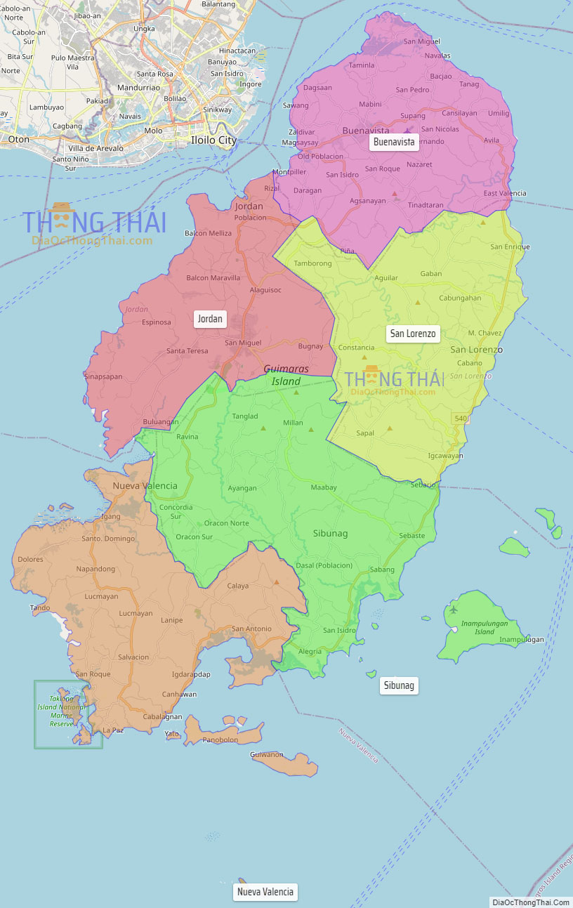
Online Interactive Map
Explore the interactive online map of Guimaras, which highlights the administrative boundaries with each sub-administrative unit distinctly colored for easy identification. Just click on the map, and the name of the sub-unit will display, providing an intuitive and engaging way to navigate the area. Users can also view the map in full screen and switch between different map views, including OpenStreetMap, Google Maps, and satellite imagery.
Click on ![]() to view map in "full screen" mode.
to view map in "full screen" mode.
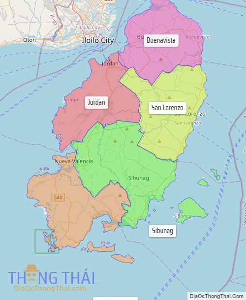
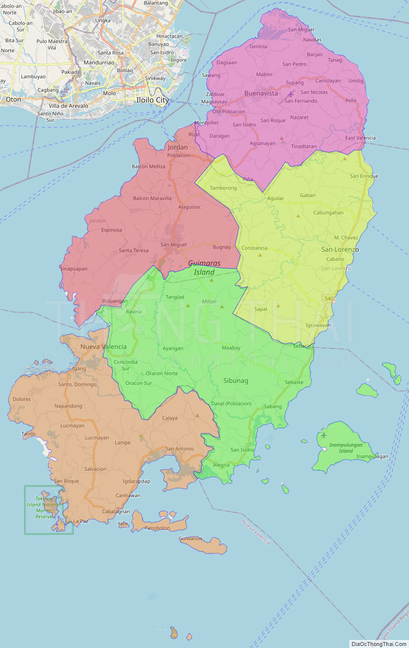
Guimaras Political Map
Map of Guimaras Province, Philippines the administrative divisions, provincial boundaries, along with detailed depictions of streets, roads, rivers, landmarks, and other geographical features.