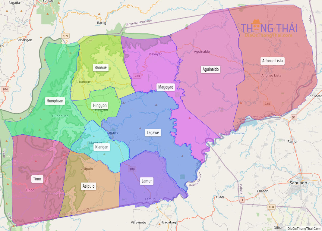
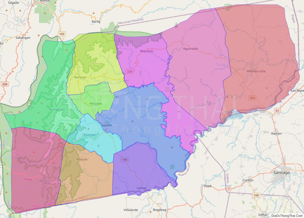
Ifugao, officially the Province of Ifugao (Ilocano: Probinsia ti Ifugao; Tagalog: Lalawigan ng Ifugao), is a landlocked province of the Philippines in the Cordillera Administrative Region in Luzon. Its capital is Lagawe and it borders Benguet to the west, Mountain Province to the north, Isabela to the east, and Nueva Vizcaya to the south. Alfonso Lista is the most populous in the province.
The Rice Terraces of the Philippine Cordilleras and Banaue Rice Terraces are the main tourist attractions in the province. These terraces are believed to have been hand-carved into the mountains 2,000 years ago to plant rice. However, recent research by carbon dating suggests that they were built much later. In 1995, the Rice Terraces of the Philippine Cordilleras were declared as a UNESCO World Heritage Site. In 2008 and 2015, the Hudhud chants of the Ifugao and the Punnuk (Tugging rituals and games) were inscribed in the UNESCO Intangible Cultural Heritage Lists.
| Type: | Province |
|---|---|
| Capital: | Lagawe |
| Area: | 2,628.21 km (1,014.76 sq mi) |
| Area Rank: | 50th out of 81 |
| Population: | 207,498 |
| Population Rank: | 72nd out of 81 |
| Density: | 0.19% |
| ZIP code: | 3600–3610 |
| ISO 3166 code: | PH-IFU |
Online Interactive Map
Explore the interactive online map of Ifugao, which highlights the administrative boundaries with each sub-administrative unit distinctly colored for easy identification. Just click on the map, and the name of the sub-unit will display, providing an intuitive and engaging way to navigate the area. Users can also view the map in full screen and switch between different map views, including OpenStreetMap, Google Maps, and satellite imagery.
Click on ![]() to view map in "full screen" mode.
to view map in "full screen" mode.
Ifugao Political Map
Map of Ifugao Province, Philippines the administrative divisions, provincial boundaries, along with detailed depictions of streets, roads, rivers, landmarks, and other geographical features.