Iloilo (/ˌɪloʊˈiːloʊ/ ih-loh-EE-loh; [ɪlo.ˈilo]), also called Iloilo Province, officially the Province of Iloilo (Hiligaynon: Kapuoran sang Iloilo; Kinaray-a: Kapuoran kang Iloilo; Filipino: Lalawigan ng Iloilo; Spanish: Província de Iloílo), is a province in the Philippines located in the Western Visayas region. Its capital and largest city is Iloilo City, the regional center of Western Visayas and politically independent from the province. Iloilo occupies the southeast portion of the Visayan island of Panay and is bordered by the province of Antique to the west, Capiz to the north, the Jintotolo Channel to the northeast, the Guimaras Strait to the east, and the Iloilo Strait and Panay Gulf to the southwest.
Just off Iloilo’s southeast coast is the island province of Guimaras, once part of Iloilo but now an independent province. Across Panay Gulf and Guimaras Strait is Negros Occidental, occupying the northwestern half of the larger island of Negros. Iloilo City, its capital, is the center of the Iloilo–Guimaras Metropolitan Area or Metro Iloilo–Guimaras, and is geographically located in the province and grouped under it by the Philippine Statistics Authority, but remains politically independent from the provincial government. According to the 2020 census, the population of the province (excluding Iloilo City) is 2,051,899. If Iloilo City is included, the population is 2,509,525 in total.
Iloilo is known for its rich history and cultural heritage. It is home to many Spanish-era historic sites, including the Miag-ao Church, a UNESCO World Heritage Site in the Philippines. The province is also home to several other prominent structures, including the San Joaquin Campo Santo, San Joaquin Church, and Santa Barbara Church, all recognized as National Cultural Treasures by the National Museum of the Philippines.
The province offers diverse attractions, from well-preserved colonial structures in the south to pristine beaches and islands in the north, namely the Bantigue Sand Bar, the Tangke Lagoon, Cabugao Island, and Antonia Island, all part of the Islas de Gigantes. Additionally, Sicogon Island, situated south of the group of islands, has gained popularity as a luxury tourist destination.
| Type: | Province |
|---|---|
| Capital: | Iloilo City |
| Area: | 5,000.83 km (1,930.83 sq mi) |
| Area Rank: | 19th out of 81 |
| Population: | 2,051,899 |
| Population Rank: | 12th out of 81 |
| Density: | 2.30% |
| ZIP code: | 5000–5043 |
| ISO 3166 code: | PH-ILI |
| Website: | iloilo.gov.ph |
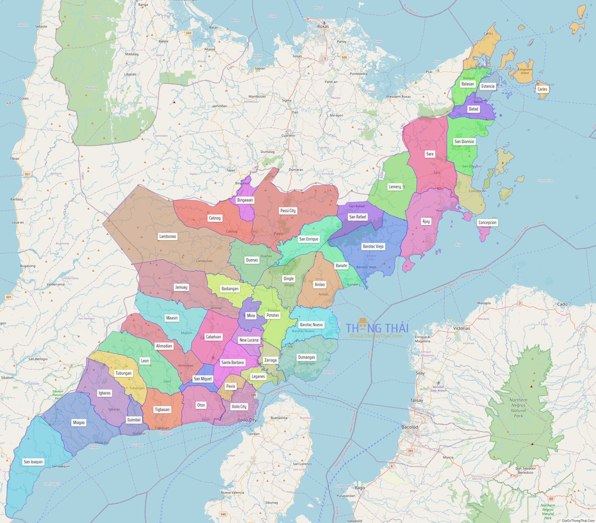
Online Interactive Map
Explore the interactive online map of Iloilo, which highlights the administrative boundaries with each sub-administrative unit distinctly colored for easy identification. Just click on the map, and the name of the sub-unit will display, providing an intuitive and engaging way to navigate the area. Users can also view the map in full screen and switch between different map views, including OpenStreetMap, Google Maps, and satellite imagery.
Click on ![]() to view map in "full screen" mode.
to view map in "full screen" mode.
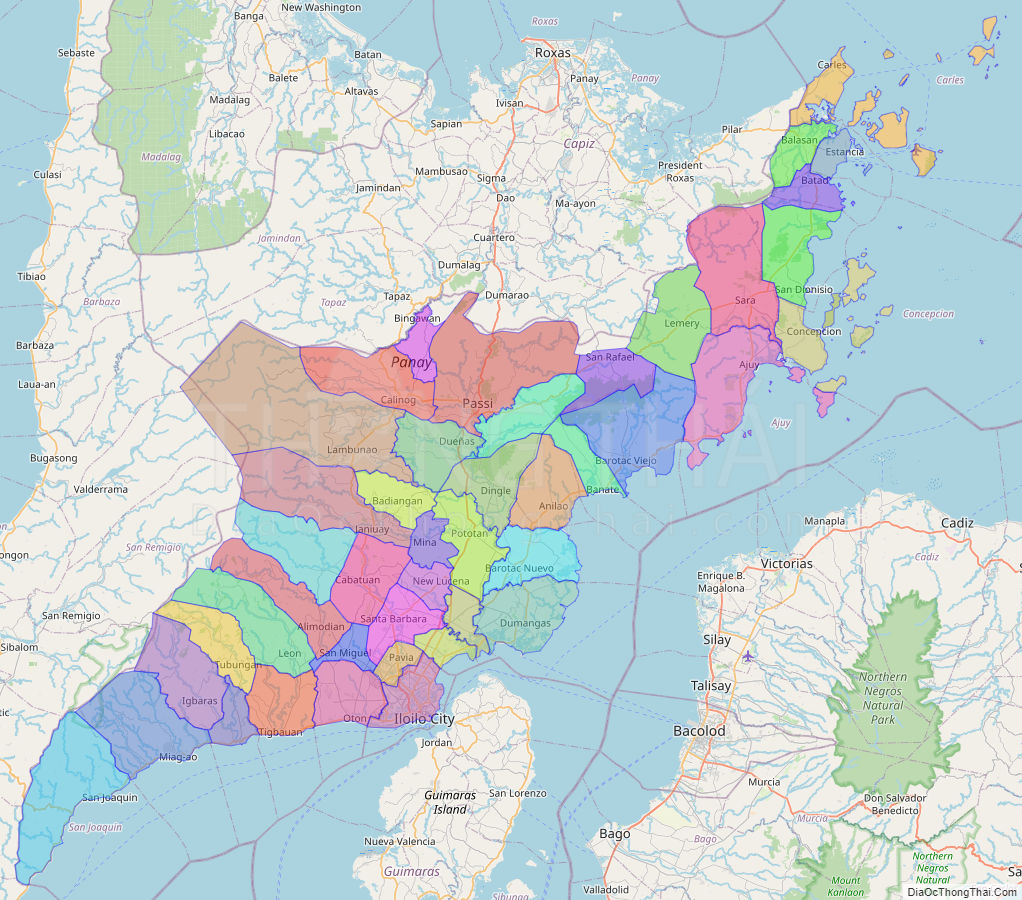
Iloilo Political Map
Map of Iloilo Province, Philippines the administrative divisions, provincial boundaries, along with detailed depictions of streets, roads, rivers, landmarks, and other geographical features.