Kalinga (IPA: [ka’liŋɡa]), officially the Province of Kalinga (Ilocano: Probinsia ti Kalinga; Tagalog: Lalawigan ng Kalinga), is a landlocked province in the Philippines situated within the Cordillera Administrative Region in Luzon. Its capital (and largest city) is Tabuk and borders Mountain Province to the south, Abra to the west, Isabela to the east, Cagayan to the northeast, and Apayao to the north. Kalinga and Apayao are the result of the 1995 partitioning of the former province of Kalinga-Apayao which was seen to better service the respective needs of the various indigenous peoples in the area.
President Emilio Aguinaldo proclaimed Lubuagan town the seat of government for 73 days from March 6, 1900, to May 18, 1900, before finally fleeing to Palanan.
| Type: | Province |
|---|---|
| Capital: | Tabuk |
| Area: | 3,231.25 km (1,247.59 sq mi) |
| Area Rank: | 41st out of 81 |
| Population: | 229,570 |
| Population Rank: | 71st out of 81 |
| Density: | 0.21% |
| ZIP code: | 3800–3808 |
| ISO 3166 code: | PH-KAL |
| Website: | www.kalinga.gov.ph |
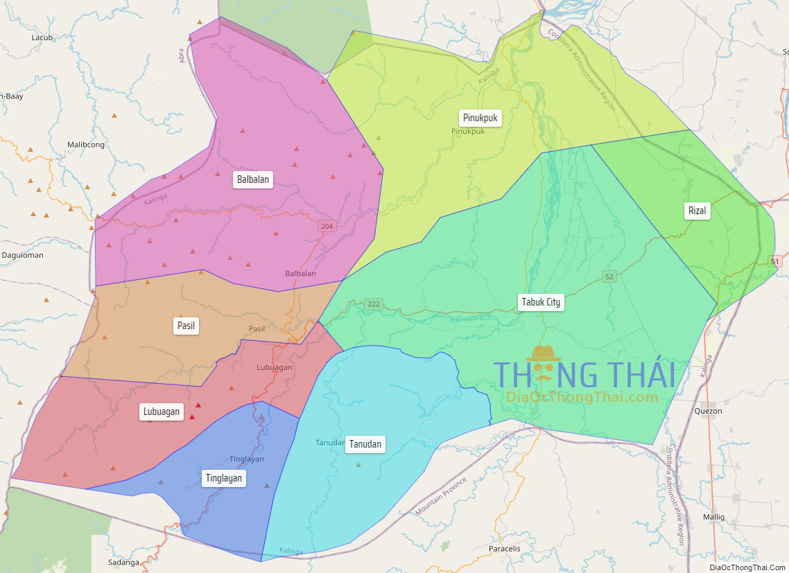
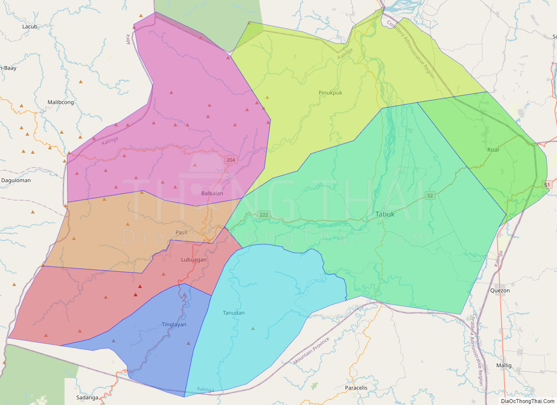
Online Interactive Map
Explore the interactive online map of Kalinga, which highlights the administrative boundaries with each sub-administrative unit distinctly colored for easy identification. Just click on the map, and the name of the sub-unit will display, providing an intuitive and engaging way to navigate the area. Users can also view the map in full screen and switch between different map views, including OpenStreetMap, Google Maps, and satellite imagery.
Click on ![]() to view map in "full screen" mode.
to view map in "full screen" mode.
Kalinga Political Map
Map of Kalinga Province, Philippines the administrative divisions, provincial boundaries, along with detailed depictions of streets, roads, rivers, landmarks, and other geographical features.