La Union (Tagalog pronunciation: [lɐ ʔʊˈɲon]), officially the Province of La Union (Ilocano: Probinsia ti La Union; Pangasinan: Luyag/Probinsia na La Union; Tagalog: Lalawigan ng La Union), is a province in the Philippines located in the Ilocos Region in the island of Luzon. Its capital is the City of San Fernando, which is the most populous in the province and also the regional center of the Ilocos Region.
The province is bordered by Ilocos Sur to the north, Benguet to the east, Pangasinan to the south, and to the west by the shores of the South China Sea.
| Type: | Province |
|---|---|
| Capital: | San Fernando |
| Area: | 1,497.70 km (578.27 sq mi) |
| Area Rank: | 69th out of 81 |
| Population: | 822,352 |
| Population Rank: | 37th out of 81 |
| Density: | 0.75% |
| ZIP code: | 2500–2520 |
| ISO 3166 code: | PH-LUN |
| Website: | www.launion.gov.ph |
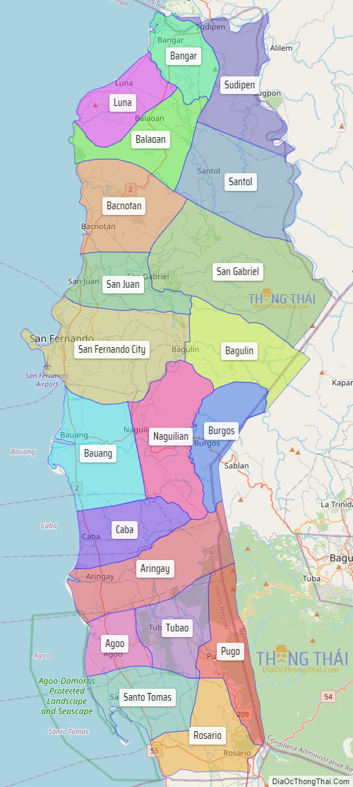
Online Interactive Map
Explore the interactive online map of La Union, which highlights the administrative boundaries with each sub-administrative unit distinctly colored for easy identification. Just click on the map, and the name of the sub-unit will display, providing an intuitive and engaging way to navigate the area. Users can also view the map in full screen and switch between different map views, including OpenStreetMap, Google Maps, and satellite imagery.
Click on ![]() to view map in "full screen" mode.
to view map in "full screen" mode.
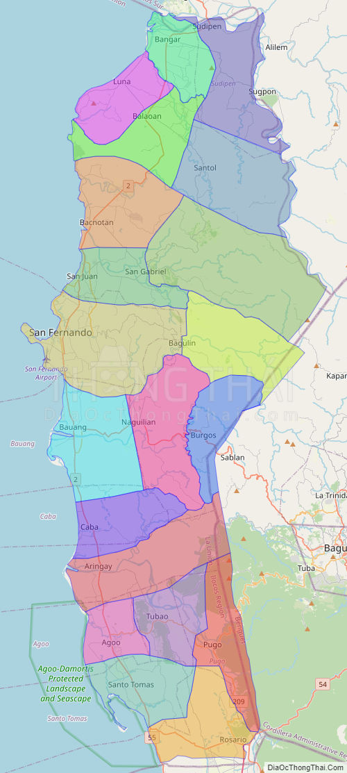
La Union Political Map
Map of La Union Province, Philippines the administrative divisions, provincial boundaries, along with detailed depictions of streets, roads, rivers, landmarks, and other geographical features.