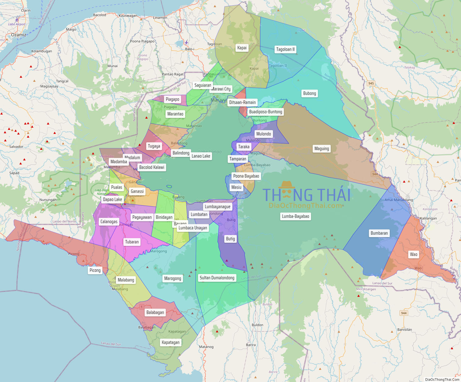
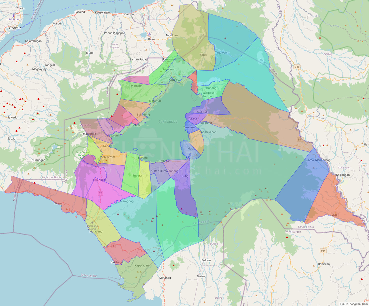
Lanao del Sur (Tagalog: Timog Lanao; Meranaw and Iranun: Pagabagatan Ranao), officially the Province of Lanao del Sur, is a province in the Philippines located in the Bangsamoro Autonomous Region in Muslim Mindanao (BARMM). The capital is the city of Marawi (the most populous in the province), and it borders Lanao del Norte to the north, Bukidnon to the east, and Maguindanao del Norte and Cotabato to the south. To the southwest lies Illana Bay, an arm of the Moro Gulf.
Situated in the interior of Lanao del Sur is Lanao Lake, the largest in Mindanao.
| Type: | Province |
|---|---|
| Capital: | Marawi |
| Area: | 3,872.89 km (1,495.33 sq mi) |
| Area Rank: | 33rd out of 81 |
| Population: | 1,195,518 |
| Population Rank: | 24th out of 81 |
| Density: | 1.10% |
| ZIP code: | 9300–9321, 9700–9716 |
| ISO 3166 code: | PH-LAS |
Online Interactive Map
Explore the interactive online map of Lanao del Sur, which highlights the administrative boundaries with each sub-administrative unit distinctly colored for easy identification. Just click on the map, and the name of the sub-unit will display, providing an intuitive and engaging way to navigate the area. Users can also view the map in full screen and switch between different map views, including OpenStreetMap, Google Maps, and satellite imagery.
Click on ![]() to view map in "full screen" mode.
to view map in "full screen" mode.
Lanao del Sur Political Map
Map of Lanao del Sur Province, Philippines the administrative divisions, provincial boundaries, along with detailed depictions of streets, roads, rivers, landmarks, and other geographical features.