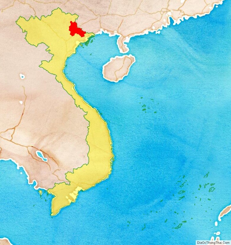
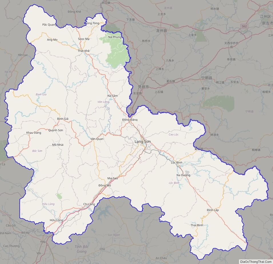
Lang Son is a province in far northern Vietnam, bordering Guangxi province in China. Its capital is also called Lang Son, which is a strategically important town at the border with China and is 137 km northeast of Hanoi connected by rail and road. Lang Son Province is bounded by China in the north, Cao Bang Province borders the northwest, Ha Bac Province to the south, Quang Ninh Province starting on the south and extending to the eastern border and Thai Nguyen Province to the west. The province covers an area of 8,327.6 square kilometres and as of 2008 it had a population of 759,000.
Lang Son Province, Ha Giang, Lao Cai, Bac Giang, Bac Kan, Cao Bang, Phu Tho, Quang Ninh, Thai Nguyen, Tuyen Quang and Yen Bai of the Northeast (Dong Bac) region) are all part of the 59 administrative provinces and five municipalities in Vietnam.
Ancient history of the province is linked to the Bronze Age when the trade route that existed between China and India that passed from the Red River Delta through Nanning to Guangzhou. The province was one of the 13 original provinces in northern Vietnam created under the reign of Emperor Minh Mang in 1831.
Friendship Gate, the historical land link between China and Vietnam, links Lang Son and Guangxi, China. Being a border province, it is important for trade between the two countries. It is accessible by road and rail from Hanoi, the Vietnamese capital, and it is the northernmost point on National Route 1A. Lang Son’s economy is 80% based on agriculture and forestry. However, in recent years economic development has received full attention to exploit its rich mineral resources.
The most important tree grown in the province is the star anise (illicium verum, Hooker), an important spice; an evergreen tree which has aromatic lanceolate leaves.
Important historical places of interest in the province are the war-ravaged Dong Don border town, which has rich war history and attracts visitors, two large limestone caves within a short distance from the Lang Son town, and a 16th-century citadel of the Ming dynasty.
The province’s name derives from Sino-Vietnamese 諒E山.
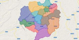
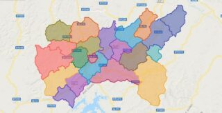
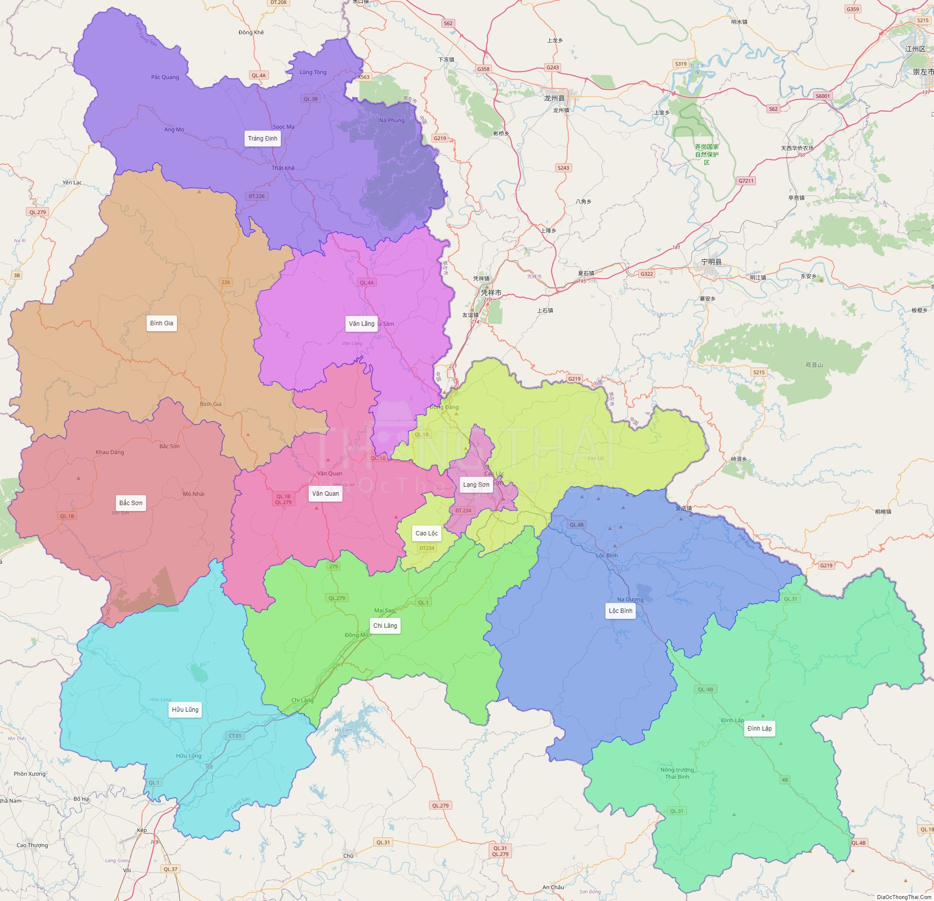
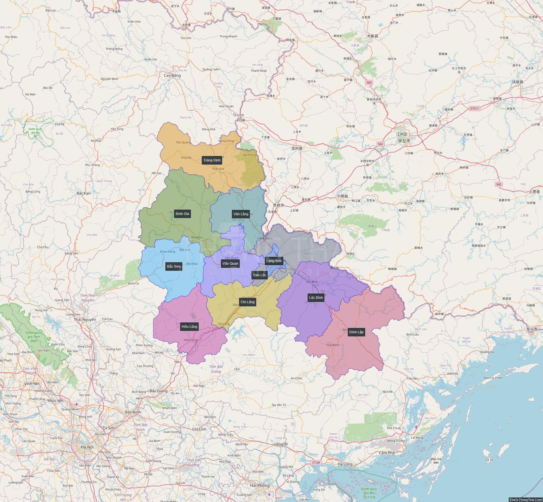
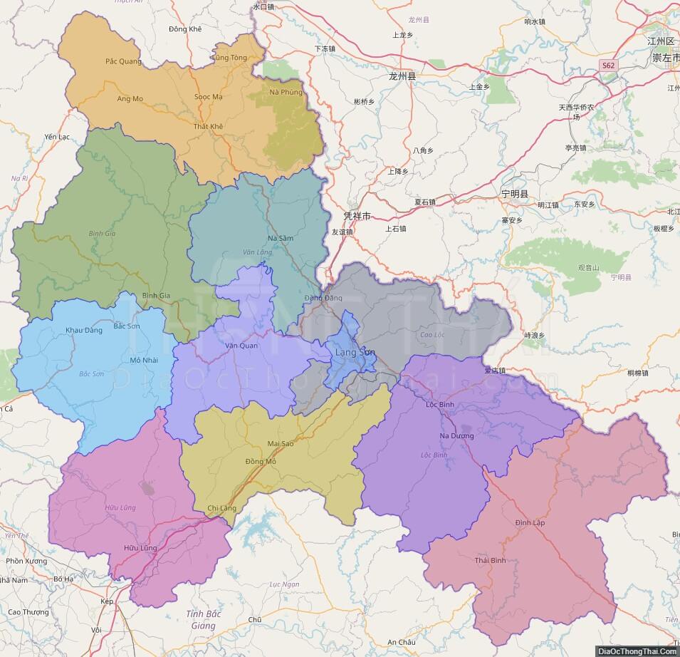
Political Map of Lang Son province
Click on ![]() to view map in "full screen" mode.
to view map in "full screen" mode.
Base Map Layer: Open Street Map (OSM), Arcgisonline, Google Map, Wmflabs.
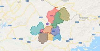
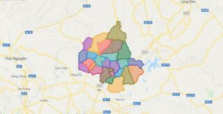
Large scale maps of Lang Son province
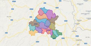
Lang Son province location map
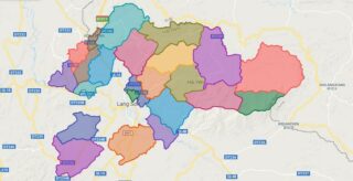
Lang Son street map
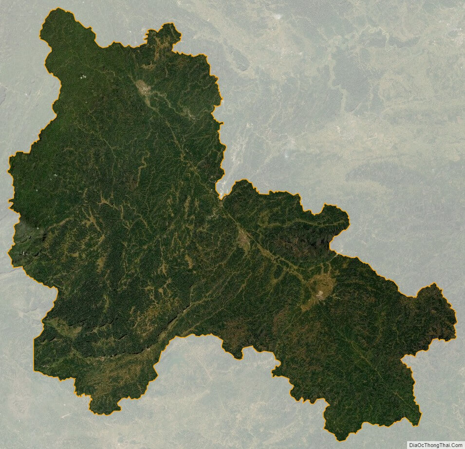
Lang Son satellite map