Leyte (also Northern Leyte; Waray: Norte san/Amihanan nga Leyte; Cebuano: Amihanang Leyte; Tagalog: Hilagang Leyte), officially the Province of Leyte, is a province in the Philippines located in the Eastern Visayas region occupying the northern three-quarters of Leyte Island (with the remaining portion being the province of Southern Leyte). Its capital and largest city is Tacloban, administered independently from the province and the regional center of Eastern Visayas. Leyte is thus north of Southern Leyte, south of Biliran, and west of Samar Island. To the west across the Camotes Sea is the province of Cebu.
The historical name of the Philippines, “Las Islas Felipenas“, named by Spanish explorer Ruy López de Villalobos in honor of Prince Philip of Spain, used to refer to the islands of Leyte and Samar only, until it was adopted to refer to the entire archipelago.
The island of Leyte is known as Tandaya during the 16th century.
Leyte is also known as the site of the largest naval battle in modern history, the Battle of Leyte Gulf, which took place during the Second World War.
Leyte is especially prone to typhoons because it geographically faces toward the Pacific Ocean. On 8 November 2013, the province was severely affected by Super Typhoon Yolanda (Haiyan). The typhoon, known internationally as Haiyan, and domestically referred to as Yolanda, killed thousands of people and garnered significant international media attention. Leyte suffered similar destruction and loss of life in 1991 from Tropical Storm Thelma.
| Type: | Province |
|---|---|
| Capital: | Tacloban |
| Area: | 6,313.33 km (2,437.59 sq mi) |
| Area Rank: | 13th out of 81 |
| Population: | 1,776,847 |
| Population Rank: | 14th out of 81 |
| Density: | 1.86% |
| ZIP code: | 6500–6542 |
| ISO 3166 code: | PH-LEY |
| Website: | http://leyteprovince.gov.ph/ |
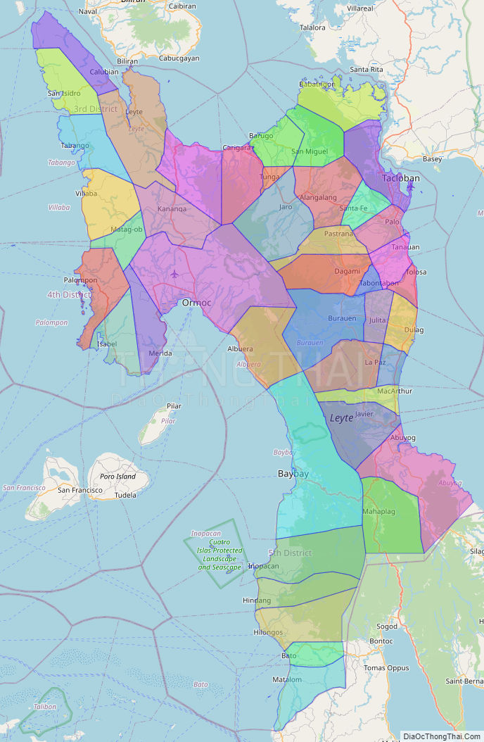
Online Interactive Map
Explore the interactive online map of Leyte, which highlights the administrative boundaries with each sub-administrative unit distinctly colored for easy identification. Just click on the map, and the name of the sub-unit will display, providing an intuitive and engaging way to navigate the area. Users can also view the map in full screen and switch between different map views, including OpenStreetMap, Google Maps, and satellite imagery.
Click on ![]() to view map in "full screen" mode.
to view map in "full screen" mode.
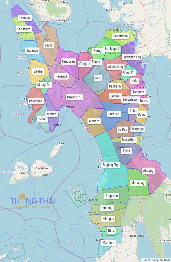
Leyte Political Map
Map of Leyte Province, Philippines the administrative divisions, provincial boundaries, along with detailed depictions of streets, roads, rivers, landmarks, and other geographical features.