Maguindanao del Sur, officially the Province of Maguindanao del Sur (Maguindanaon: Dairat nu Salatan Magindanaw, Jawi:دايرت نو سلاتان مڬیندانو ), is a landlocked province in the Philippines located in the Bangsamoro region in Mindanao. Its capital is the municipality of Buluan near the city of Tacurong in the neighboring province of Sultan Kudarat. It borders Cotabato province to the east, Maguindanao del Norte to the west, and Sultan Kudarat to the south.
| Type: | Province |
|---|---|
| Capital: | Buluan |
| Area: | 4,973.48 km (1,920.27 sq mi) |
| Population: | 741,221 |
| Density: | 0.68% |
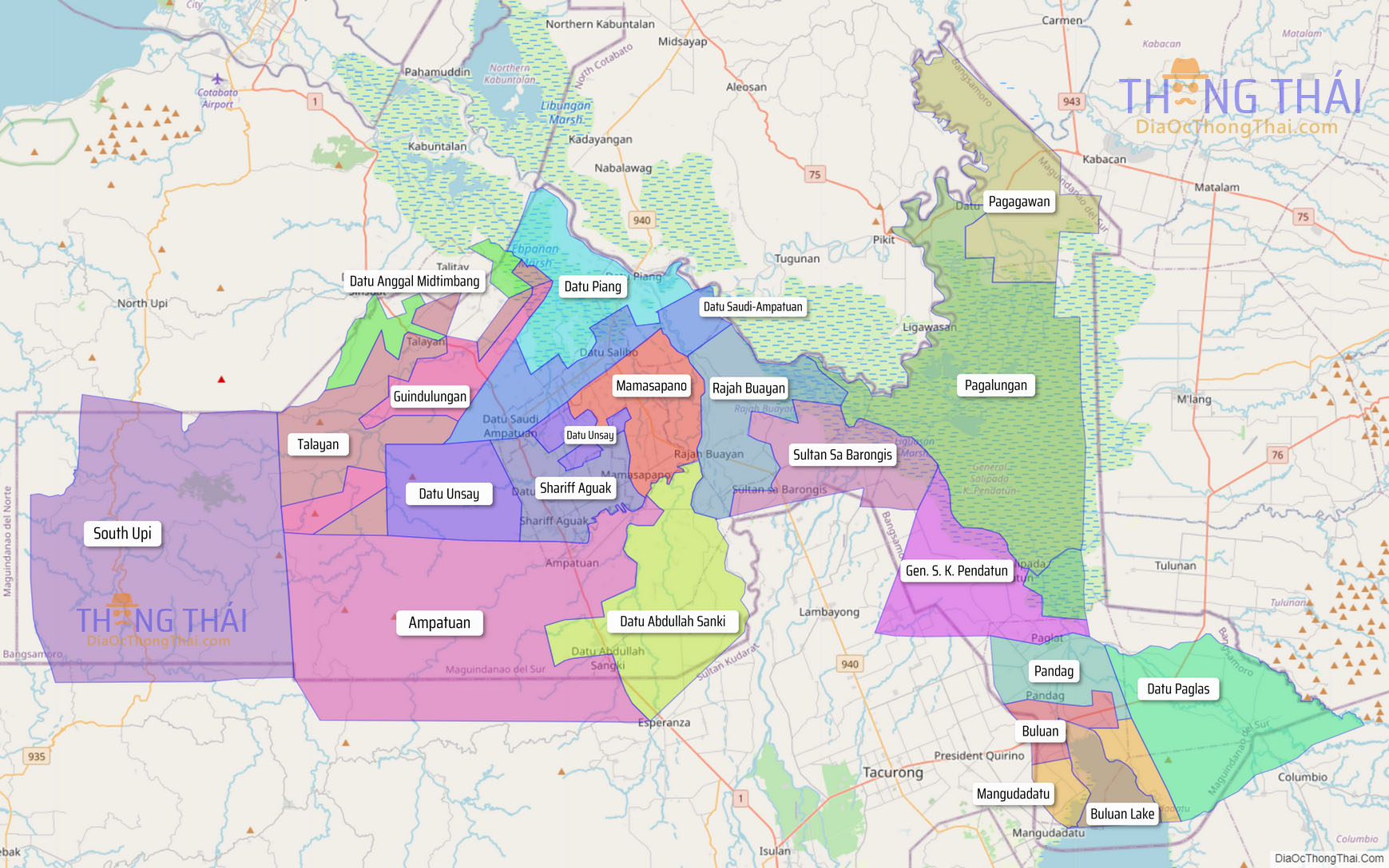
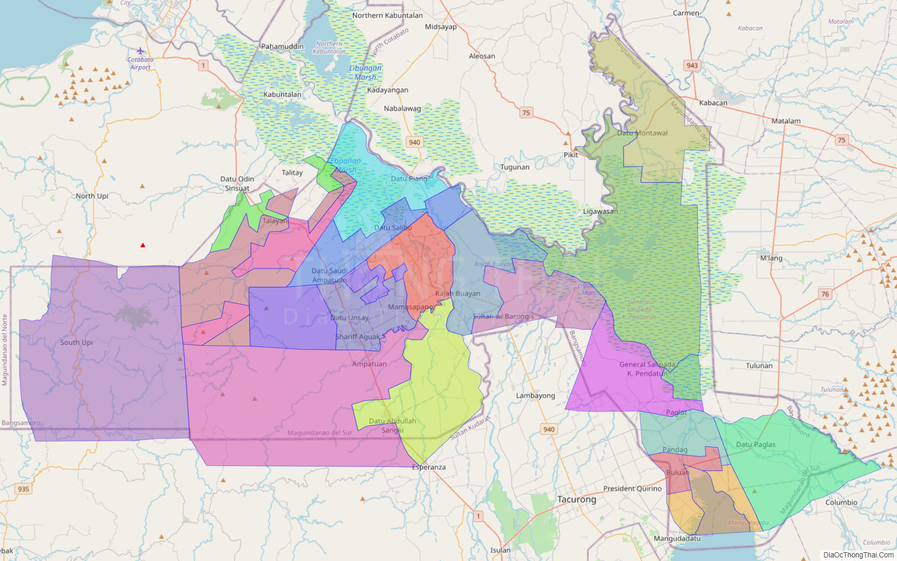
Online Interactive Map
Explore the interactive online map of Maguindanao del Sur, which highlights the administrative boundaries with each sub-administrative unit distinctly colored for easy identification. Just click on the map, and the name of the sub-unit will display, providing an intuitive and engaging way to navigate the area. Users can also view the map in full screen and switch between different map views, including OpenStreetMap, Google Maps, and satellite imagery.
Click on ![]() to view map in "full screen" mode.
to view map in "full screen" mode.
Maguindanao del Sur Political Map
Map of Maguindanao del Sur Province, Philippines the administrative divisions, provincial boundaries, along with detailed depictions of streets, roads, rivers, landmarks, and other geographical features.