Marinduque (/ˌmærənˈduːkeɪ/; Tagalog pronunciation: [maɾinˈduke]), officially the Province of Marinduque, is an island province in the Philippines located in Southwestern Tagalog Region or Mimaropa, formerly designated as Region IV-B. Its capital is the municipality of Boac, the most populous in the province. Marinduque lies between Tayabas Bay to the north and Sibuyan Sea to the south. It is west of the Bondoc Peninsula of Quezon province in mainland Luzon; east of Mindoro Island; and north of the island province of Romblon. Some parts of the Verde Island Passage, the center of the center of world’s marine biodiversity and a protected marine area, are also within Marinduque’s provincial waters.
The province of Marinduque was ranked number 1 by the Philippine National Police and Philippine Security Forces as the 2013 Most Peaceful Province of the country due to its low crime rate statistics alternately ranking with the province of Batanes yearly. Furthermore, for almost 200 years, the province is home to one of the oldest religious festivals of the country, the Moriones celebrated annually every Holy Week.
| Type: | Province |
|---|---|
| Capital: | Boac |
| Area: | 952.58 km (367.79 sq mi) |
| Area Rank: | 76th out of 81 |
| Population: | 239,207 |
| Population Rank: | 69th out of 81 |
| Density: | 0.22% |
| ZIP code: | 4900–4905 |
| ISO 3166 code: | PH-MAD |
| Website: | www.marinduque.gov.ph |
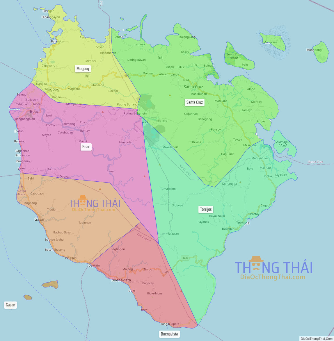
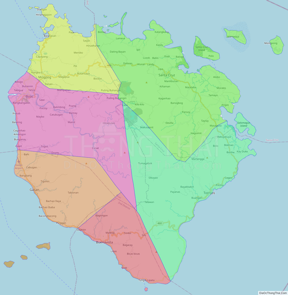
Online Interactive Map
Explore the interactive online map of Marinduque, which highlights the administrative boundaries with each sub-administrative unit distinctly colored for easy identification. Just click on the map, and the name of the sub-unit will display, providing an intuitive and engaging way to navigate the area. Users can also view the map in full screen and switch between different map views, including OpenStreetMap, Google Maps, and satellite imagery.
Click on ![]() to view map in "full screen" mode.
to view map in "full screen" mode.
Marinduque Political Map
Map of Marinduque Province, Philippines the administrative divisions, provincial boundaries, along with detailed depictions of streets, roads, rivers, landmarks, and other geographical features.