Nueva Ecija, officially the Province of Nueva Ecija (Tagalog: Lalawigan ng Nueva Ecija [ˌnwɛː.bɐ ʔɛˈsiː.ha], also [ˌnwɛː.vɐ-]; Ilocano: Probinsia ti Nueva Ecija; Pangasinan: Luyag/Probinsia na Nueva Ecija), is a landlocked province in the Philippines located in the Central Luzon region. Its capital is the city of Palayan, while Cabanatuan, its former capital, is the largest local government unit (LGU). Nueva Ecija borders, from the south clockwise, Bulacan, Pampanga, Tarlac, Pangasinan, Nueva Vizcaya and Aurora. The province is nationally known as the Rice Granary of the Philippines, producing the largest rice yield in the country.
| Type: | Province |
|---|---|
| Capital: | Palayan |
| Area: | 5,751.33 km (2,220.60 sq mi) |
| Area Rank: | 12th out of 81 |
| Population: | 2,310,134 |
| Population Rank: | 10th out of 81 |
| Density: | 2.12% |
| ZIP code: | 3100–3133 |
| ISO 3166 code: | PH-NUE |
| Website: | www.nuevaecija.ph |
Online Interactive Map
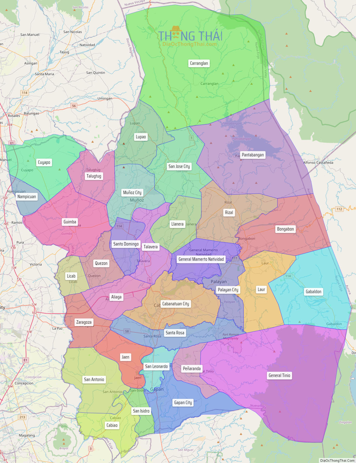
Explore the interactive online map of Nueva Ecija, which highlights the administrative boundaries with each sub-administrative unit distinctly colored for easy identification. Just click on the map, and the name of the sub-unit will display, providing an intuitive and engaging way to navigate the area. Users can also view the map in full screen and switch between different map views, including OpenStreetMap, Google Maps, and satellite imagery.
Click on ![]() to view map in "full screen" mode.
to view map in "full screen" mode.
Nueva Ecija Political Map
Map of Nueva Ecija Province, Philippines the administrative divisions, provincial boundaries, along with detailed depictions of streets, roads, rivers, landmarks, and other geographical features.