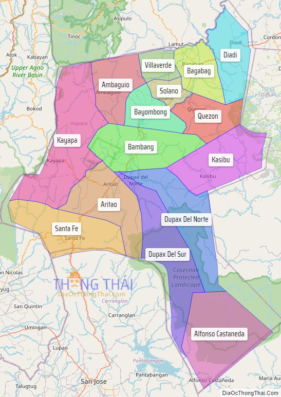
Nueva Vizcaya, officially the Province of Nueva Vizcaya (Ilocano: Probinsia ti Nueva Vizcaya; Gaddang: Probinsia na Nueva Vizcaya; Pangasinan: Luyag/Probinsia na Nueva Vizcaya; Tagalog: Lalawigan ng Nueva Vizcaya [ˈnwɛva vɪsˈkaja]), is a landlocked province in the Philippines located in the Cagayan Valley region in Luzon. Its capital and largest town is Bayombong. It is bordered by Benguet to the west, Ifugao to the north, Isabela to the northeast, Quirino to the east, Aurora to the southeast, Nueva Ecija to the south, and Pangasinan to the southwest. Quirino province was created from Nueva Vizcaya in 1966.
| Type: | Province |
|---|---|
| Capital: | Bayombong |
| Area: | 4,813.88 km (1,858.65 sq mi) |
| Area Rank: | 31st out of 81 |
| Population: | 497,432 |
| Population Rank: | 59th out of 81 |
| Density: | 0.46% |
| ZIP code: | 3700–3714 |
| ISO 3166 code: | PH-NUV |
| Website: | www.nuevavizcaya.gov.ph |
Online Interactive Map
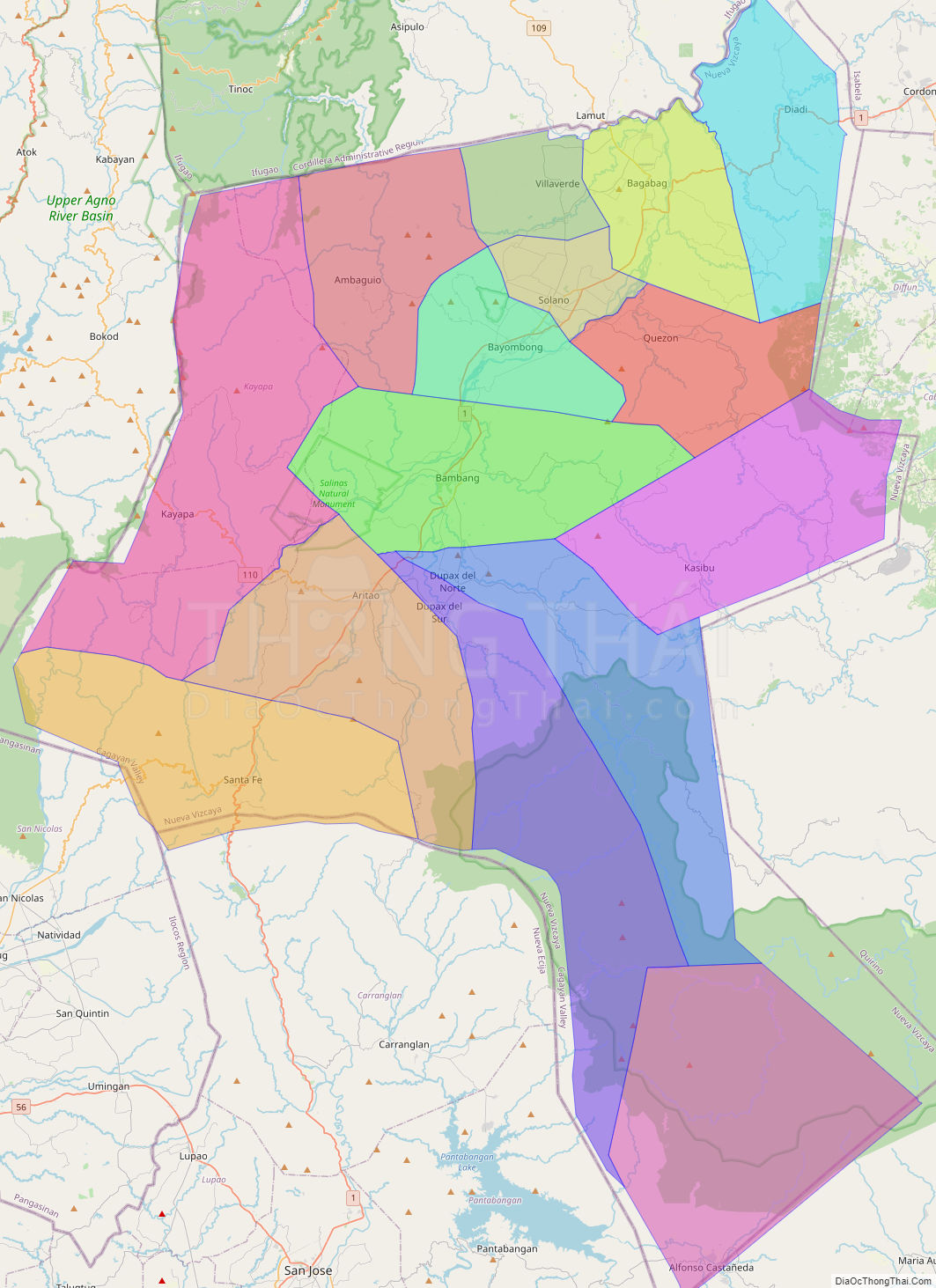
Explore the interactive online map of Nueva Vizcaya, which highlights the administrative boundaries with each sub-administrative unit distinctly colored for easy identification. Just click on the map, and the name of the sub-unit will display, providing an intuitive and engaging way to navigate the area. Users can also view the map in full screen and switch between different map views, including OpenStreetMap, Google Maps, and satellite imagery.
Click on ![]() to view map in "full screen" mode.
to view map in "full screen" mode.
Nueva Vizcaya Political Map
Map of Nueva Vizcaya Province, Philippines the administrative divisions, provincial boundaries, along with detailed depictions of streets, roads, rivers, landmarks, and other geographical features.