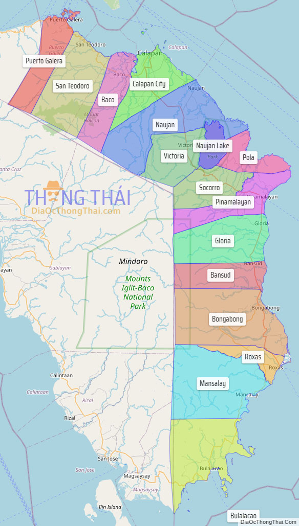
Oriental Mindoro (Tagalog: Silangang Mindoro), officially the Province of Oriental Mindoro (Tagalog: Lalawigan ng Silangang Mindoro (Oriental Mindoro)), is a province in the Philippines located on the island of Mindoro under Mimaropa region in Luzon, about 140 kilometres (87 mi) southwest of Manila. The province is bordered by the Verde Island Passage and the rest of Batangas to the north, by Marinduque, Maestre de Campo (or known as Sibale but official name is Concepcion) Island, Tablas Strait and the rest of Romblon to the east, by Semirara and the rest of Caluya Islands, Antique to the south, and by Occidental Mindoro to the west. Its provincial capital Calapan, the only city in the island, is the most-populous in the province, and Mimaropa’s regional center.
Oriental Mindoro is touted as the country’s emerging eco-tourism destination. In 2005, the Philippines was found to be the center of marine fish biodiversity and the home of the most diverse marine ecosystem in the world, by American biologists Kent Carpenter and Victor Springer. Most of the endemic species in the Philippines are found in the Verde Island Passage between Mindoro island and the main island of Luzon. The passage houses 2,983 individual species of algae, corals, crustaceans, mollusks, fishes, marine reptiles, and marine mammals, based on a study conducted by Carpenter and Springer in 2005.
UNESCO declared Puerto Galera a biosphere reserve under its Man and the Biosphere Programme in the 1970s. The Verde Island Passage is at the apex of the so-called Coral Triangle – the Philippines, Indonesia, and Malaysia – which has the distinction of being the “center of the center of the world’s marine biodiversity” and the “center of the center of marine shorefish biodiversity”.
| Type: | Province |
|---|---|
| Capital: | Calapan |
| Area: | 4,238.38 km (1,636.45 sq mi) |
| Area Rank: | 28th out of 81 |
| Population: | 908,339 |
| Population Rank: | 33rd out of 81 |
| Density: | 0.83% |
| ZIP code: | 5200–5214 |
| ISO 3166 code: | PH-MDR |
| Website: | www.ormindoro.gov.ph |
Online Interactive Map
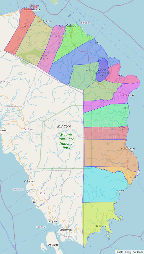
Explore the interactive online map of Oriental Mindoro, which highlights the administrative boundaries with each sub-administrative unit distinctly colored for easy identification. Just click on the map, and the name of the sub-unit will display, providing an intuitive and engaging way to navigate the area. Users can also view the map in full screen and switch between different map views, including OpenStreetMap, Google Maps, and satellite imagery.
Click on ![]() to view map in "full screen" mode.
to view map in "full screen" mode.
Oriental Mindoro Political Map
Map of Oriental Mindoro Province, Philippines the administrative divisions, provincial boundaries, along with detailed depictions of streets, roads, rivers, landmarks, and other geographical features.