Palawan (/pəˈlɑːwən/, Tagalog: [pɐˈlaː.wan]), officially the Province of Palawan (Cuyonon: Probinsya i’ang Palawan; Tagalog: Lalawigan ng Palawan), is an archipelagic province of the Philippines that is located in the region of Mimaropa. It is the largest province in the country in terms of total area of 14,649.73 km (5,656.29 sq mi). The capital and largest city is Puerto Princesa wherein it is geographically grouped but administered independently from the province. Palawan is known as the Philippines’ Last Frontier and as the Philippines’ Best Island.
The islands of Palawan stretch between Mindoro island in the northeast and Borneo in the southwest. It lies between the South China Sea and the Sulu Sea. The province is named after its largest island, Palawan Island (09°30′N 118°30′E / 9.500°N 118.500°E / 9.500; 118.500), measuring 450 kilometers (280 mi) long, and 50 kilometers (31 mi) wide.
In 2019, it was proposed to divide Palawan into three separate provinces, though it was later rejected by the local population in a 2021 plebiscite.
| Type: | Province |
|---|---|
| Capital: | Puerto Princesa |
| Area: | 14,649.73 km (5,656.29 sq mi) |
| Area Rank: | 1st out of 81 |
| Population: | 939,594 |
| Population Rank: | 31st out of 81 |
| Density: | 1.14% |
| ZIP code: | 5300–5322 |
| ISO 3166 code: | PH-PLW |
| Website: | www.palawan.gov.ph |
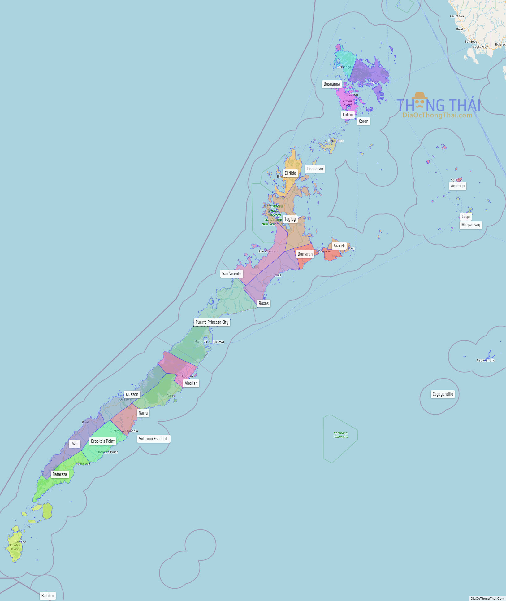
Online Interactive Map
Explore the interactive online map of Palawan, which highlights the administrative boundaries with each sub-administrative unit distinctly colored for easy identification. Just click on the map, and the name of the sub-unit will display, providing an intuitive and engaging way to navigate the area. Users can also view the map in full screen and switch between different map views, including OpenStreetMap, Google Maps, and satellite imagery.
Click on ![]() to view map in "full screen" mode.
to view map in "full screen" mode.
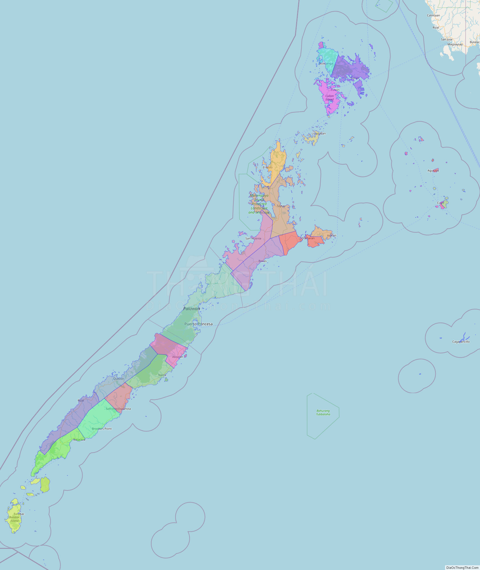
Palawan Political Map
Map of Palawan Province, Philippines the administrative divisions, provincial boundaries, along with detailed depictions of streets, roads, rivers, landmarks, and other geographical features.