Pampanga, officially the Province of Pampanga (Kapampangan: Lalawigan ning Pampanga; Tagalog: Lalawigan ng Pampanga IPA: [pɐmˈpaŋɡa] pəm-PAHNG-ga), is a province in Central Luzon in the Philippines. Lying on the northern shore of Manila Bay, Pampanga is bordered by Tarlac to the north, Nueva Ecija to the northeast, Bulacan to the east, Manila Bay to the central-south, Bataan to the southwest and Zambales to the west. Its capital is the City of San Fernando, the regional center of Central Luzon. Angeles City is the largest LGU, but while geographically within Pampanga, it is classified as a first-class, highly urbanized city and has been governed independently of the province since it received its charter in 1964.
The name La Pampanga was given by the Spaniards, who encountered natives living along the banks (pampáng) of the Pampanga River. Its creation in 1571 makes it the first Spanish province on Luzon Island (Cebu in Visayas is older as it was founded by the Spaniards in 1565). The town of Villa de Bacolor in the province briefly served as the Spanish colonial capital when Great Britain invaded Manila as part of the Seven Years’ War. At the eve of the Philippine Revolution of 1896, Pampanga was one of eight provinces placed under martial law for rebellion against the Spanish Empire; it is thus represented on the Philippine national flag as one of the eight rays of the sun.
Pampanga is served by Clark International Airport (formerly Diosdado Macapagal International Airport), which is in Clark Freeport Zone, some 16 kilometres (9.9 mi) north of the provincial capital. The province is home to two Philippine Air Force airbases: Basa Air Base in Floridablanca and the former United States Clark Air Base in Angeles. Due to its growing population and developments, the Clark Global City is now developed and is located in Clark Freeport Zone. In 2015, the province had 2,198,110 inhabitants, while it had 1,079,532 registered voters.
| Type: | Province |
|---|---|
| Capital: | San Fernando |
| Area: | 2,002.20 km (773.05 sq mi) |
| Area Rank: | 61st out of 81 |
| Population: | 2,437,709 |
| Population Rank: | 9th out of 81 |
| Density: | 2.66% |
| ZIP code: | 2000–2024 |
| ISO 3166 code: | PH-PAM |
| Website: | www.pampanga.gov.ph |
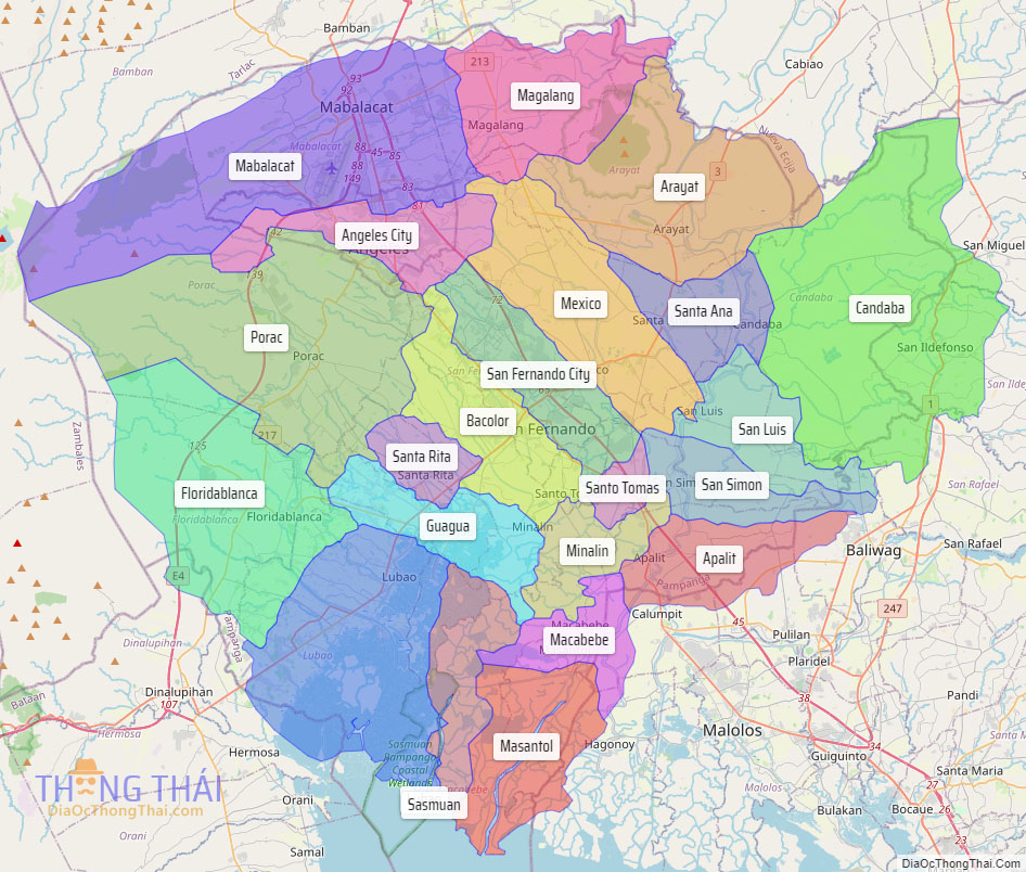
Online Interactive Map
Explore the interactive online map of Pampanga, which highlights the administrative boundaries with each sub-administrative unit distinctly colored for easy identification. Just click on the map, and the name of the sub-unit will display, providing an intuitive and engaging way to navigate the area. Users can also view the map in full screen and switch between different map views, including OpenStreetMap, Google Maps, and satellite imagery.
Click on ![]() to view map in "full screen" mode.
to view map in "full screen" mode.
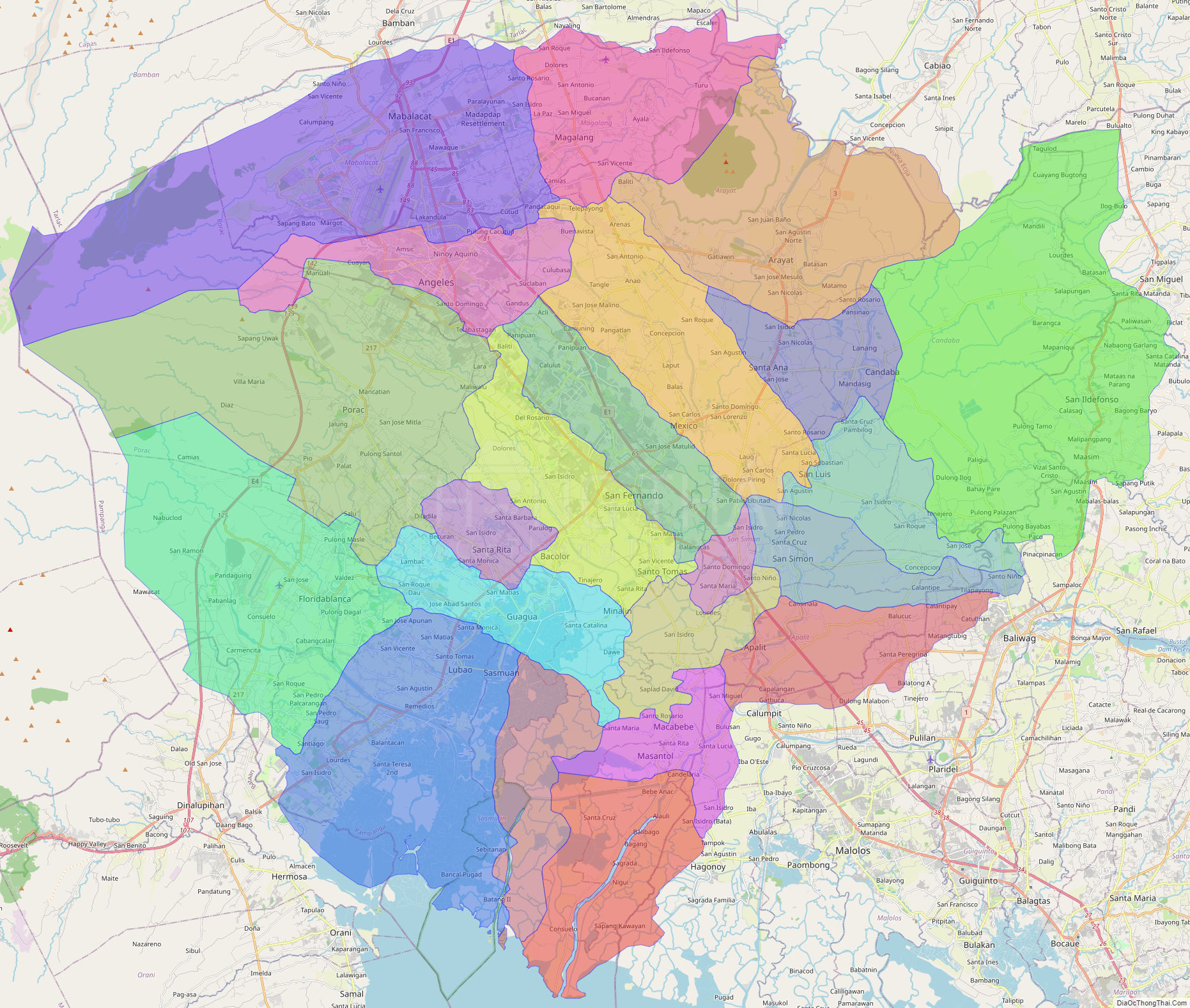
Pampanga Political Map
Map of Pampanga Province, Philippines the administrative divisions, provincial boundaries, along with detailed depictions of streets, roads, rivers, landmarks, and other geographical features.