Sultan Kudarat, officially the Province of Sultan Kudarat (Hiligaynon: Kapuoran sang Sultan Kudarat; Maguindanaon: Dairat nu Sultan Kudarat, Jawi: دايرت نو سولتان كودرت; Cebuano: Lalawigan sa Sultan Kudarat; Ilocano: Probinsia ti Sultan Kudarat; Filipino: Lalawigan ng Sultan Kudarat), is a province in the Philippines located in the Soccsksargen region in Mindanao. Its capital is Isulan while the commercial center and largest city is Tacurong.
On February 23, 1995, Sultan Kudarat transferred from the Autonomous Region in Muslim Mindanao (now Bangsamoro Autonomous Region) to Soccsksargen.
| Type: | Province |
|---|---|
| Capital: | Isulan |
| Area: | 5,298.34 km (2,045.70 sq mi) |
| Area Rank: | 18th out of 81 |
| Population: | 854,052 |
| Population Rank: | 34th out of 81 |
| Density: | 0.78% |
| ZIP code: | 9800–9811 |
| ISO 3166 code: | PH-SUK |
| Website: | sultankudaratprovince.gov.ph |
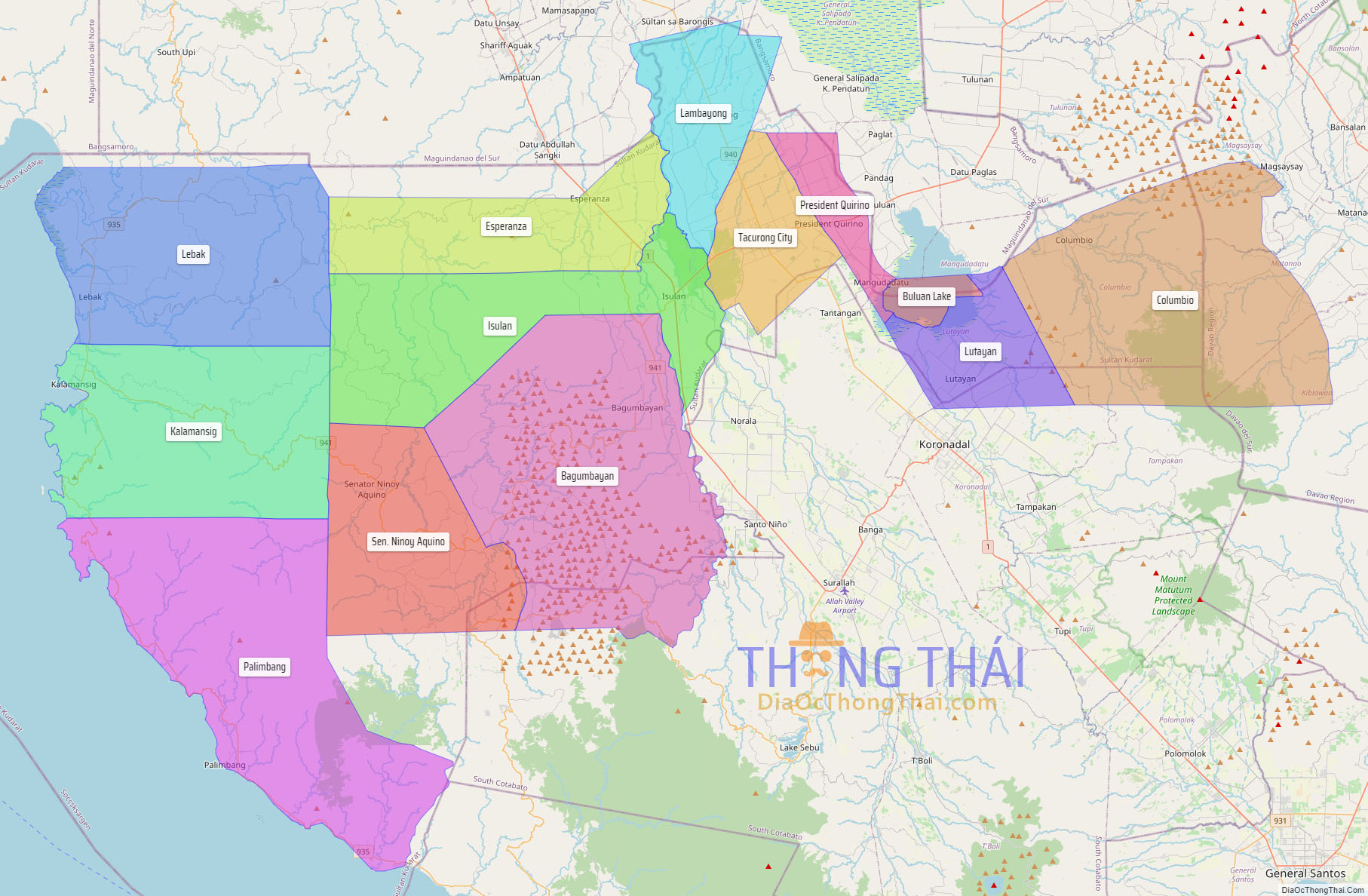
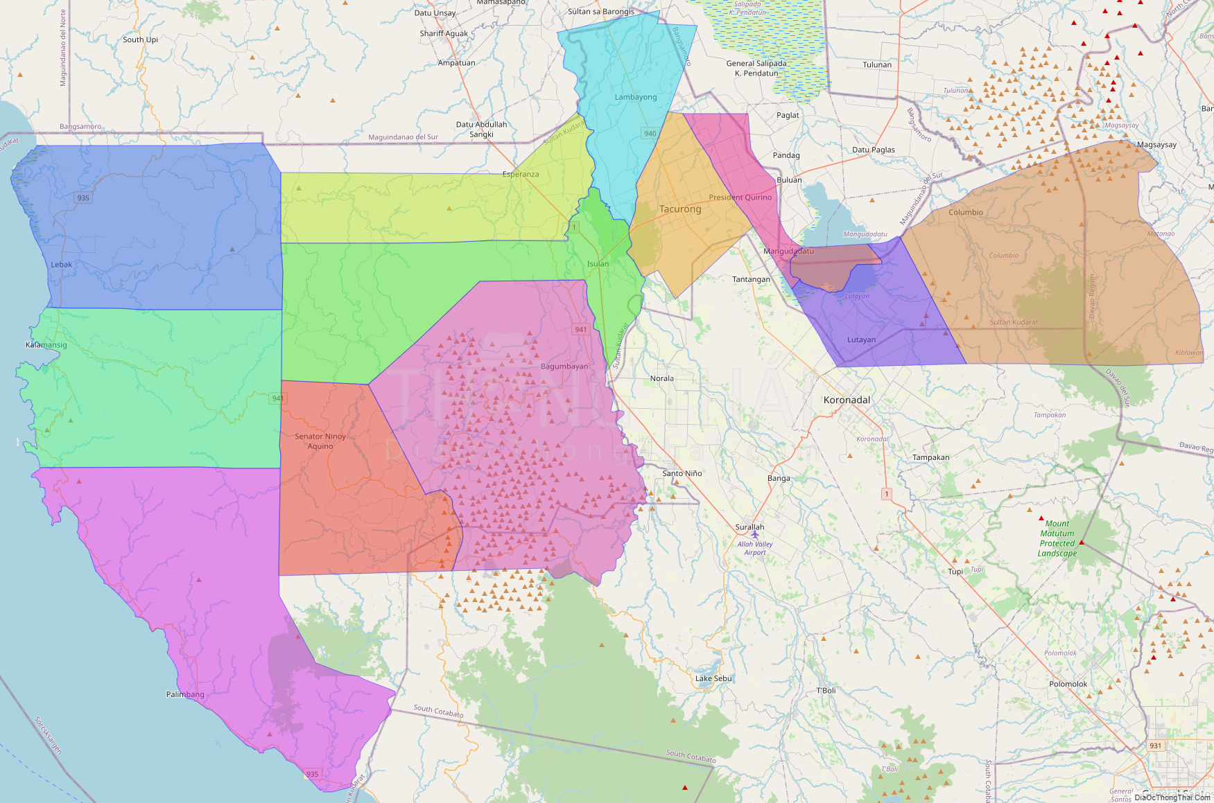
Online Interactive Map
Explore the interactive online map of Sultan Kudarat, which highlights the administrative boundaries with each sub-administrative unit distinctly colored for easy identification. Just click on the map, and the name of the sub-unit will display, providing an intuitive and engaging way to navigate the area. Users can also view the map in full screen and switch between different map views, including OpenStreetMap, Google Maps, and satellite imagery.
Click on ![]() to view map in "full screen" mode.
to view map in "full screen" mode.
Sultan Kudarat Political Map
Map of Sultan Kudarat Province, Philippines the administrative divisions, provincial boundaries, along with detailed depictions of streets, roads, rivers, landmarks, and other geographical features.