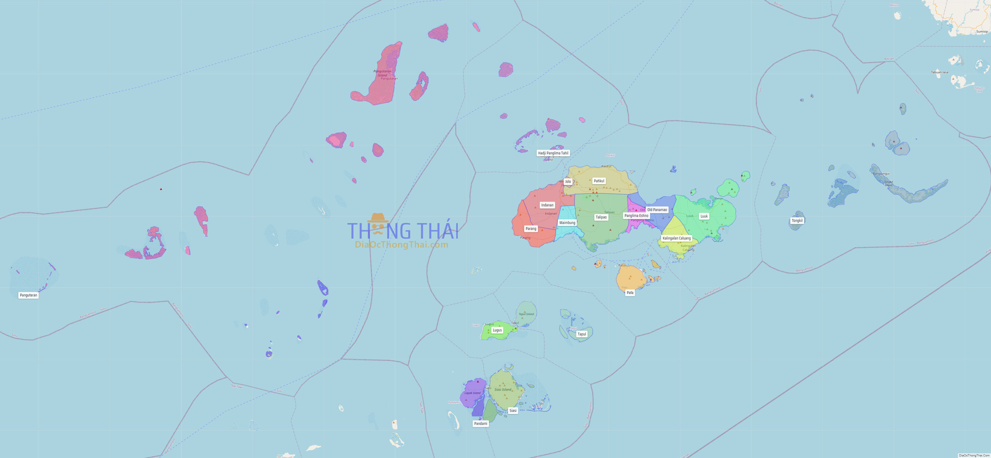
Sulu ([sʊˈlu]), officially the Province of Sulu (Tausūg: Wilāya sin Lupa’ Sūg; Tagalog: Lalawigan ng Sulu), is a province of the Philippines in the Sulu Archipelago and part of the Bangsamoro Autonomous Region in Muslim Mindanao (BARMM).
Its capital is Jolo on the island of the same name. Maimbung, the royal capital of the Sultanate of Sulu, is also located in the province. Sulu is along the southern border of the Sulu Sea and the northern boundary of the Celebes Sea.
Out of all 82 provinces in the Philippines, it is the poorest, as evidenced by it having the highest poverty rate.
| Type: | Province |
|---|---|
| Capital: | Jolo |
| Area: | 1,600.40 km (617.92 sq mi) |
| Area Rank: | 66th out of 81 |
| Population: | 1,000,108 |
| Population Rank: | 28th out of 81 |
| Density: | 0.92% |
| ZIP code: | 7400–7416 |
| ISO 3166 code: | PH-SLU |
Online Interactive Map
Explore the interactive online map of Sulu, which highlights the administrative boundaries with each sub-administrative unit distinctly colored for easy identification. Just click on the map, and the name of the sub-unit will display, providing an intuitive and engaging way to navigate the area. Users can also view the map in full screen and switch between different map views, including OpenStreetMap, Google Maps, and satellite imagery.
Click on ![]() to view map in "full screen" mode.
to view map in "full screen" mode.
Sulu Political Map
Map of Sulu Province, Philippines the administrative divisions, provincial boundaries, along with detailed depictions of streets, roads, rivers, landmarks, and other geographical features.