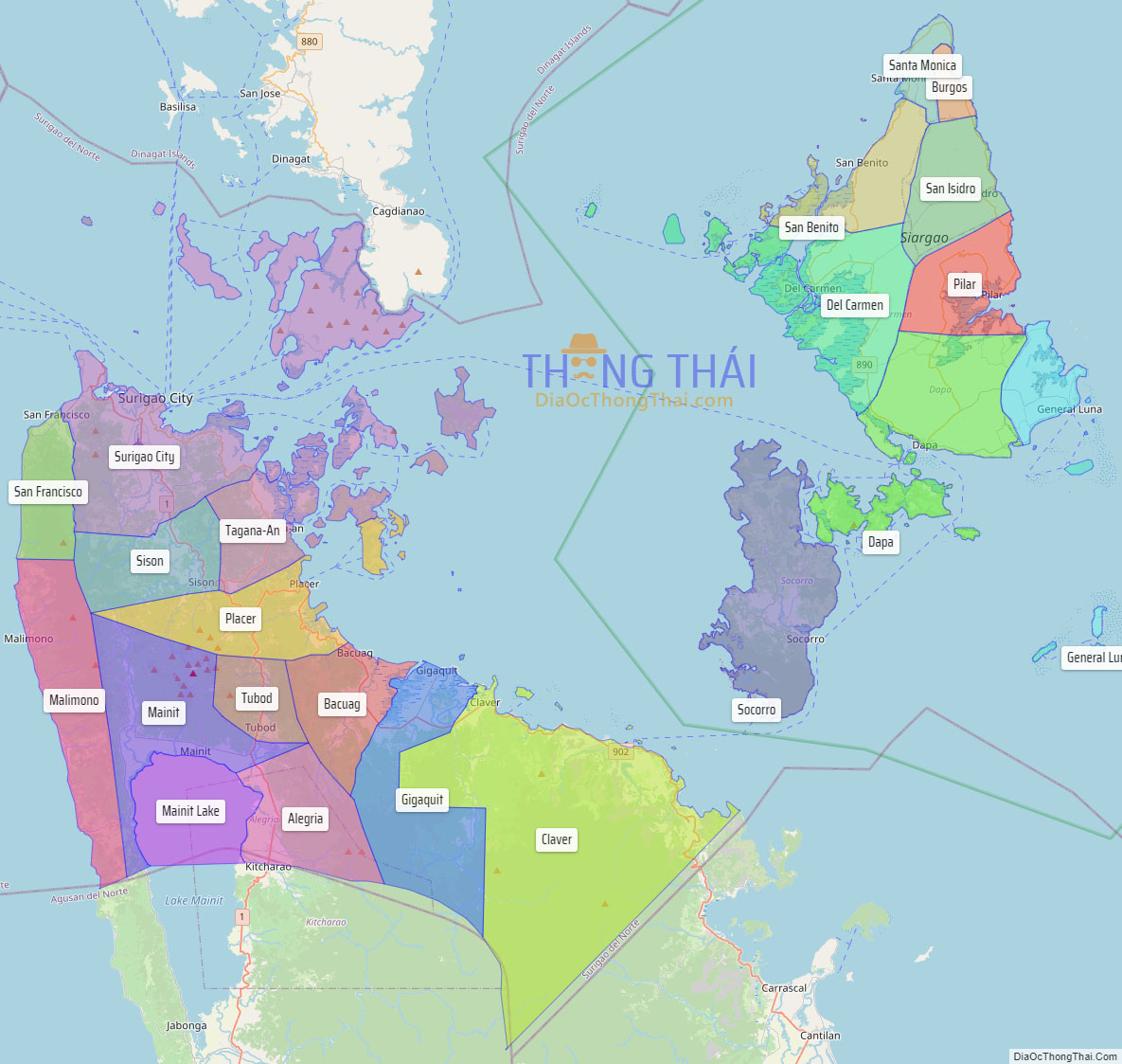
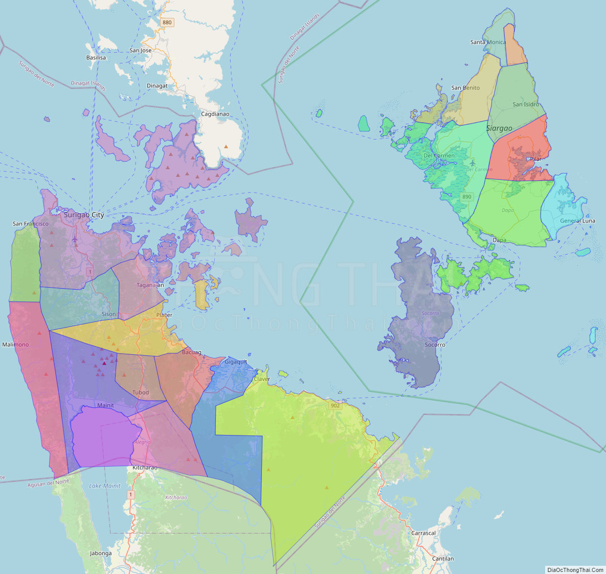
Surigao del Norte (Surigaonon: Probinsya nan Surigao del Norte; Cebuano: Amihanang Surigao; Tagalog: Hilagang Surigao), officially the Province of Surigao del Norte, is a province in the Philippines located in the Caraga region of Mindanao. The province was formerly under the jurisdiction of Region 10 (Northern Mindanao) until 1995. Its capital is Surigao City, the most populous in the province. The province comprises two major islands—Siargao and Bucas Grande—in the Philippine Sea, plus a small area at the northeastern tip of mainland Mindanao and other surrounding minor islands and islets. This mainland portion borders Agusan del Norte – between the Municipality of Alegria in Surigao del Norte and the Municipality of Kitcharao in Agusan del Norte; and the province of Surigao del Sur, to the south.
Surigao del Norte is the second northernmost of the Mindanao provinces and is an important commerce and transportation hub between Visayas and Mindanao. Numerous ferries cross the Surigao Strait between Surigao and the island of Leyte transporting vehicles, cargoes, and passengers between Liloan in Southern Leyte and Surigao City.
| Type: | Province |
|---|---|
| Capital: | Surigao City |
| Area: | 1,972.93 km (761.75 sq mi) |
| Area Rank: | 62nd out of 81 |
| Population: | 534,636 |
| Population Rank: | 57th out of 81 |
| Density: | 0.49% |
| ZIP code: | 8400–8425 |
| ISO 3166 code: | PH-SUN |
| Website: | surigaodelnorte.gov.ph |
Online Interactive Map
Explore the interactive online map of Surigao del Norte, which highlights the administrative boundaries with each sub-administrative unit distinctly colored for easy identification. Just click on the map, and the name of the sub-unit will display, providing an intuitive and engaging way to navigate the area. Users can also view the map in full screen and switch between different map views, including OpenStreetMap, Google Maps, and satellite imagery.
Click on ![]() to view map in "full screen" mode.
to view map in "full screen" mode.
Surigao del Norte Political Map
Map of Surigao del Norte Province, Philippines the administrative divisions, provincial boundaries, along with detailed depictions of streets, roads, rivers, landmarks, and other geographical features.