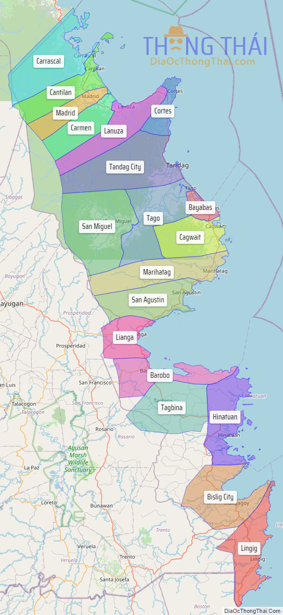
Surigao del Sur (Surigaonon: Probinsya nan Surigao del Sur; Cebuano: Habagatang Surigao; Tagalog: Timog Surigao), officially the Province of Surigao del Sur, is a province in the Philippines located in the Caraga region in Mindanao. Its capital is Tandag City while Bislig is the most populous city in the province. Surigao del Sur is situated at the eastern coast of Mindanao and faces the Philippine Sea to the east.
| Type: | Province |
|---|---|
| Capital: | Tandag |
| Area: | 4,932.70 km (1,904.53 sq mi) |
| Area Rank: | 21st out of 81 |
| Population: | 642,255 |
| Population Rank: | 47th out of 81 |
| Density: | 0.59% |
| ZIP code: | 8300–8318 |
| ISO 3166 code: | PH-SUR |
| Website: | www.surigaodelsur.gov.ph |
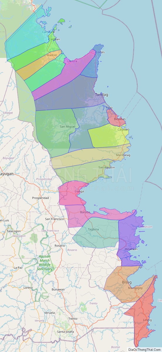
Online Interactive Map
Explore the interactive online map of Surigao del Sur, which highlights the administrative boundaries with each sub-administrative unit distinctly colored for easy identification. Just click on the map, and the name of the sub-unit will display, providing an intuitive and engaging way to navigate the area. Users can also view the map in full screen and switch between different map views, including OpenStreetMap, Google Maps, and satellite imagery.
Click on ![]() to view map in "full screen" mode.
to view map in "full screen" mode.
Surigao del Sur Political Map
Map of Surigao del Sur Province, Philippines the administrative divisions, provincial boundaries, along with detailed depictions of streets, roads, rivers, landmarks, and other geographical features.