Tarlac, officially the Province of Tarlac (Kapampangan: Lalawigan ning Tarlac; Pangasinan: Luyag/Probinsia na Tarlac; Ilocano: Probinsia ti Tarlac; Tagalog: Lalawigan ng Tarlac; [tɐɾˈlak]), is a landlocked province in the Philippines located in the Central Luzon region. Its capital is the city of Tarlac, which is the most populous in the province. It is bounded on the north by the province of Pangasinan, Nueva Ecija on the east, Zambales on the west, and Pampanga in the south. The province comprises three congressional districts and is subdivided into 17 municipalities and one city, Tarlac City, which is the provincial capital.
The province is situated in the heartland of Luzon, in what is known as the Central Plain also spanning the neighbouring provinces of Pampanga, Pangasinan, Nueva Ecija, and Zambales. Tarlac covers a total land area of 3,053.45 km (305,345 ha).
Early in history, what came to be known as Valenzuela Ranch today was once a thickly-forested area, peopled by roving tribes of nomadic Aetas who are said to be the aboriginal settlers of the Philippines, and for a lengthy period, it was the remaining hinterland of Luzon’s Central Plains. Today, Tarlac is one of the most multi-cultural provinces in the region for having a mixture of four distinct ethnic groups: the Kapampangans, the Pangasinans, the Ilocanos, and the Tagalogs. It is also known for its fine food and vast sugar and rice plantations in Central Luzon.
| Type: | Province |
|---|---|
| Capital: | Tarlac City |
| Area: | 3,053.60 km (1,179.00 sq mi) |
| Area Rank: | 45th out of 81 |
| Population: | 1,503,456 |
| Population Rank: | 18th out of 81 |
| Density: | 1.38% |
| ISO 3166 code: | PH-TAR |
| Website: | visit-tarlac.com |
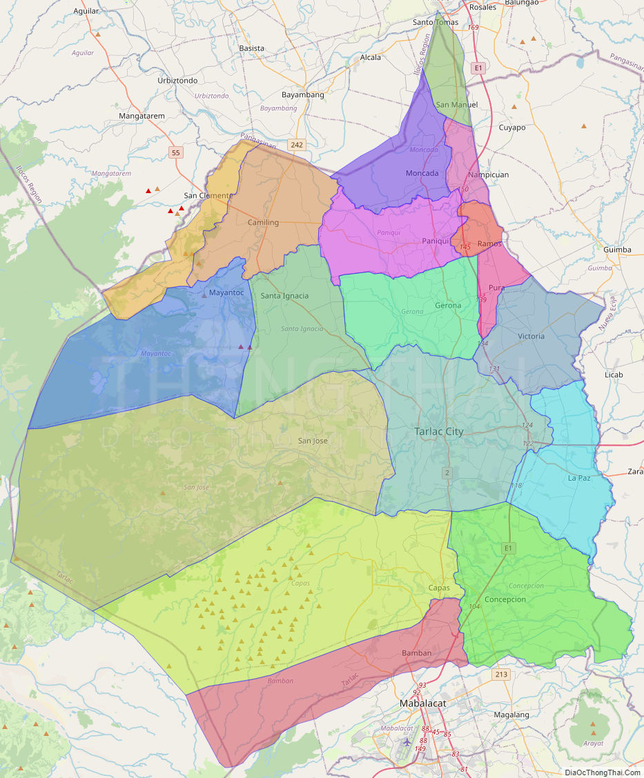
Online Interactive Map
Explore the interactive online map of Tarlac, which highlights the administrative boundaries with each sub-administrative unit distinctly colored for easy identification. Just click on the map, and the name of the sub-unit will display, providing an intuitive and engaging way to navigate the area. Users can also view the map in full screen and switch between different map views, including OpenStreetMap, Google Maps, and satellite imagery.
Click on ![]() to view map in "full screen" mode.
to view map in "full screen" mode.
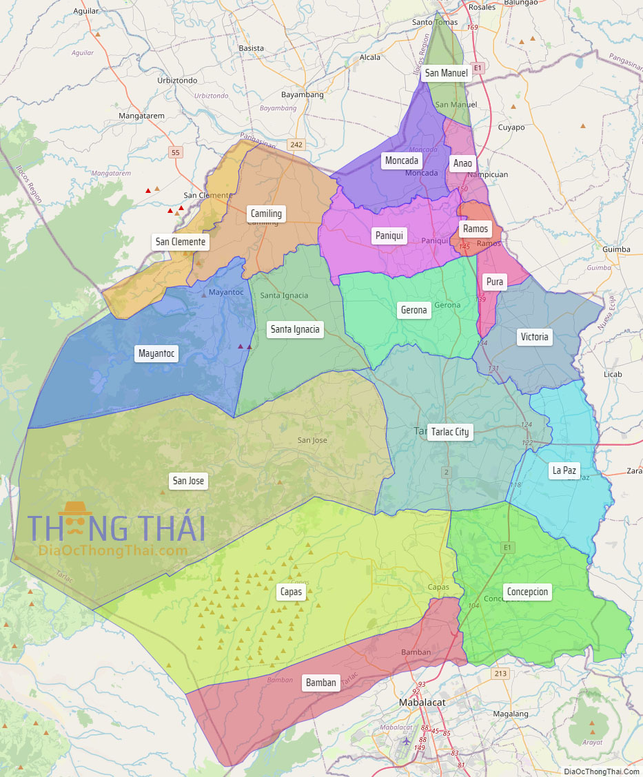
Tarlac Political Map
Map of Tarlac Province, Philippines the administrative divisions, provincial boundaries, along with detailed depictions of streets, roads, rivers, landmarks, and other geographical features.