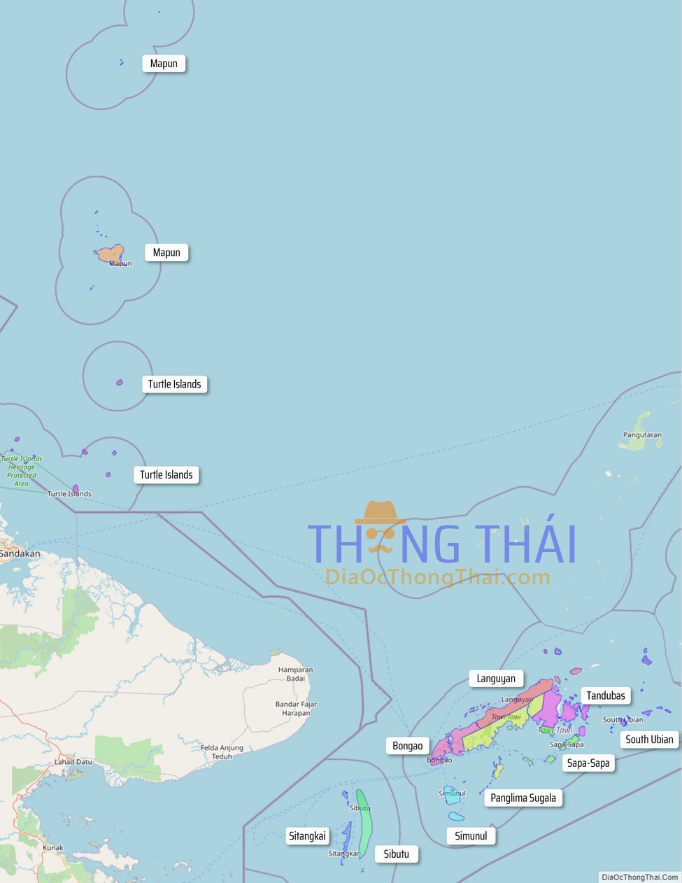
Tawi-Tawi, officially the Province of Tawi-Tawi (Tausug: Wilaya’ sin Tawi-Tawi; Sinama: Jawi Jawi/Jauih Jauih; Tagalog: Lalawigan ng Tawi-Tawi), is an island province in the Philippines located in the Bangsamoro Autonomous Region in Muslim Mindanao (BARMM). The capital of Tawi-Tawi is Bongao.
It is the southernmost province of the country, sharing sea borders with the Malaysian state of Sabah and the Indonesian North Kalimantan province, both on the island of Borneo to the west. To the northeast lies the province of Sulu. Tawi-Tawi also covers some islands in the Sulu Sea to the northwest, Cagayan de Tawi-Tawi Island and the Turtle Islands, just 20 kilometres (12 mi) away from Sabah.
The municipalities comprising the current Tawi-Tawi province were formerly under the jurisdiction of Sulu until 1973.
| Type: | Province |
|---|---|
| Capital: | Bongao |
| Area: | 1,087.40 km (419.85 sq mi) |
| Area Rank: | 74th out of 81 |
| Population: | 440,276 |
| Population Rank: | 62nd out of 81 |
| Density: | 0.40% |
| ZIP code: | 7500–7509 |
| ISO 3166 code: | PH-TAW |
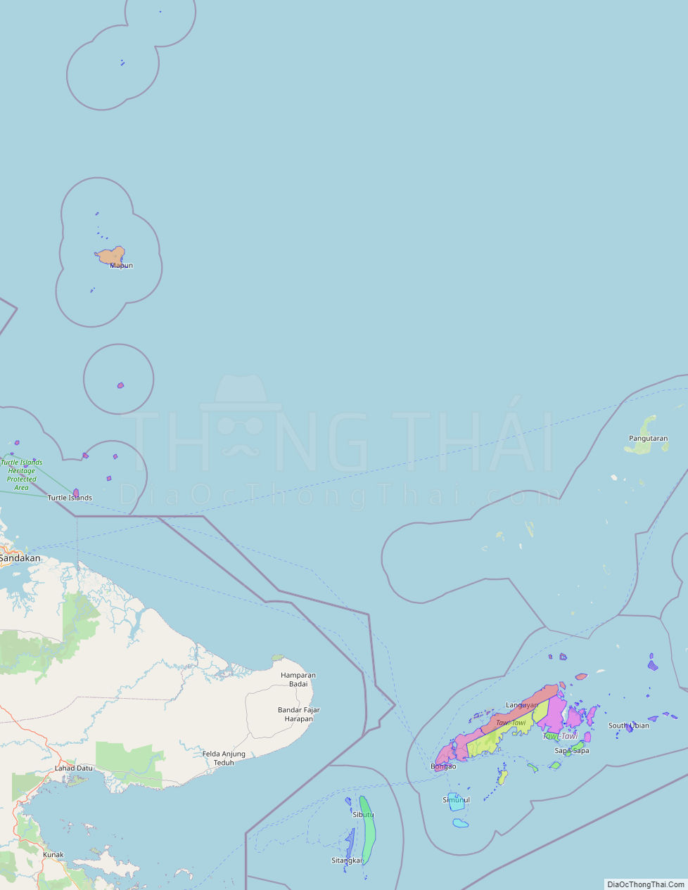
Online Interactive Map
Explore the interactive online map of Tawi-Tawi, which highlights the administrative boundaries with each sub-administrative unit distinctly colored for easy identification. Just click on the map, and the name of the sub-unit will display, providing an intuitive and engaging way to navigate the area. Users can also view the map in full screen and switch between different map views, including OpenStreetMap, Google Maps, and satellite imagery.
Click on ![]() to view map in "full screen" mode.
to view map in "full screen" mode.
Tawi-Tawi Political Map
Map of Tawi-Tawi Province, Philippines the administrative divisions, provincial boundaries, along with detailed depictions of streets, roads, rivers, landmarks, and other geographical features.