Map of Horatio city

Map of Horatio city

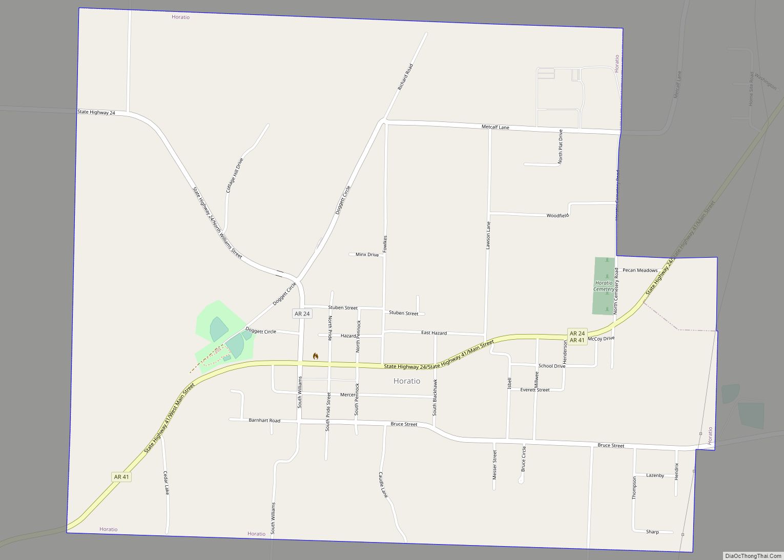
Horatio is a city in Sevier County, Arkansas, United States. The population was 1,044 at the 2010 census. Horatio city overview: Name: Horatio city LSAD Code: 25 LSAD Description: city (suffix) State: Arkansas County: Sevier County Elevation: 384 ft (117 m) Total Area: 1.80 sq mi (4.66 km²) Land Area: 1.78 sq mi (4.62 km²) Water Area: 0.01 sq mi (0.04 km²) Total Population: 920 Population … Read more

Map of Hope city, Arkansas

Map of Hope city, Arkansas

Hope is a city in Hempstead County in southwestern Arkansas, United States. Hope is the county seat of Hempstead County and the principal city of the Hope Micropolitan Statistical Area, which includes all of Hempstead and Nevada counties. As of the 2010 census the population was 10,095, and in 2019 the population was estimated at … Read more

Map of Hot Springs city

Map of Hot Springs city, Arkansas

Hot Springs is a resort city in the state of Arkansas and the county seat of Garland County. The city is located in the Ouachita Mountains among the U.S. Interior Highlands, and is set among several natural hot springs for which the city is named. As of the 2020 United States Census, the city had … Read more

Map of Hot Springs Village CDP

Map of Hot Springs Village CDP

Hot Springs Village is a census-designated place (CDP) in Garland and Saline counties in the U.S. state of Arkansas. As it is situated in two counties, it is also part of two metropolitan statistical areas. The portion in Garland County is within the Hot Springs Metropolitan Statistical Area, while the portion extending into Saline County … Read more

Map of Horseshoe Lake town

Map of Horseshoe Lake town

Horseshoe Lake is a town in Crittenden County, Arkansas, United States. The population was 264 at the 2020 census. The town is named after Horseshoe Lake, an oxbow lake at the eastern tip of which the town is located. Horseshoe Lake town overview: Name: Horseshoe Lake town LSAD Code: 43 LSAD Description: town (suffix) State: … Read more

Map of Hughes city, Arkansas

Map of Hughes city, Arkansas

Hughes is a city in St. Francis County, Arkansas, United States. As of the 2020 census, it had a population of 1,056. Hughes city overview: Name: Hughes city LSAD Code: 25 LSAD Description: city (suffix) State: Arkansas County: St. Francis County Elevation: 207 ft (63 m) Total Area: 2.28 sq mi (5.92 km²) Land Area: 2.26 sq mi (5.86 km²) Water Area: 0.02 sq mi … Read more

Map of Hoxie city

Map of Hoxie city, Arkansas

Hoxie is a city in Lawrence County, Arkansas, United States. It lies immediately south of Walnut Ridge. The population was 2,780 at the 2010 census. Hoxie city overview: Name: Hoxie city LSAD Code: 25 LSAD Description: city (suffix) State: Arkansas County: Lawrence County Elevation: 266 ft (81 m) Total Area: 6.67 sq mi (17.26 km²) Land Area: 6.67 sq mi (17.26 km²) Water … Read more

Map of Houston town, Arkansas

Map of Houston town, Arkansas

Houston is a town in Perry County, Arkansas, United States. The population was 143 at the 2020 census. It is part of the Little Rock–North Little Rock–Conway Metropolitan Statistical Area. Houston town overview: Name: Houston town LSAD Code: 43 LSAD Description: town (suffix) State: Arkansas County: Perry County Elevation: 295 ft (90 m) Total Area: 1.01 sq mi (2.62 km²) … Read more

Map of Hunter town

Map of Hunter town, Arkansas

Hunter is a town in southeast Woodruff County, Arkansas, United States. The population was 152 at the 2000 census. Gilbert G. Collier, awarded the Medal of Honor for his action in the Korean War, was born in Hunter. Hunter town overview: Name: Hunter town LSAD Code: 43 LSAD Description: town (suffix) State: Arkansas County: Woodruff … Read more

Map of Humphrey city

Map of Humphrey city, Arkansas

Humphrey is a city in Arkansas and Jefferson counties in the U.S. state of Arkansas. Its population was 557 at the 2010 census. It is included in the Pine Bluff Metropolitan Statistical Area. Humphrey city overview: Name: Humphrey city LSAD Code: 25 LSAD Description: city (suffix) State: Arkansas County: Arkansas County, Jefferson County Elevation: 190 ft … Read more

Map of Humnoke city

Map of Humnoke city

Humnoke is a city in Lonoke County, Arkansas, United States. The population was 284 at the 2010 census. It is part of the Little Rock–North Little Rock–Conway Metropolitan Statistical Area. Humnoke city overview: Name: Humnoke city LSAD Code: 25 LSAD Description: city (suffix) State: Arkansas County: Lonoke County Elevation: 197 ft (60 m) Total Area: 0.31 sq mi (0.81 km²) … Read more

Map of Huttig city

Map of Huttig city

Huttig is a city in Union County, Arkansas, United States. The population was 597 at the 2010 census. Huttig city overview: Name: Huttig city LSAD Code: 25 LSAD Description: city (suffix) State: Arkansas County: Union County Elevation: 102 ft (31 m) Total Area: 3.08 sq mi (7.98 km²) Land Area: 2.98 sq mi (7.72 km²) Water Area: 0.10 sq mi (0.26 km²) Total Population: 448 Population … Read more