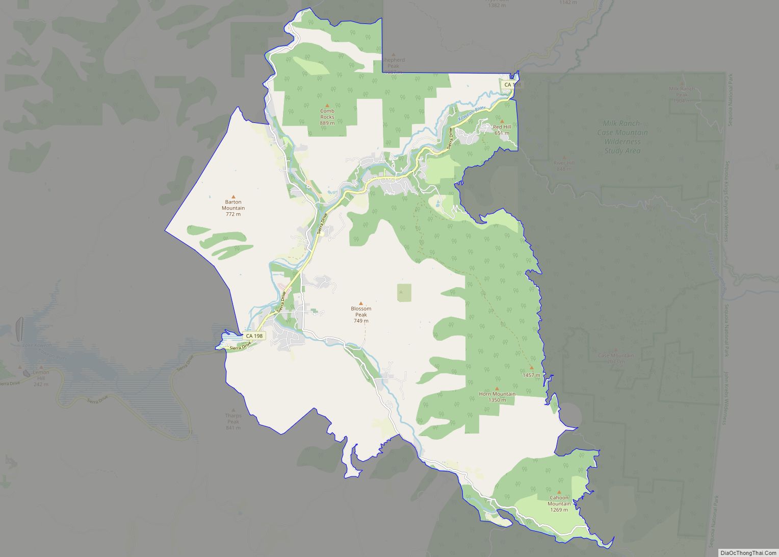
Map of Tobin CDP

Map of Tobin CDP

Tobin is a census-designated place (CDP) in Plumas County, California, United States. The population was 12 at the 2010 census, up from 11 at the 2000 census. Tobin CDP overview: Name: Tobin CDP LSAD Code: 57 LSAD Description: CDP (suffix) State: California County: Plumas County Elevation: 2,064 ft (629 m) Total Area: 5.029 sq mi (13.025 km²) Land Area: 5.029 sq mi … Read more

Map of Tipton CDP

Map of Tipton CDP, California

Tipton is a census-designated place (CDP) in Tulare County, California, United States. The population was 2,543 at the 2010 census, up from 1,790 at the 2000 census. Tipton CDP overview: Name: Tipton CDP LSAD Code: 57 LSAD Description: CDP (suffix) State: California County: Tulare County Elevation: 276 ft (84 m) Total Area: 1.010 sq mi (2.615 km²) Land Area: 1.010 sq mi … Read more

Map of Timber Cove CDP

Map of Timber Cove CDP

Timber Cove is a census-designated place (CDP) in Sonoma County, California. Timber Cove sits at an elevation of 554 feet (169 m). The 2010 United States census reported Timber Cove’s population was 164. Timber Cove CDP overview: Name: Timber Cove CDP LSAD Code: 57 LSAD Description: CDP (suffix) State: California County: Sonoma County Elevation: 554 ft (169 m) … Read more

Map of Tooleville CDP

Map of Tooleville CDP

Tooleville is an unincorporated community in Tulare County, California. Tooleville sits at an elevation of 397 feet (121 m). The 2010 United States census reported Tooleville’s population was 339. For statistical purposes, the US Census Bureau has designated it a census-designated place (CDP). Tooleville has the lowest per capita income ($3,711) of any CDP in California … Read more

Map of Tonyville CDP

Map of Tonyville CDP

Tonyville is a census-designated place (CDP) in Tulare County, California. Tonyville sits at an elevation of 361 feet (110 m). The 2010 United States census reported Tonyville’s population was 316. Tonyville CDP overview: Name: Tonyville CDP LSAD Code: 57 LSAD Description: CDP (suffix) State: California County: Tulare County Elevation: 361 ft (110 m) Total Area: 0.050 sq mi (0.131 km²) Land … Read more

Map of Tomales CDP

Map of Tomales CDP

Tomales is a census-designated place (CDP) on State Route 1 in Marin County, California, United States. The population was 187 at the 2020 census. Tomales CDP overview: Name: Tomales CDP LSAD Code: 57 LSAD Description: CDP (suffix) State: California County: Marin County Elevation: 89 ft (27 m) Total Area: 0.332 sq mi (0.859 km²) Land Area: 0.332 sq mi (0.859 km²) Water Area: … Read more

Map of Toro Canyon CDP

Map of Toro Canyon CDP

Toro Canyon (Toro, Spanish for “bull”) is a census-designated place (CDP) in Santa Barbara County, California, United States. The population was 1,835 at the 2020 census, up from 1,508 at the 2010 census. Toro Canyon CDP overview: Name: Toro Canyon CDP LSAD Code: 57 LSAD Description: CDP (suffix) State: California County: Santa Barbara County Elevation: … Read more

Map of Topaz CDP

Map of Topaz CDP

Topaz (also Topaz Post Office) is an unincorporated community and census-designated place (CDP) in Mono County, California, United States. It is located 3 miles (5 km) north of Coleville, at an elevation of 5,033 feet (1,534 m). Topaz’s ZIP Code is 96133. The population was 150 at the 2020 census. Topaz CDP overview: Name: Topaz CDP LSAD … Read more

Map of Topanga CDP

Map of Topanga CDP

Topanga (pronunciation) (Tongva: Topaa’nga) is a census-designated place (CDP) in western Los Angeles County, California, United States. Located in the Santa Monica Mountains, the community exists in Topanga Canyon and the surrounding hills. The narrow southern portion of Topanga at the coast is between the city of Malibu and the Los Angeles neighborhood of Pacific … Read more

Map of Traver CDP

Map of Traver CDP

Traver is a census-designated place (CDP) in Tulare County, California, United States. The population was 713 at the 2010 census, down from 732 at the 2000 census. Traver CDP overview: Name: Traver CDP LSAD Code: 57 LSAD Description: CDP (suffix) State: California County: Tulare County Elevation: 289 ft (88 m) Total Area: 0.843 sq mi (2.184 km²) Land Area: 0.843 sq mi … Read more

Map of Tranquillity CDP

Map of Tranquillity CDP

Tranquillity is a census-designated place (CDP) in Fresno County, California, United States. It is located 10 miles (16 km) southeast of Mendota, at an elevation of 164 feet (50 m). The population was 799 at the 2010 census, down from 813 at the 2000 census. Tranquillity High School is the only high school in Tranquillity. Tranquillity CDP … Read more

Map of Tracy city

Map of Tracy city, California

Tracy is the second most populated city in San Joaquin County, California, United States. The population was 93,000 at the 2020 census. Tracy is located inside a geographic triangle formed by Interstate 205 on the north side of the city, Interstate 5 to the east, and Interstate 580 to the southwest. Tracy city overview: Name: … Read more