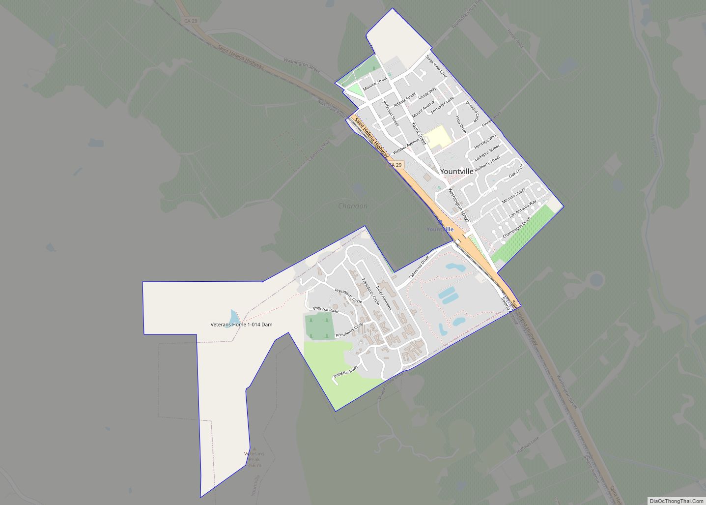
Map of Zayante CDP

Map of Zayante CDP

Zayante (Ohlone: Sayante) is a census-designated place (CDP) in Santa Cruz County, California. It is a residential area located on Zayante Creek. Zayante sits at an elevation of 699 feet (213 m). The 2020 United States census reported Zayante’s population was 729. Zayante CDP overview: Name: Zayante CDP LSAD Code: 57 LSAD Description: CDP (suffix) State: … Read more

Map of Yucca Valley town

Map of Yucca Valley town

Yucca Valley is an incorporated town in San Bernardino County, California, United States. The population was 20,700 as of the 2010 census. Yucca Valley lies 17 miles (27 km) west of Twentynine Palms, 27 miles (43 km) north of Palm Springs, 62 miles (100 km) south of Barstow via State Route 247 and 55 miles (89 km) east of … Read more

Map of Yucaipa city

Map of Yucaipa city

Yucaipa (Serrano: Yukaipa’t) is a city located 10 miles (16 km) east of San Bernardino, in San Bernardino County, California, United States. The population was 54,542 at the 2020 census, up from 51,367 at the 2010 census. Yucaipa has the distinction of being the longtime home to a large population of Serrano Native Americans. Yucaipa city … Read more